Utility surveys
Professional underground utility survey and utility mapping across London and the UK
Get a quote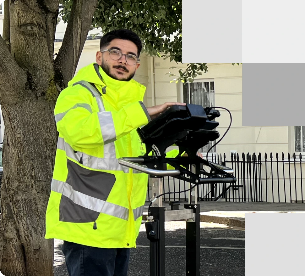
Our expert team performs an underground utility surveys with advanced technology, ensuring precise utility mapping of the site in London
About utility surveys services
Delivering expert underground utility and utility mapping surveys
Red Laser is a leading name among utility survey companies. We offer comprehensive utility surveys and underground utility mapping services, ensuring precise and reliable results for projects across London and the UK. Our utility survey services are designed to locate and map underground utilities with accuracy and efficiency, that meet PAS 128 standards. We deliver dependable data for a wide range of projects, helping you make informed decisions and prevent costly mistakes. Our underground utility surveyors can detect and identify a wide range of utilities, including:
- Sewers and gas mains
- Lighting cables
- Communication cables
- Traffic signaling cables
- Water and gas pipes
- Fuel and vent pipes
Methods and equipment we use
Our underground utility surveyors employ advanced tools and methodologies to gather and analyse subsurface data. Depending on your project’s needs, we utilise a variety of techniques to target specific underground services, including:
- EML (Electro-Magnetic Locators): These devices are used for accurately detecting buried utilities and metal objects.
- Mobile mapping: A method used for collecting high-density data over large areas, ideal for urban environments.
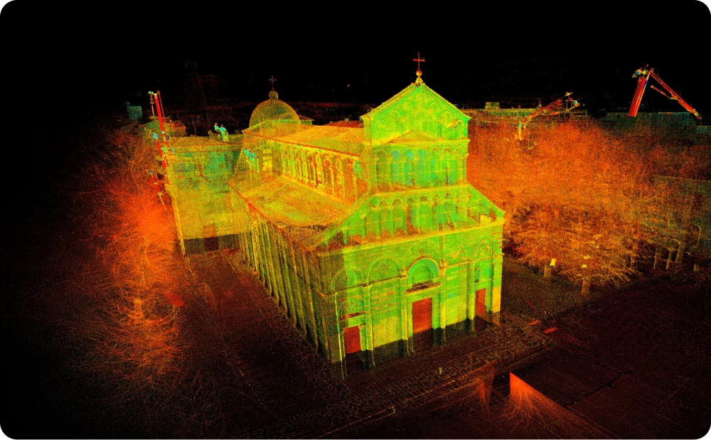
- GPR (Ground Penetrating Radar): Using 2D and 3D technology with towing and pushing systems for versatile frequency ranges, GPR provides in-depth analysis of underground conditions.
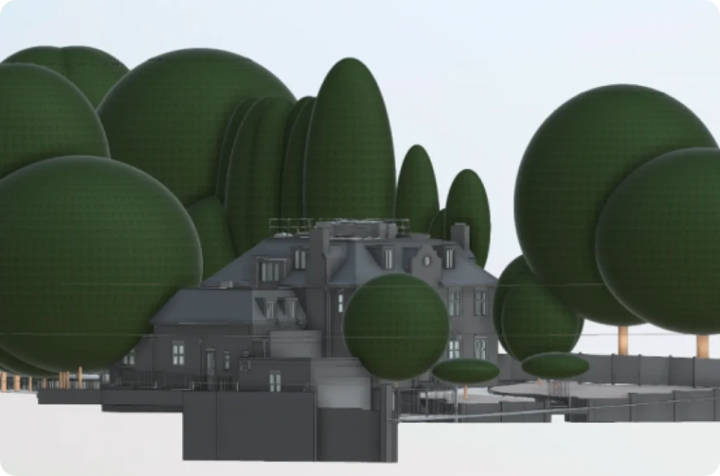
- 3D Laser scanners: Using the latest technology from industry leaders like Leica and Faro, we create accurate drawings and 3D models.
- Total stations: It allows for precise measurements and positioning of underground utilities in relation to the site.
- Software for drawing, modeling and data processing: We use advanced software and proprietary applications to process data and create detailed utility maps.

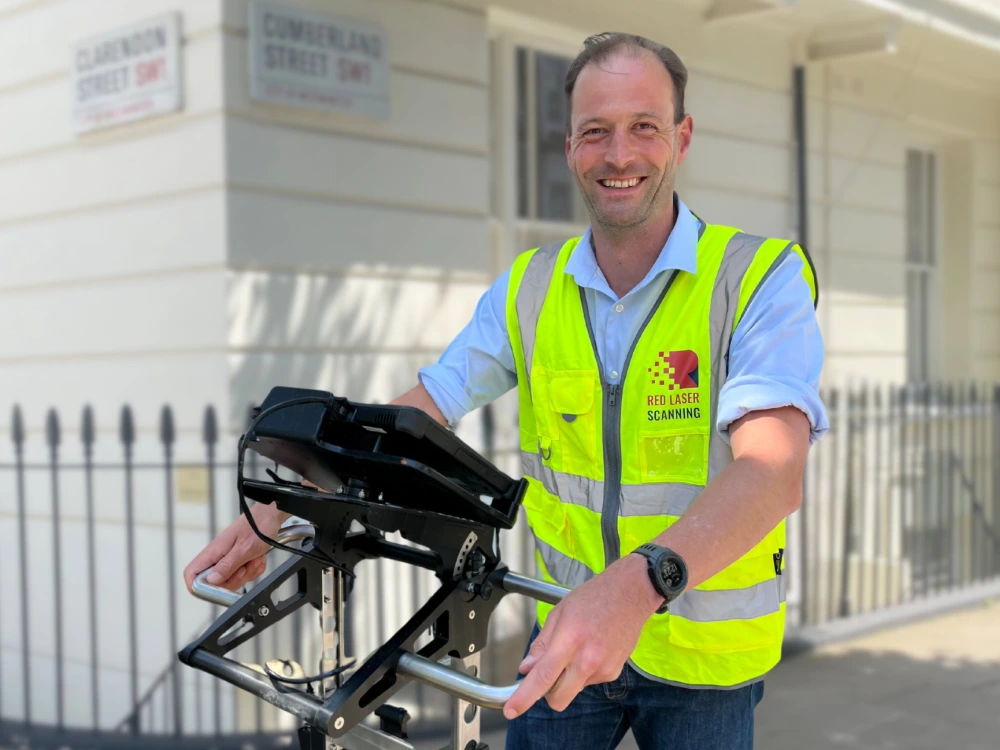
Our team captures detailed utility surveys data, providing comprehensive insights into underground utilities to support your project
Choose Red Laser for professional utility surveys and underground utility mapping
We’re focused on delivering accuracy, efficiency, and safety for your project
Applications of Utility Surveys
Ensuring safe and efficient project execution
Utility surveys provide critical data to avoid conflicts with underground infrastructure, streamline construction, and support informed decision-making across various industries.
Dedicated underground utility surveys department
Proven experience and a track record you can trust
Our dedicated Underground Utility Survey department, led by Nick, an experienced underground utility surveyor with a PhD in Geodesy and Navigation and an MSc in Surveying. Our team offers specialised services for large-scale developments, refurbishments, railway, underground, and airport projects.
We pride ourselves on our comprehensive certifications, including PASMA, PAL, CSCS, harness training, inspection, and Asbestos awareness. We ensure that we meet the highest standards of safety and precision on every project. Our commitment to meticulous attention to detail guarantees that we provide reliable, accurate data to support your project’s success. Partnering with us means benefiting from a team that consistently delivers exceptional results, regardless of the complexity of the task.
Book your utility surveys
Choose experts in underground utility surveys and underground utility mapping
When you choose Red Laser, a leader among utility survey companies, you’re partnering with experienced professionals who prioritize accuracy, safety, and efficiency. Our surveying and mapping services are tailored to your specific needs, ensuring reliable data for successful project planning and execution. Trust Red Laser to conduct your utility survey to the highest industry standards, offering peace of mind and cost-effective solutions.
Get a quote“The guys were here all day today and what a great experience. Very professional, very thorough and really nice chaps too. Look forward to seeing the outputs too, as the peek I had at the scans while they were mapping was amazing! They didn’t have tech like that when I did my engineering degree in 1987, I can tell you!”
Our underground and utility surveys services
We offer a comprehensive range of underground and utility survey services, including:
Underground surveys
Locate underground features and utilities to prevent disruptions and ensure safe project execution.
CCTV drainage survey
Conduct thorough inspections using CCTV technology to identify conditions, blockages or damages in drainage systems, preventing future complications.
GPR surveys
Utilise high-quality Ground Penetrating Radar (GPR) equipment to detect subsurface anomalies in a non-intrusive manner, providing precise data for your project.
Concrete scanning
Perform detailed scans of concrete structures to locate embedded reinforcements, ensuring safety and efficiency of construction actvities.
PAS 128 survey
Following PAS128 standard for underground utility detection, delivering reliable and standardised underground survey results.
Culvert inspection and cleaning
Inspect and clean culverts to ensure proper drainage and prevent blockages that could lead to flooding or structural damage.
Our case studies
See how we’ve helped clients achieve their goals with reliable surveying and geospatial solutions
Start working with us
Partner with Red Laser for a confident project launch