Point Cloud Survey for Structural Assessment – Blackpool Tower, Lancashire
Get a quote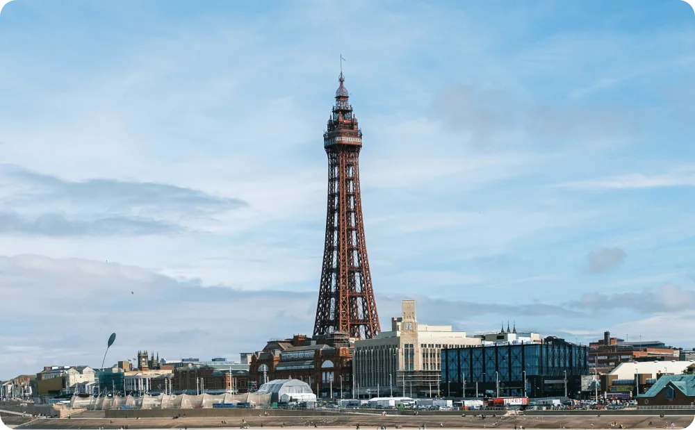
Blackpool Tower, Lancashire. Photo by Josè Maria Sava on Unsplash
Location: Blackpool Tower, Lancashire
Project Overview
Blackpool Tower is one of the UK’s most recognisable historic landmarks. As part of planned works to modify elements within the lift shaft, a detailed laser scanning survey was commissioned to accurately document the existing structure and support safe, informed intervention.
The project required precise, reliable data within a highly constrained and complex environment—capturing both internal and external elements of the tower without disrupting its historic fabric.
Client Requirements
The client required a comprehensive point cloud survey to:
Given the tower’s heritage status and operational constraints, the survey needed to be non-invasive, safe, and highly controlled.
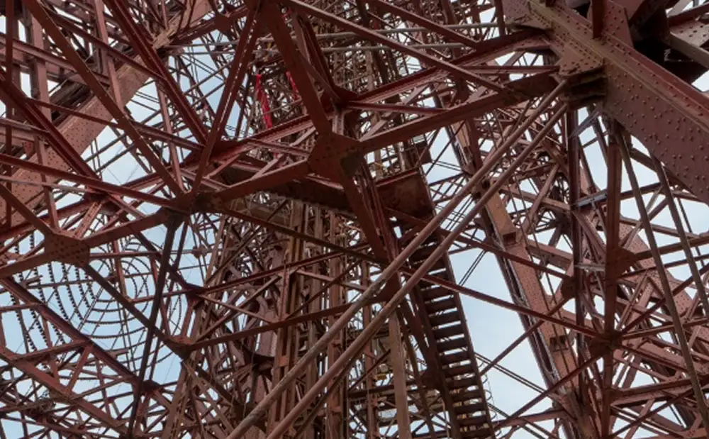
On-site survey image showing the complex steel framework within Blackpool Tower’s lift shaft
Our Approach
Red Laser carried out a full laser scanning survey of Blackpool Tower, focusing on the lift shaft and surrounding structural elements. Scans were undertaken from multiple vantage points, including staircases, roof levels, and the top of the lift car, to ensure complete coverage of the vertical structure.
Due to the height and confined nature of the environment, safety was a critical consideration throughout the project. Our surveyors operated using full-body harnesses and secured lanyards, following a detailed risk assessment and method statement tailored specifically to the site.
High-density scan data was captured at up to one million points per second, producing a detailed colour point cloud that accurately represents the tower’s geometry and structural condition.
Deliverables
The final survey package included:
- Complete laser scanning survey of Blackpool Tower
- High-resolution colour 3D point cloud
The point cloud provides a reliable digital record of the lift shaft and surrounding structure, suitable for detailed assessment, coordination, and future reference.
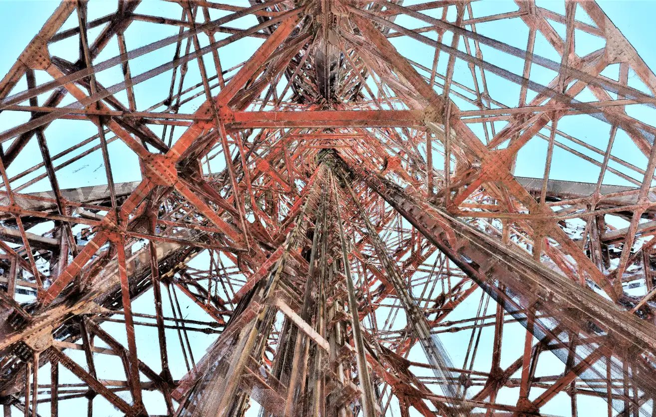
Detailed 3D point cloud showing the internal steel framework and vertical geometry of Blackpool Tower’s lift shaft
Colour point cloud data showing the steel framework and surrounding structure of Blackpool Tower

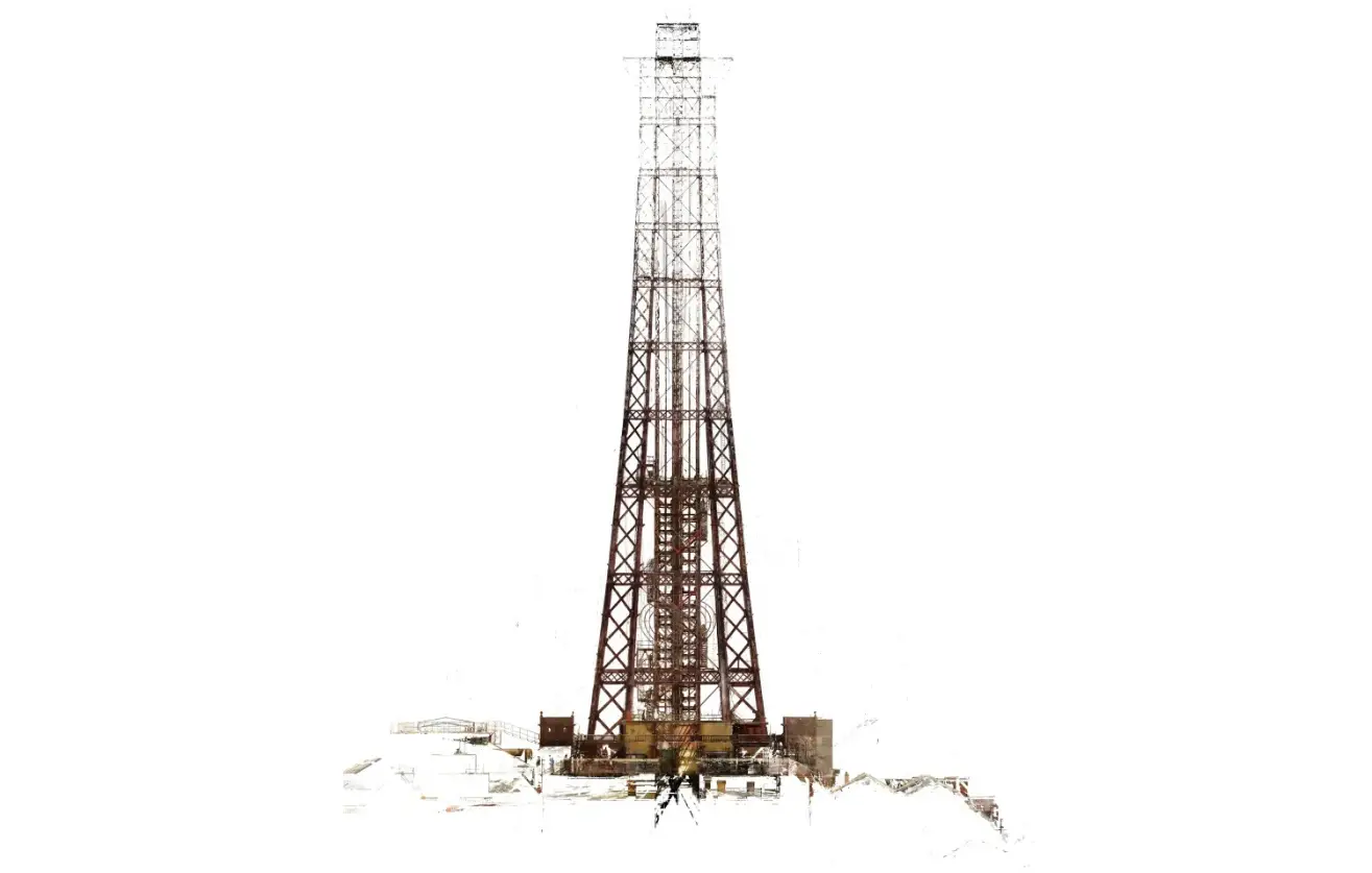
Complete orthophoto of Blackpool Tower produced from registered point cloud data, providing an accurate digital record of the tower’s full structural framework
Supporting Structural Assessment
The colour point cloud enabled the project team to review the tower’s structure remotely, interrogate complex areas within the lift shaft, and assess the relationship between existing steel elements and the surrounding fabric.
Data was made available through Webshare Cloud, allowing stakeholders to navigate the scan positions, extract measurements, and collaborate without repeated site access—reducing risk and disruption within the historic landmark.
Outcome
The survey delivered a complete and accurate digital representation of Blackpool Tower’s lift shaft and structural framework. With verified point cloud data in place, the client was able to progress alteration works with confidence, supported by a clear understanding of existing conditions.
This project demonstrates how laser scanning can safely capture complex heritage structures, even in challenging vertical environments, while providing dependable data for critical decision-making.

Fully registered 3D point cloud of Blackpool Tower and surrounding structures, providing a complete digital record for structural assessment, coordination, and future reference
Start Your Project with Confidence
If your project involves complex, high-risk, or heritage structures, accurate survey data is essential.
Start working with us
Partner with Red Laser for a confident project launch