GPR survey service
Reliable and effective GPR (Ground Penetrating Radar) surveys across London and the UK
Get a quote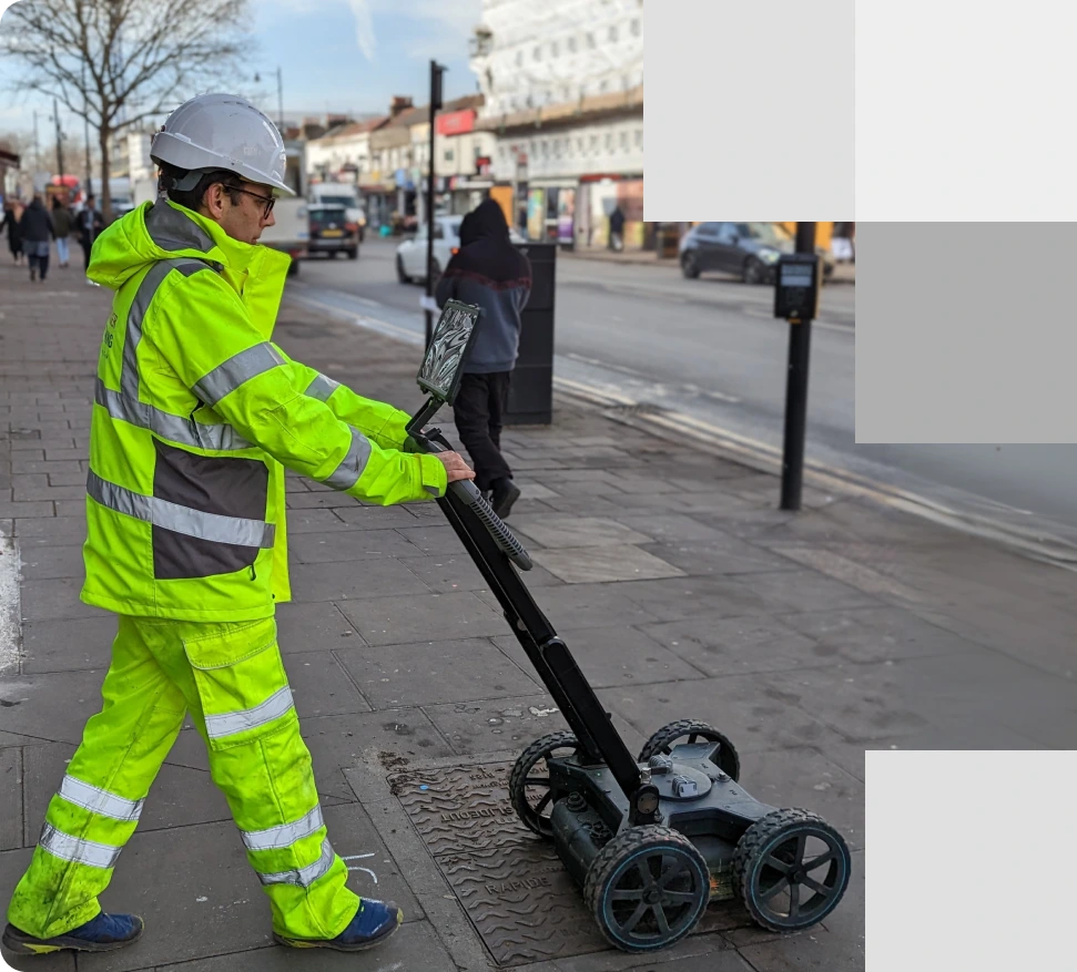
Our GPR surveyor inspects urban subsurfaces, operating equipment on the sidewalk to accurately detect underground utilities and ensure safe excavation practices
About GPR survey service
GPR survey explained
Ground Penetrating Radar (GPR) is a non-destructive technology that allows detailed investigation of below-surface environments. GPR equipment transmits signals into the ground, detecting underground features by receiving reflections. This technology is essential for locating utilities, identifying voids or cavities, assessing structural conditions, and guiding excavation work. GPR surveys provide crucial information on the locations of subsurface features and the construction of structures, preventing costly surprises during excavation and ensuring on-site safety. With a clear picture of what lies beneath, you can make informed decisions and avoid project delays.
Our GPR surveying specialists can accurately identify the following subsurface features:
- Utility location and depth: Detection of underground utilities, including gas, water pipes, and electrical lines.
- Voids and cavities: Detection of subsurface voids, including air pockets, mine shafts, and other underground cavities that could impact stability.
- Material inconsistencies: Identification of inconsistencies within materials, such as variations in concrete or previously excavated areas, which could indicate potential issues.
- Structural foundations: Assessment of structural elements like footings and foundations, ensuring they meet safety and design standards.
- Underground storage tanks: Location and identification of underground storage tanks, which are crucial for environmental assessments and property development.
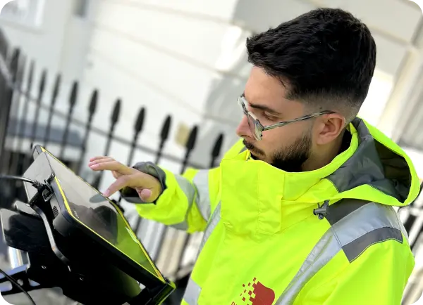
Red Laser expert surveyor operates advanced equipment in London to accurately identify subsurface features, including utilities, structures, and geological conditions
Contact us to book your GPR services
We offer comprehensive GPR surveying services in London. Get in touch to discuss your specific project and receive a customised quote.
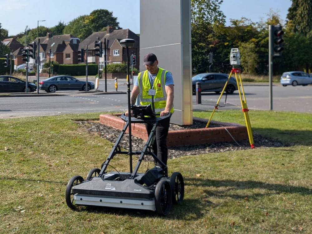
GPR survey applications
Diverse uses of GPR services across industries and projects
Our experienced team provides accurate and reliable GPR survey results for a variety of applications, including:
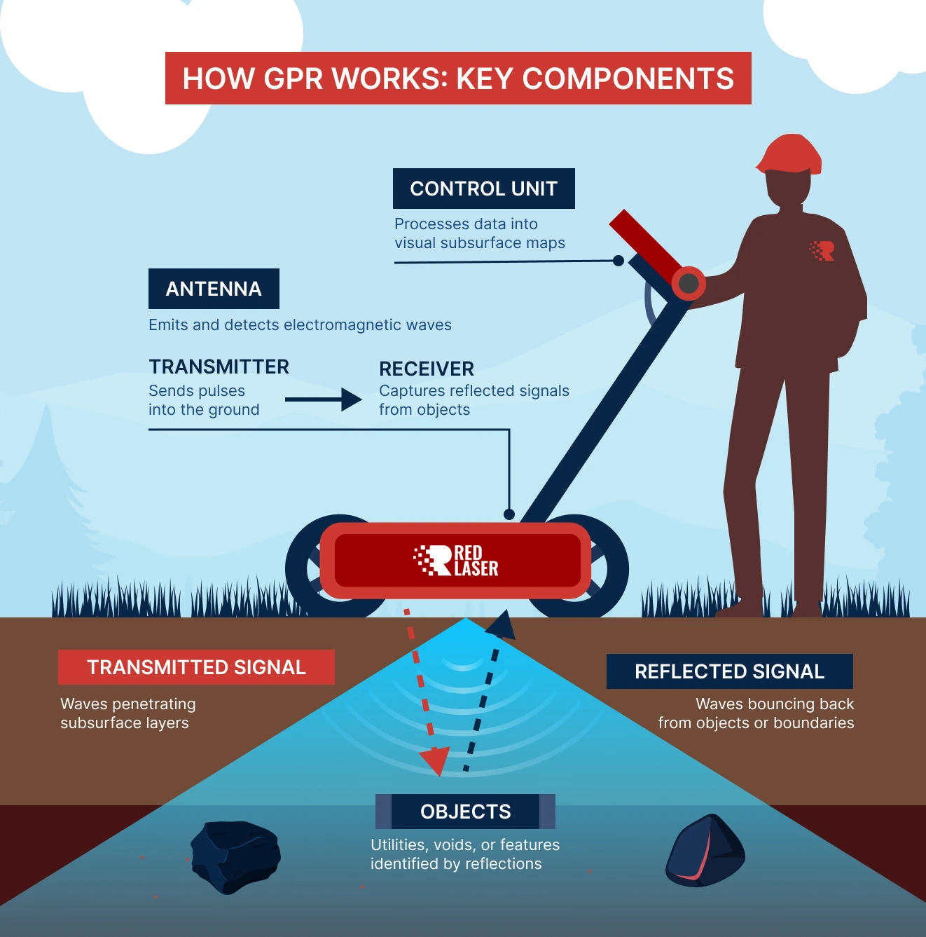
Using advanced technology, our system sends radar waves into the ground, collecting data from reflections. Professionals analyse this data to reveal what's below your site
The process of GPR survey
Precision and accuracy in conducting GPR surveys for reliable results
At Red Laser, we ensure accurate GPR surveys by sending radar waves into the ground, which bounce back when they encounter subsurface objects or materials. Our advanced technology captures this data in real-time, while our skilled surveyors analyse and transform it into clear, detailed visuals, providing you with a comprehensive understanding of what lies beneath your site for precise decision-making and planning.
Here’s how GPR works:
- The scanner: Sends radar waves into the ground.
- Reflection: Waves bounce back when they encounter objects or materials below the surface.
- Data Collection: Our advanced tech captures this info in real-time.
- Analysis: Our professional surveyor transforms the data into clear, detailed visuals, giving you a complete understanding of what’s beneath your site.
Why choose GPR services?
GPR surveys offer a multitude of benefits, making them a preferred choice for various applications:
- Non-Destructive and Non-Invasive method: GPR scanning allows for the inspection of subsurface features without the need for digging or drilling, preserving the integrity of the surveyed area and minimising disruption to the site and environment.
- Accurate and detailed: GPR provides detailed images that enable precise detection and mapping of underground utilities, structures, and other features, ensuring reliable data for project planning and management.
- Cost-Effective: By accurately locating underground objects before excavation begins, GPR surveys reduce the risk of costly damages and delays associated with hitting unforeseen obstacles, thus saving money in the long run.
- Quick: GPR surveyor can conduct site inspection rapidly compared to traditional excavation methods. This speed facilitates quicker decision-making and project progression, helping to meet tight deadlines and reduce project durations.
Book your GPR survey with confidence
Choose a professional reliable team
With years of collective experience in geospatial solutions and a deep understanding of GPR scanning and underground surveying, Red Laser stands out as a premier choice among GPR companies. Our expertise enables us to successfully manage and execute even the most complex projects. We offer personalised solutions and integrated services tailored to meet the specific requirements of each project, ensuring precision and client satisfaction.
Get a quote“We really appreciate the effort Antonio and Danas went to Monday to get survey completed. We will 100% keep Red Laser in mind for future work.”
Our case studies
See how we’ve helped clients achieve their goals with reliable surveying and geospatial solutions
Start working with us
Partner with Red Laser for a confident project launch
What can ground penetrating radar find?
A GPR scanner is capable of locating a wide range of defects, failures, problems and risks that are otherwise difficult or impossible to find without causing disruption to the site
How deep can a ground penetrating radar go?
It depends on the type of material surveyed. With low conductivity materials like granite or dry sand, you get depths of up to 100 feet. High conductivity materials, on the other hand, may not yield as much depth due to the absorption of GPR signals.
Can GPR data be interpreted easily?
Using our software and the latest technology in radar services, we can transfer data in the format that you prefer depending on how you’re going to use this information for your projects.
Is GPR capable of measuring depth or thickness?
Certainly! When you book a GPR survey with us, you’ll receive detailed information including the depth and thickness of underground features. Our scanners use advanced GPR signals to precisely calculate these measurements.
Can a GPR survey differentiate sub-surface features?
Yes, GPR is highly effective at differentiating rebar from both service conduits and tendons. This advanced technology provides incredibly detailed information about the subsurface environment.
How much does a GPR survey cost?
Considering project specifics like materials involved, site location, and the desired level of detail, GPR survey costs can vary. For a personalised quote, please contact us.
