Measured Building Survey — London & UK
- ±1mm accuracy
- Quote within 24 hours
- Urgent slots available
Measured Building Survey Company — Red Laser, London & UK
Red Laser is a measured building survey company based in London, delivering RICS-compliant surveys across the UK to ±1mm accuracy using Leica RTC360 3D laser scanners. Deliverables include floor plans, elevations, sections, point clouds, Revit models and CAD drawings — all processed in-house, quality checked and issued in agreed formats. Detailed, itemised quote within 24 hours.
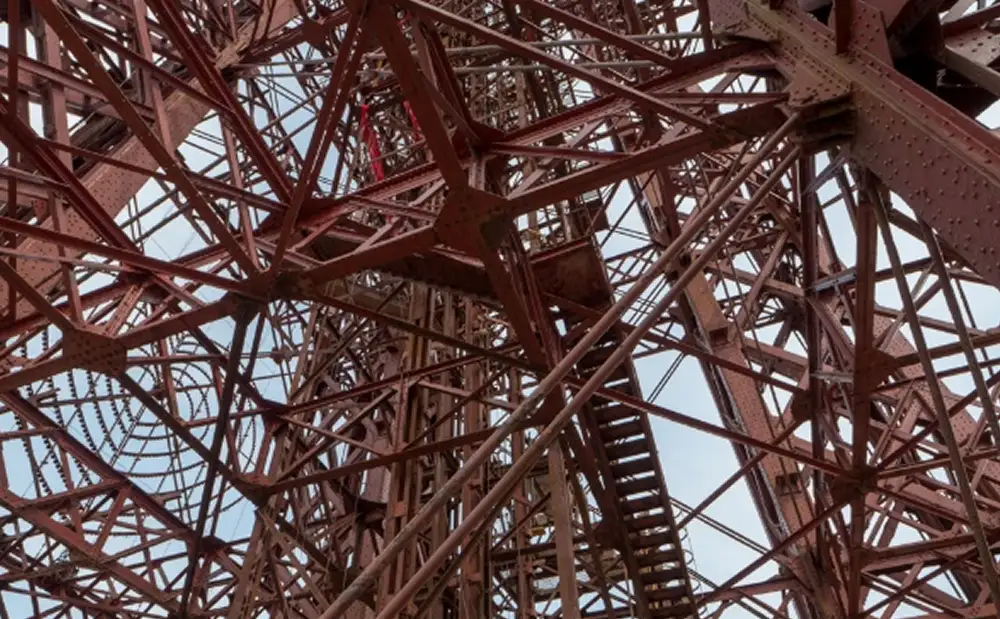
We use 3D laser scanning technology for measured building surveys to capture highly accurate data, providing detailed and reliable information for construction and design projects
What is a measured building survey?
A measured building survey — also called a building measurement survey, measurement survey or architectural survey — is a precise record of an existing building’s dimensions, layout and features. Using 3D laser scanning or traditional measurement methods, the survey produces floor plans, elevations, sections and 3D models that architects, engineers, developers and facilities managers use as the data foundation for design, planning, construction and building management.
Measured building surveys deliver:
- Floor plans, elevations and cross-sections
- CAD drawings in DWG, RVT and IFC formats
- 3D models and point clouds
- Photogrammetry and orthophotos for heritage work
All Red Laser measured building surveys are carried out in compliance with the RICS Measured Survey specification. Processed in-house, quality checked and issued in the agreed formats — ready to use.
Innovative technology and equipment
Boosting project success
We pride ourselves on staying at the forefront of technology to provide our clients with the most accurate and comprehensive measured survey services available. Working with leading measured surveying tools from renowned brands such as Leica, FARO, and AutoDesk, we ensure delivery of precise and reliable measured survey results. We use different types of equipment depending on project, its size, complexity, access restrictions
See moreWhen do you need a measured building survey?
All Red Laser measured building surveys are carried out in compliance with the RICS Measured Survey specification. Processed in-house, quality checked and issued in the agreed formats — ready to use.
Speak with our team about your project — we respond within 24 hours.
How we capture measured building survey data
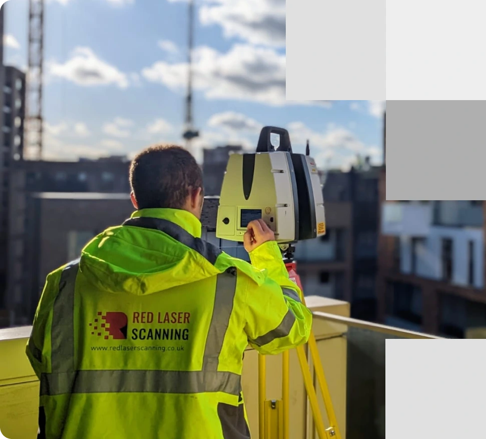
Red Laser uses Leica RTC360 3D laser scanners as the primary instrument for measured building surveys. The scanner captures up to two million data points per second, producing a complete point cloud of the building — every wall, ceiling, floor, window opening and structural element — in a single site visit. All data is registered and processed in-house by our survey team.
Leica RTC360 3D laser scanner | ±1mm
The primary instrument for most measured building surveys — fast, high-density capture for buildings of all sizes.
FARO Focus laser scanner | ±1mm
Complex or high-volume sites requiring multiple instrument deployments alongside the RTC360.
Total station (Leica TS series) | ±1mm
Control network establishment and precise setting-out reference points.
Photogrammetry / DSLR cameras | ±2–5mm
Close-range façade documentation, heritage recording and orthophoto production.
What does a full measured building survey include?
Everything agreed at quote stage — processed in-house, quality checked, issued in the formats you need.
Every measured building survey is scoped to your project requirements. The deliverables below represent the full range available from a complete survey. Your quote confirms exactly what is included.
2D CAD drawings
- Floor plans — Plan views of every floor showing walls, doors, windows, columns and fixed features to the agreed Level of Detail. The most frequently requested deliverable.
- Reflected ceiling plans — Ceiling heights, beams, coffers, light fittings and sprinklers mapped from above. Essential for fit-out, interior design and MEP coordination.
- Internal elevations — Every internal wall face with accurate heights, openings, fixtures and features. Standard for refurbishment, fit-out and interior design projects.
- External elevations — All façades showing external appearance, materials and architectural detail. Required for planning applications, heritage submissions and design development.
- Cross-sections — Vertical cuts through the building showing floor-to-floor heights, structural elements and the relationship between levels. Used by architects and structural engineers.
- Roof plan — Complete roof geometry including parapet heights, plant equipment, roof lights and drainage. Essential for roof replacement, extension and planning work.
3D models
Produced directly from the point cloud. More detailed than traditional measured drawings — used for BIM coordination, design development, clash detection and client presentations.
- Revit model — BIM-ready, IFC-exportable — A fully coordinated 3D model built in Revit. Ready to use in BIM workflows, clash detection and design development. Exportable to IFC for open BIM projects.
- SketchUp model — 3D model in SketchUp format. Used for early-stage design exploration, client presentations and planning visualisations.
- AutoCAD 3D model (DWG) —3D model in DWG format for teams working in AutoCAD-based workflows.
- 3D mesh model — Detailed surface mesh capturing complex geometry, curves and irregular features. Used for heritage recording, conservation projects and buildings where standard modelling methods are insufficient.
Schedules & calculations
Supporting documents derived from the survey data. Commonly requested alongside the main drawing package.
- Window and door schedules — Dimensioned schedule of every opening across the building — type, size, position and reference. Standard for refurbishment specifications, fit-out and planning submissions.
- Area calculations (GIA, GEA, NIA, NLA) — Floor area measurements to RICS Code of Measuring Practice. Used for property valuation, lease agreements, planning applications and space planning.
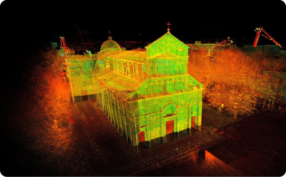
Point cloud
The raw output of the 3D laser scan — and a deliverable in its own right. A point cloud is a dense set of millions of measured data points capturing every surface of the building to ±1mm accuracy. It contains more information than any drawing or model derived from it, and can be revisited at any time if additional outputs are needed without returning to site.
- Point cloud (E57, RCP) — Importable directly into Revit, AutoCAD, ArchiCAD and Autodesk ReCap. Used by BIM managers, architects and engineers who need direct access to the raw scan data.
Tell us which deliverables your project needs — scope and format confirmed at the time of quote
Request a measured building survey quote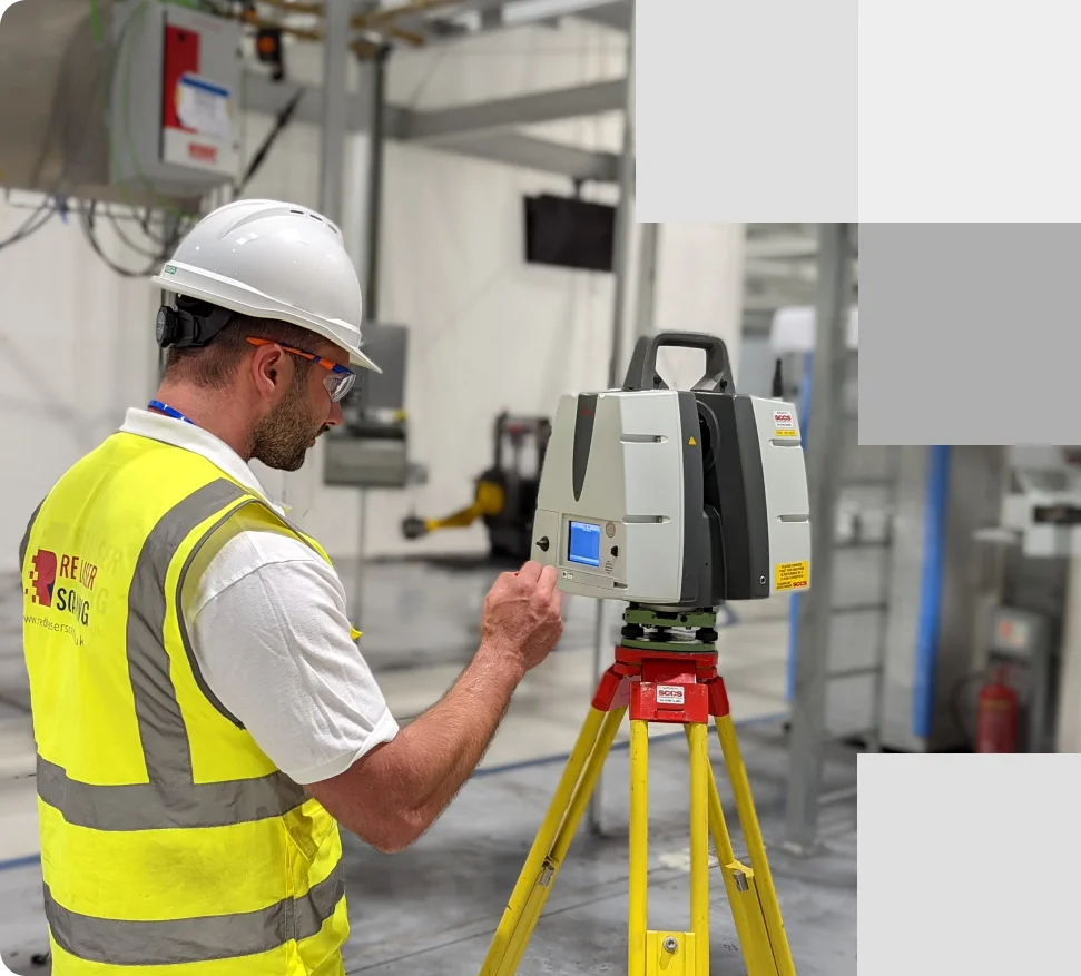
Surveyor carrying out a measured building survey inside a large factory using a 3D laser scanner to capture accurate industrial building measurements
How much does a measured building survey cost?
Every project is scoped and priced individually. Quote within 24 hours.
Every project is different.The cost of a measured building survey is determined by the following factors:
- Floor areaThe most significant factor. Larger buildings require more scan positions and more processing time.
- Number of floorsEach floor requires separate scan setup and registration. Multi-storey buildings take longer.
- Level of Detail (LOD)A full measured survey with all fittings, MEP and ceiling detail costs more than a basic structural survey.
- Deliverables requiredA point cloud only is less expensive than a full suite of CAD drawings, 3D model and BIM model.
- Access and complexityRestricted access, unusual geometry, listed building constraints or multi-occupier sites add time on site.
Straightforward pricing. No hidden fees.
For indicative measured building survey prices, see our pricing page.
Recent measured building survey projects
From period townhouses to multi-storey commercial buildings — across London and the UK
Why clients choose Red Laser for measured building surveys
"I must say that at first glance I consider them to be some of the most well-considered survey drawings that I have come across in a long time. Thank you and your team for their obvious diligence."
- Reliable data. ±1mm accuracyYour measured building survey is captured using Leica RTC360 3D laser scanners, to ±1mm positional accuracy across the full building. Every scan station is registered to a controlled survey network — so drawings are geometrically consistent from floor to floor and elevation to elevation. Accurate survey data removes the need for redesign caused by incorrect dimensions. Before any deliverable is issued, it is checked against your project brief by a second surveyor. You receive the files once they have passed QC — not before.
- Itemised quote. No scope surprisesYour quote lists every element — deliverables, drawing scale, Level of Detail, format and delivery programme — before a single scan is taken. What is quoted is what you receive. There are no format revisions or scope additions after the survey is complete, because everything is confirmed before it begins.
- Direct access from day oneWhen you contact Red Laser, everyone you speak to has a professional background in surveying, construction or engineering. That means the person scoping your building survey understands your project — not just the process of booking one. Urgent and next-day site slots are available.
A Red Laser surveyor reviews measured building survey notes and drawings, cross-checking data to prevent errors before delivery
How Red Laser prevents survey errors
Five safeguards on every measured building survey
Professional buyers commission building surveys because the cost of inaccurate data — in aborted design, rework or failed planning applications — far exceeds the cost of the survey itself. These are the safeguards built into every Red Laser project.
- Scope, format or scale wrong on deliveryDeliverables, format, scale and Level of Detail confirmed in writing before mobilisation — floor by floor, drawing by drawing
- Drawings contain dimensional errorsAll deliverables checked against your project brief by a second surveyor before issue
- All data is processed in-house by our survey teamAll deliverables checked against your project brief by a second surveyor before issue
- Access issues cause incomplete captureSite programme and access requirements confirmed before the team arrives on site
- Survey delayed post-mobilisationDelivery programme agreed at quote stage and written into project confirmation before work begins

Infographic: The process of measured building survey service
How our measured survey process works
Quality assured. On time.
- Enquiry Send your project details — building address, scope, deliverables, programme | Response within 24 hours.
- Quote Red Laser reviews scope and confirms approach, access requirements and equipment | Detailed, itemised quote — deliverables, format, scale, LOD, delivery programme.
- Site survey Leica RTC360 captures the full building — interior and exterior — to ±1mm accuracy | Complete point cloud registered to a controlled survey network.
- Processing and QC Data processed in-house. Drawings and models produced. Checked against your brief by a second surveyor | QC-signed deliverables ready to use in your design software.
- Delivery Files issued in agreed formats — DWG, RVT, E57, PDF | Design-ready survey data, delivered to programme.
Ready to start?
We’ll confirm your programme at the time of quote.
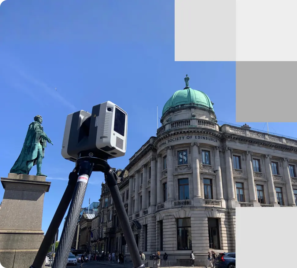
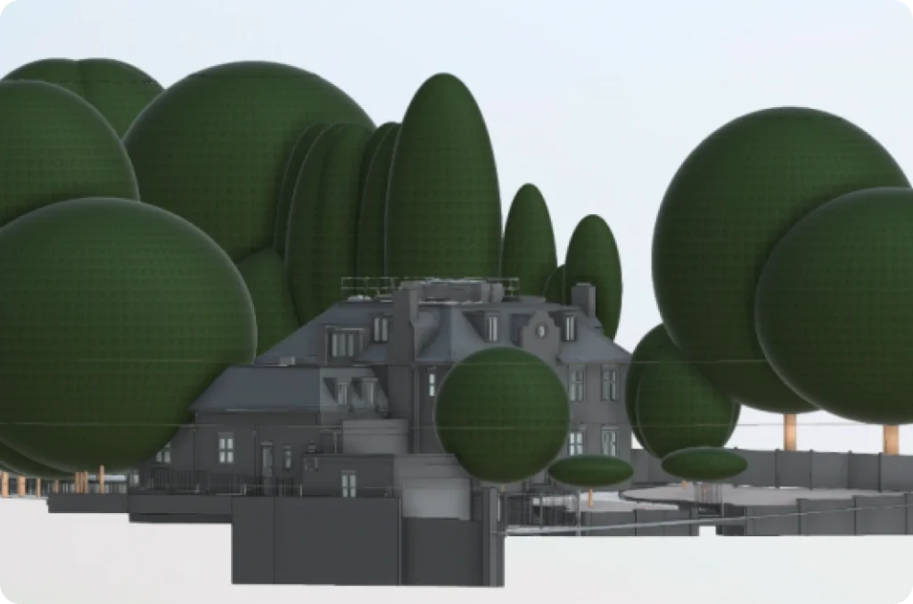
A measured building survey of The Royal Society of Edinburgh, captured using high-accuracy 3D laser scanning to record detailed architectural features
Measured building surveys for your sector
- ArchitectureDesign-ready floor plans, elevations and sections to RICS specification — in DWG or RVT, at the scale your planning submission or design package requires.
- Property developmentVerified GIA, NIA and GEA area calculations and existing conditions drawings — accurate building data before you commit to acquisition or planning.
- ConstructionAs-existing CAD drawings and point clouds for construction coordination, verification and setting-out reference.
- Heritage and conservationNon-contact laser scan and photogrammetric record of listed buildings and conservation structures — no damage to fabric, full dimensional accuracy
- Structural and civil engineeringAccurate cross sections, level data and structural geometry for analysis, retrofit design and refurbishment coordination.
- Facilities managementUp-to-date floor plans, area schedules and 360° virtual tours for estate management, maintenance planning and space utilisation.
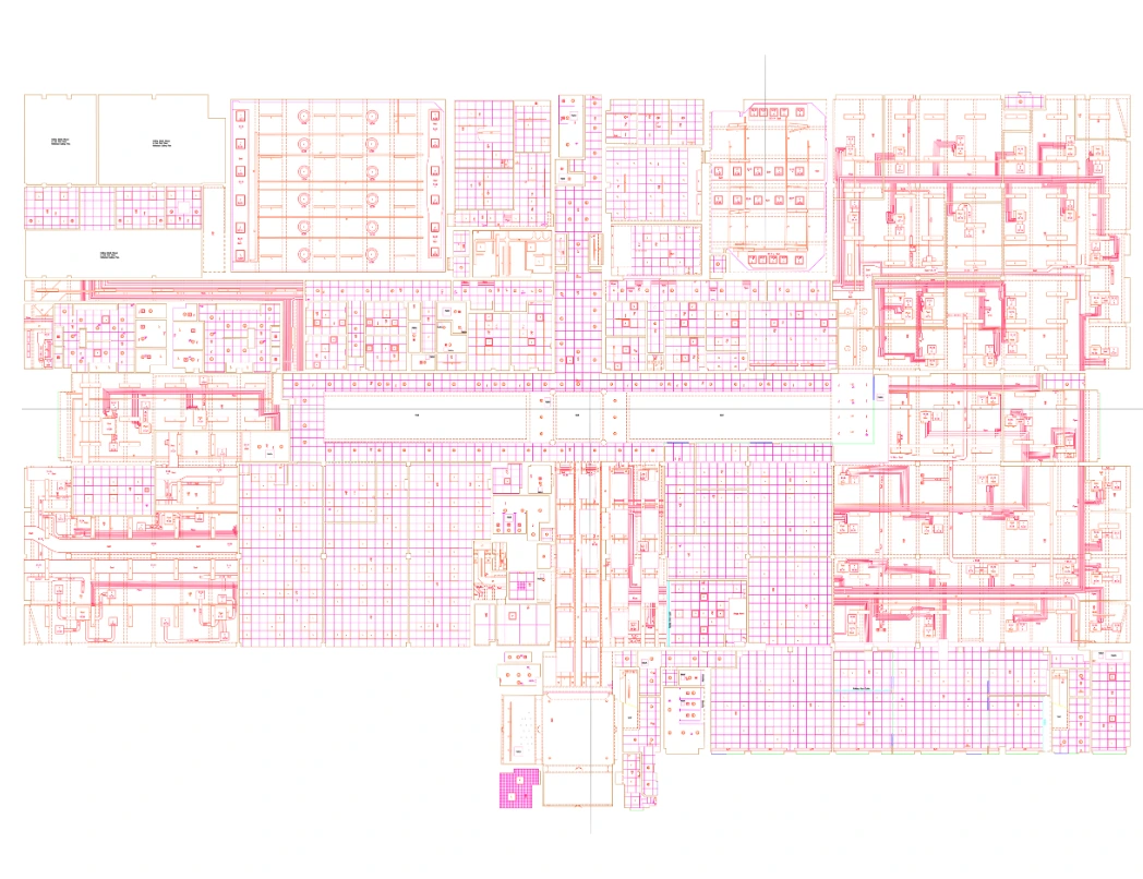
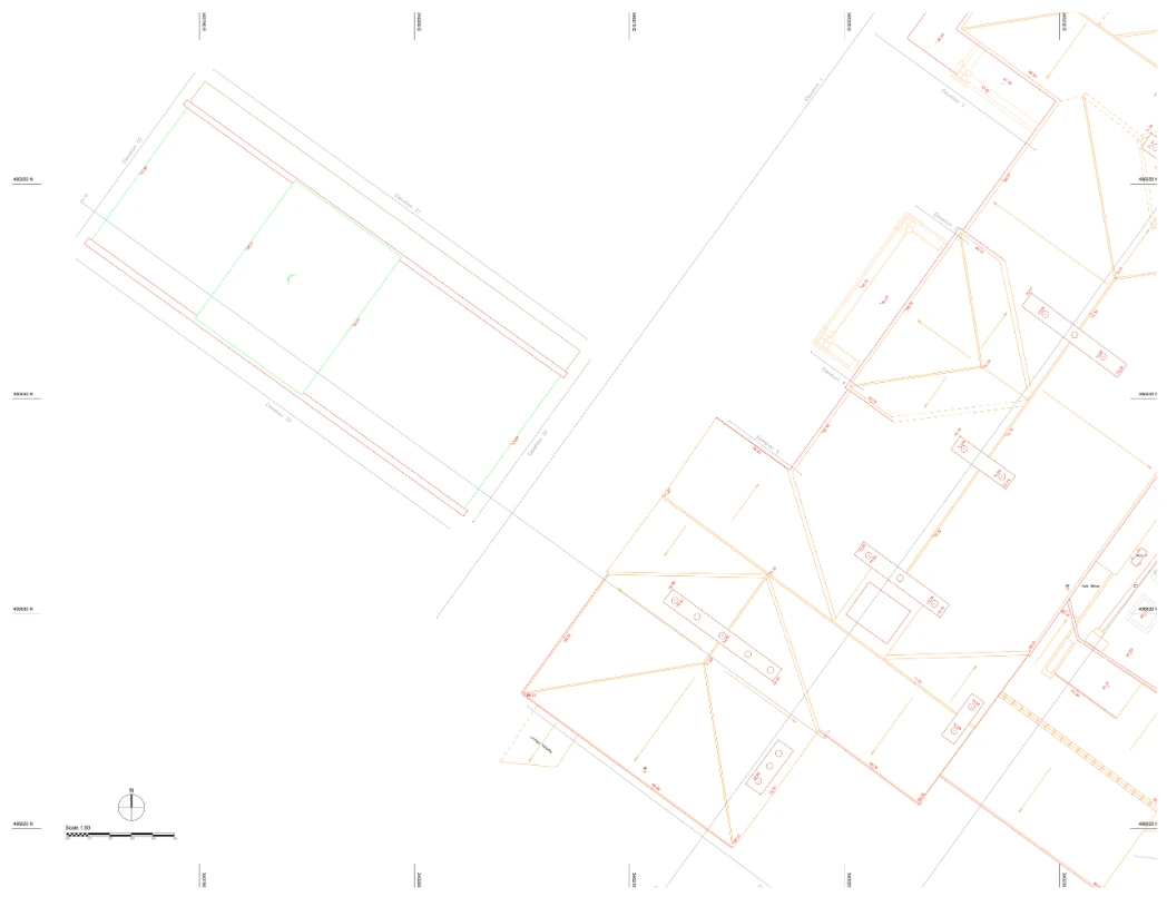
Measured building survey deliverables
Delivering detailed drawings and models ensuring accuracy and efficiency
Our full measured building survey outputs encompass detailed drawings and models, including floor plans, roof plans, internal and external elevations, sections, and ceiling plans. These surveys are conducted to an agreed level of detail, ensuring the accuracy and scale required for your project. In a basic survey we record the essential elements such as walls, doors, and windows, while a full measured building survey provides a comprehensive view, including detailed electrical layouts and plumbing.


Get accurate survey data with confidence
Expert measured building surveys for reliable project outcomes
At Red Laser, we are dedicated to delivering the best quality measured building surveys that provide precise and reliable data that will help drive your project forward. Reach out to us today to discuss your requirements and receive a personalised quote, including the cost of a measured building survey.
Get a quote“Thank you so much for your efforts; the team has done an excellent job! The amendments are very thorough, and I really appreciate the added elevation, especially given it was beyond the original scope.
You’ve been incredibly quick. Thanks again for your hard work.
”
Start working with us
Partner with Red Laser for a confident project launch

Measured building surveys across London and the UK
Red Laser is based in London at 23 Sussex Street, SW1V 4RR. Our team delivers building surveys nationwide — across all London boroughs and regularly throughout the UK in Manchester, Birmingham, Bristol, Edinburgh, Leeds and beyond.
Travel and site programme for projects outside London are confirmed at quote stage. No hidden costs.
Red Laser also delivers a full range of measured survey services — from topographic and heritage surveys to drone surveys and area measurement. See our measured surveys page for the complete service range.

Surveyor carrying out a measured building survey using a Leica 3D laser scanner for accurate building measurements in London and across the UK
Frequently asked questions about measured building surveys
What is a measured building survey?
A measured building survey — also called a building measurement survey, measurement survey or architectural survey — is a precise record of an existing building’s dimensions, layout and features. Using 3D laser scanning, it produces floor plans, elevations, sections and 3D models for use in design, planning, construction and building management. Used at every stage of a building’s life — from planning and design through to refurbishment, acquisition and facilities management.
When do I need a measured building survey?
You need a measured building survey whenever design or construction decisions depend on accurate existing conditions data — typically at the start of a refurbishment, before a planning application, during pre-acquisition due diligence, or when creating a BIM model of an existing building. It is the essential first step for any architect, developer or engineer working with an existing structure.
What deliverables do I receive from a measured building survey?
You receive the deliverables agreed at quote stage — from a floor plan–only package to a full set including CAD drawings, a Revit model, point cloud data and area schedules. Standard outputs include floor plans, reflected ceiling plans, internal and external elevations, cross sections, roof plans, and point cloud in your required format. All deliverables are quality-checked against your brief before issue.
What affects the cost of a measured building survey?
Measured building survey cost is determined by building size and number of floors, the Level of Detail required, the deliverables needed, access conditions on site, and the drawing scale specified. Red Laser provides a detailed, itemised quote within 24 hours — covering every element of scope with no cost surprises after the survey is complete.
How long does a measured building survey take?
Site survey duration depends on building size, number of floors, complexity and Level of Detail required — confirmed at quote stage. The delivery programme for drawings and models is agreed in writing before the survey begins. Urgent and next-day site slots are available for time-critical projects.
Can you carry out a measured house survey on a residential property?
Yes. Red Laser carries out measured building surveys on residential properties of all types — from single-storey extensions to multi-storey period townhouses. The same Leica RTC360 process applies, with deliverables produced at the scale and Level of Detail the architect or planning consultant requires. Surveys on listed residential buildings use non-contact methods throughout.
Does Red Laser follow RICS measured building survey specifications?
Yes. All Red Laser measured building surveys are carried out in compliance with the RICS Measured Survey specification — the governing standard for building measurement across the UK. Area calculations — GIA, NIA, GEA and NLA — follow the RICS Code of Measuring Practice. Compliance is confirmed in project documentation and available on request.
What is the difference between a measured building survey and a building measurement survey?
A measured building survey and a building measurement survey are the same service — the terms are used interchangeably across the industry. Both describe a precise survey of an existing building’s dimensions and layout, producing drawings and models for design, planning and construction use. Red Laser delivers both under the same RICS-compliant process.
What happens when you
Contact us?
- Send us your project details — building address, scope, deliverables needed and programme. Two minutes. No obligation.
- Our team reviews your requirements and confirms the right approach and equipment for your building.
- You receive a detailed, itemised quote within 24 hours — scope, format, scale, LOD and delivery programme included.
- Programme agreed and confirmed in writing. Survey booked. Nothing starts without your approval.
