Unlock insights with BIM underground services
Optimise your projects with precise BIM underground services
Get a quote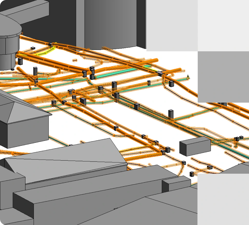
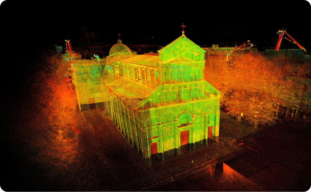
Precise BIM-ready model of underground utilities, demonstrating the capabilities of BIM underground services in enhancing infrastructure management through accurate 3D visualisation and mapping
About our scan to BIM underground services
Comprehensive underground CAD and BIM modelling
Accurately mapping underground utilities is crucial for effective construction planning and risk mitigation. Our BIM underground services use advanced geospatial and laser scanning technologies to capture detailed data on buried utilities, including pipes, cables, and other subsurface structures.
This data is processed into 3D underground surveys and integrated into CAD and BIM-ready models, enabling precise planning and design coordination. Our models include a complete representation of underground utilities, offering a reliable resource for clash detection, route optimisation, and lifecycle management.
By leveraging these models, you gain a clear understanding of your subsurface infrastructure, minimising risks and avoiding costly project delays.
Why choose Red Laser for BIM underground services?
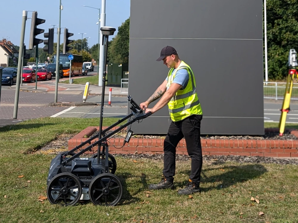
- Advanced technology: We utilise advanced tools like ground-penetrating radar (GPR) and 3D laser scanning.
- Accurate data: High-precision mapping of underground utilities and subsurface features.
- Comprehensive models: Our detailed CAD and BIM utilities surveys tailored to your needs.
- Tailored solutions: Custom models with varying Levels of Detail (LOD) to suit your project requirements.
- Regulatory compliance: We ensure adherence to industry standards and guidelines.
- On-time delivery: Our reliable service delivered on schedule to keep your project on track.
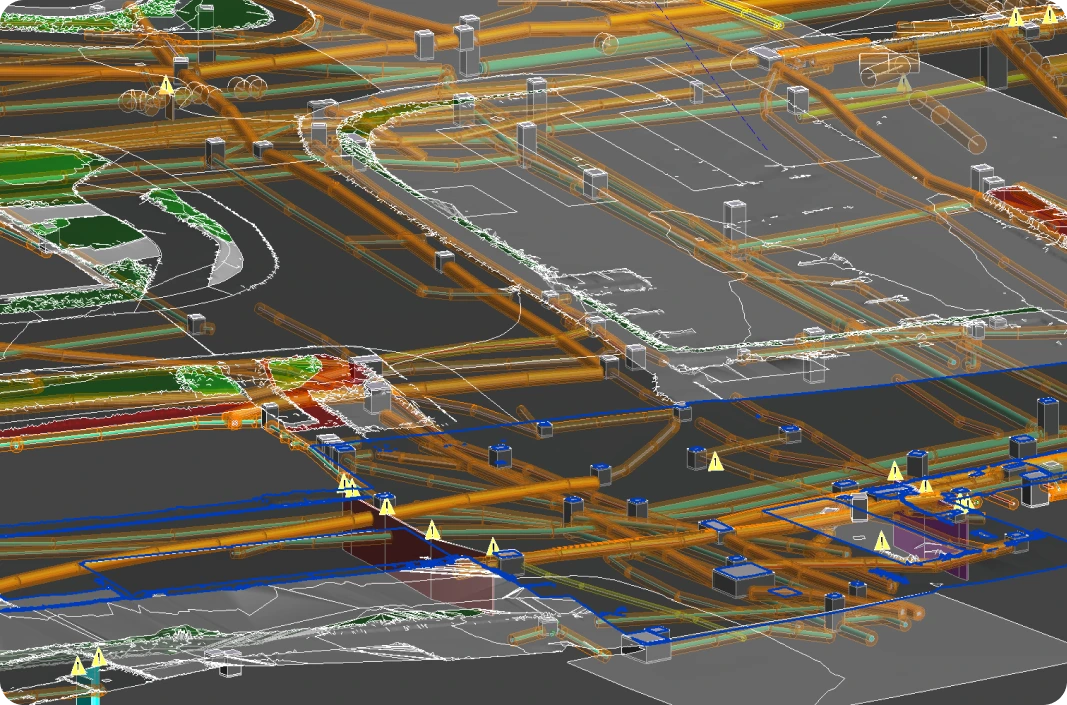
This BIM-ready model by Red Laser highlights BIM underground services, mapping complex utility networks essential for efficient urban planning and construction management
Ready to map your underground utilities?
Partner with Red Laser for accurate and reliable 3D underground surveys and BIM modeling. Ensure your projects are built on a strong foundation with precise underground utility data.
Applications of BIM underground services
Our Scan to BIM underground services are vital for a variety of projects, including:
Advanced methods we use for underground BIM services
Our Scan to BIM underground services employ a combination of advanced technologies to ensure precise and reliable modelling of subsurface infrastructure.
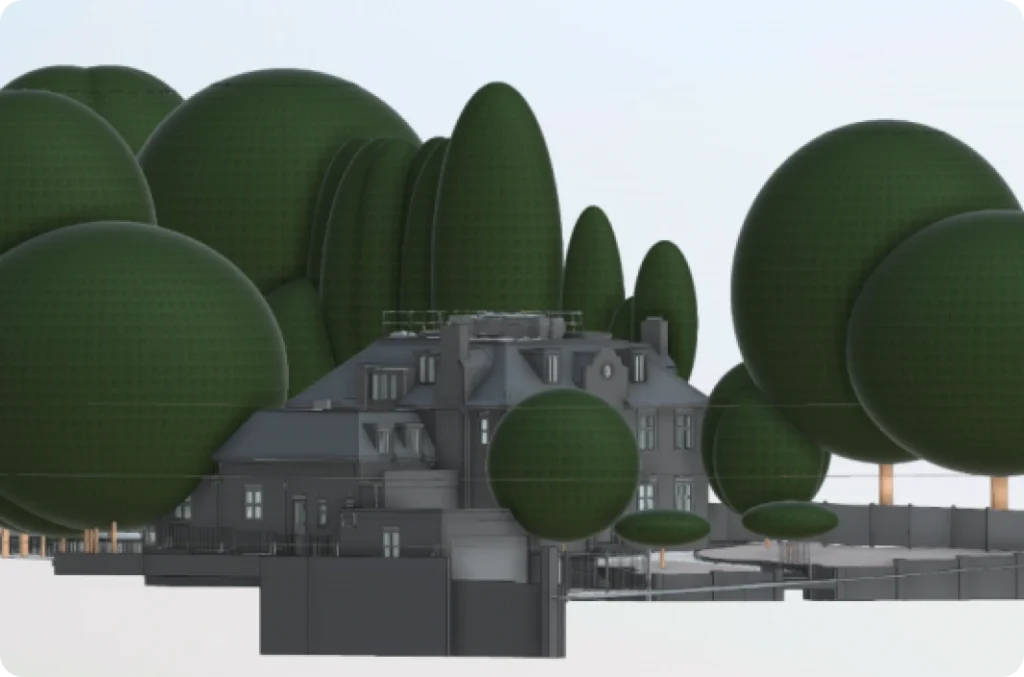
- Laser scanning (LiDAR): This method emits laser pulses to capture high-accuracy 3D point cloud data of underground structures, creating detailed models that perform well under diverse conditions.
- Ground penetrating radar (GPR): Using electromagnetic waves, GPR detects the presence and depth of underground utilities, including non-metallic assets, and is effective across various soil types.
- Photogrammetry: Overlapping photographs are processed to generate 3D models, providing a visual context that complements LiDAR and GPR data.
- Data fusion: This technique integrates LiDAR, GPR, and photogrammetry data into a single, unified model, delivering a comprehensive view of underground infrastructure for better decision-making.
- Point cloud processing: Specialised software is used to clean and refine point cloud data, reducing noise and enhancing the overall quality for accurate modelling.
By combining these methods, we deliver a complete and precise understanding of underground utilities, ensuring better project outcomes and reduced risks.
Partner with Red Laser for reliable underground BIM solutions
Red Laser is a trusted provider of BIM underground services, combining advanced technology with expert knowledge to deliver exceptional results. Whether it’s infrastructure planning, risk assessment, or facility management, our solutions ensure accuracy and reliability every step of the way.
See examples of our underground BIM-ready models and experience the Red Laser difference.
Get a quote“Many thanks for the files and the great service you guys provide.”
Our case studies
See how we’ve helped clients achieve their goals with reliable surveying and geospatial solutions
Start working with us
Partner with Red Laser for a confident project launch

What is Scan to BIM for underground services?
Scan to BIM is a process that uses laser scanning and advanced techniques to capture accurate, real-world data of underground utilities. The data is converted into a 3D underground survey and Building Information Model (BIM), enabling precise planning, coordination, and analysis of underground services in a digital format
Why is Scan to BIM important for underground services?
It helps reduce errors during construction or renovation projects by providing a detailed and accurate digital representation of subsurface utilities. This prevents clashes with other structures, improves project efficiency, and enhances coordination through our BIM Utilities Service
What equipment is used for Scan to BIM of underground services?
- Ground Penetrating Radar (GPR)
- Total Stations
- 3D Laser Scanners
- GNSS systems
- Advanced software for BIM modelling
How long does the Scan to BIM process take?
The time required varies based on the complexity of the site, the extent of underground services, and the project scope. Smaller projects may take a few days, while larger ones may require weeks.
Is scan to BIM compliant with industry standards?
At Red Laser, Scan to BIM is conducted in accordance with industry standards such as PAS 128 for utility detection and mapping, ensuring high-quality and reliable deliverables.
