Professional drone survey services
Utilising the advanced drone technology, we deliver precise aerial data solutions in London and nationwide. Get started by contacting us today
Get a quote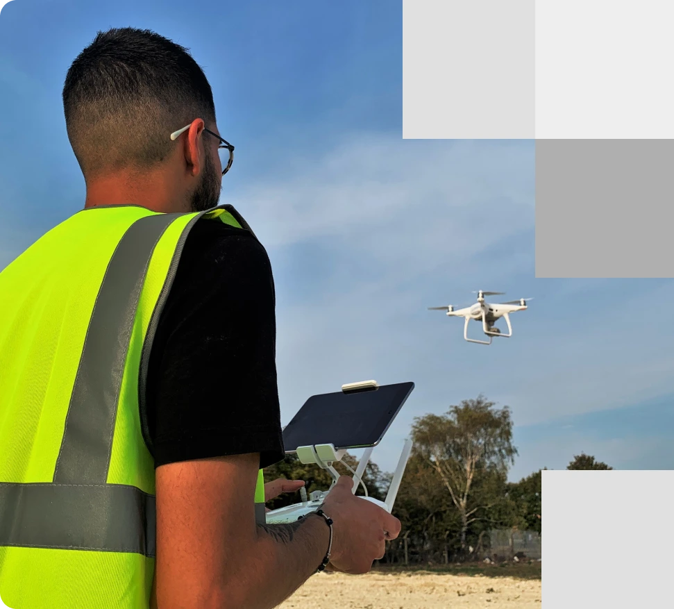
Specialists setting up drone survey for a comprehensive survey, focusing on high-quality data acquisition for mapping, analysis, and real-time insights to support project accuracy
About drone survey
Advanced aerial mapping and data collection
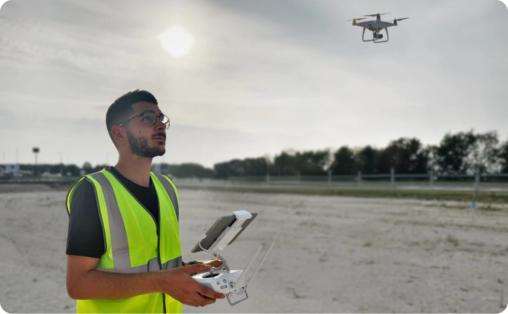
A drone survey can provide precise data and detailed measurements, even on large-scale or restricted sites. In some cases, this method proves more efficient than traditional on-ground techniques, offering accurate on-site measurements of distance, depth, volume, and pitch in less time.
At Red Laser, we conduct reliable aerial mapping and drone surveys using advanced drone technology, ensuring that your project’s needs and requirements are fully met with precision and efficiency.
- Site monitoring: Track project progress with aerial drone technology.
- Accurate measurements: Capture precise data for distance, depth, and volume.
- Thermal inspections: Identify heat-related issues with thermal imaging.
- HD video footage: Obtain clear aerial videos for a comprehensive site view.
- Photogrammetry: A process creating detailed maps using drone-captured images.
- RTK & LiDAR: Integrate advanced scanning for detailed and accurate data.
Benefits of drone surveys
- Time-efficient: Drone surveys are completed in a fraction of the time compared to traditional methods.
- High accuracy: Achieve precise measurements with advanced drone technology.
- Cost-effective: Reduce the need for extensive manpower and equipment on the ground out weighing the surveying drone cost.
- Access to hard-to-reach areas: Safely survey areas that are difficult or dangerous to access.
- Comprehensive data collection: Capture high-definition images, videos, and thermal data.
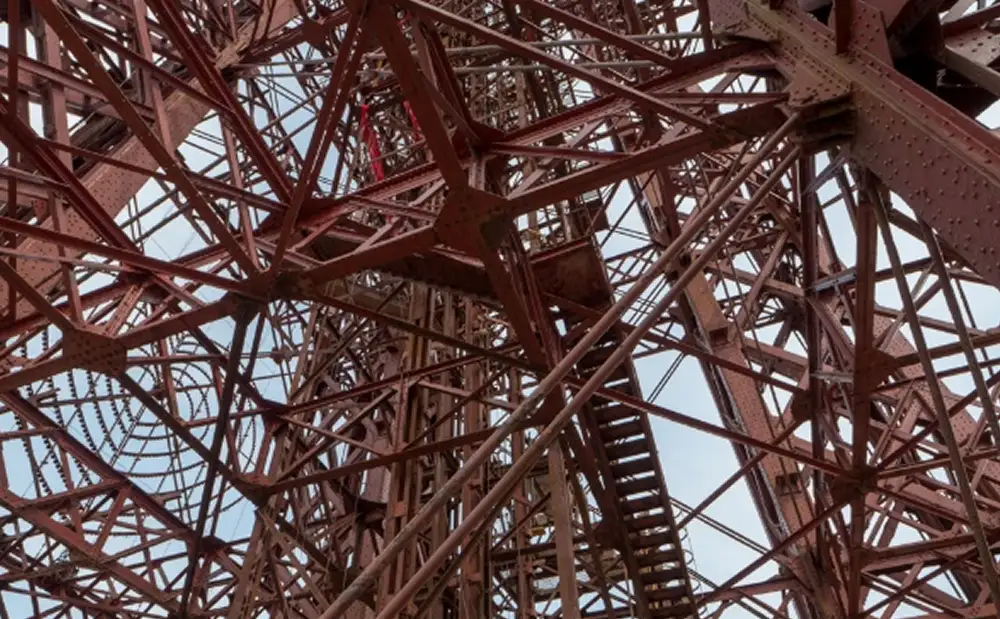
Our experts offer drone survey services for detailed roof inspections, providing precise data and insights while enhancing safety and efficiency throughout the process
Ready to take your project to new heights?
Contact us today for trusted drone survey services across the UK
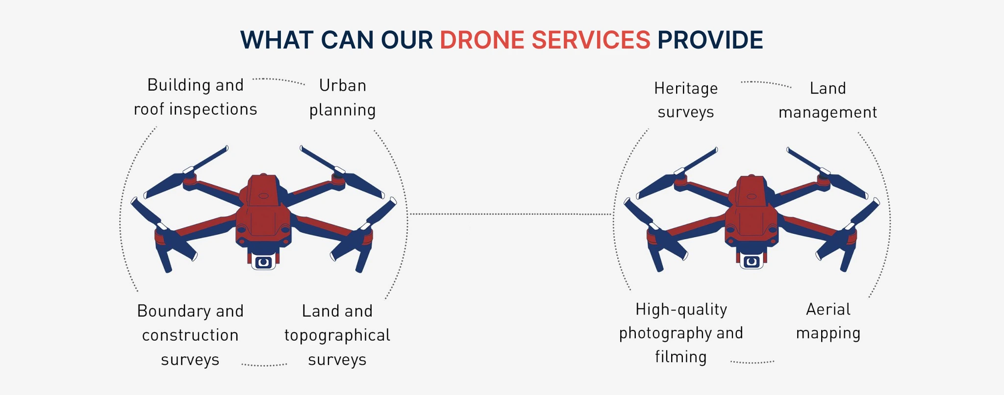
Infographic: Drone survey services
Applications of drone surveys
Comprehensive solutions for various projects
Our drone surveying service covers a wide range of applications, including:
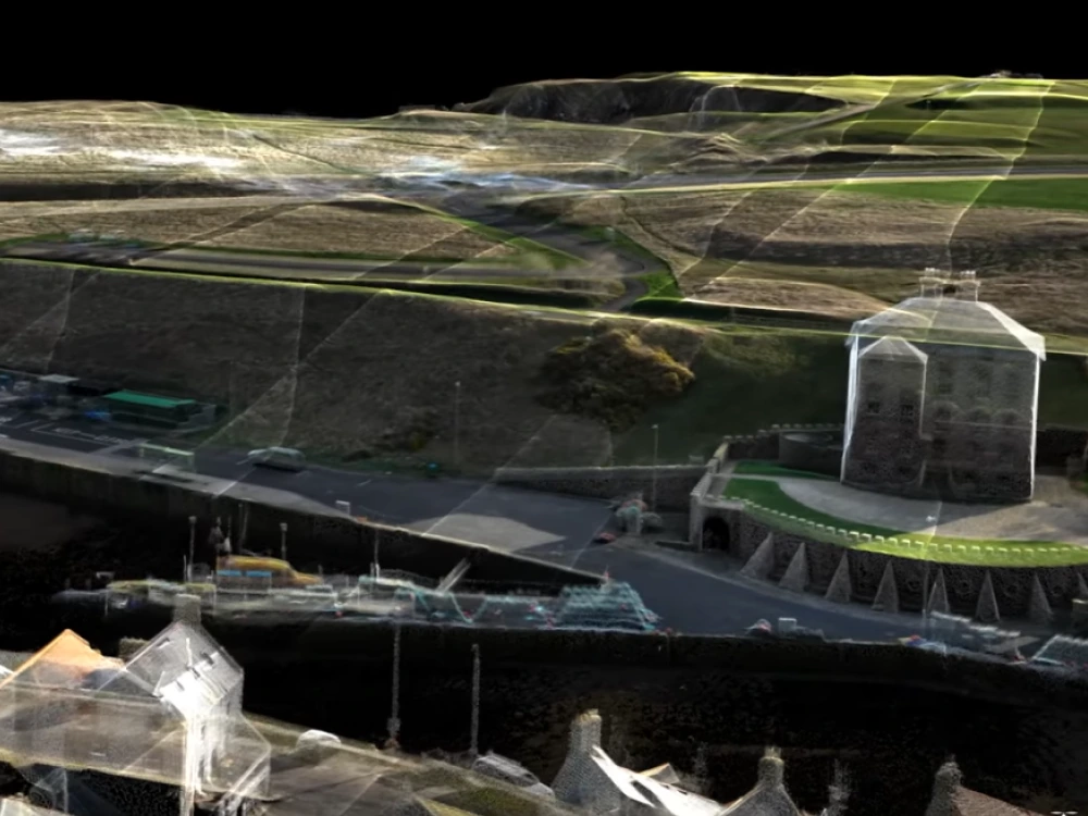
Highly detailed deliverables from drone surveying specialists
We provide comprehensive data and visualisations for your project, including:
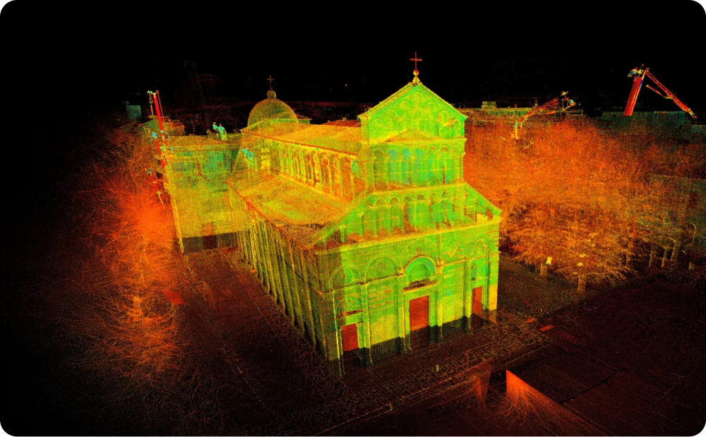
- LiDAR Mapping: Our drones are equipped with LiDAR systems that measure distances with pulsed laser light, providing 3D visualisations and mapping for detailed analysis.
- Orthoimagery: Receive detailed representations of the Earth’s surface through aerial images. This data is transformed into spatial mapping and GIS datasets, available in multispectral, hyperspectral, and thermal formats. We also offer topographic and planimetric data derived from orthoimagery.
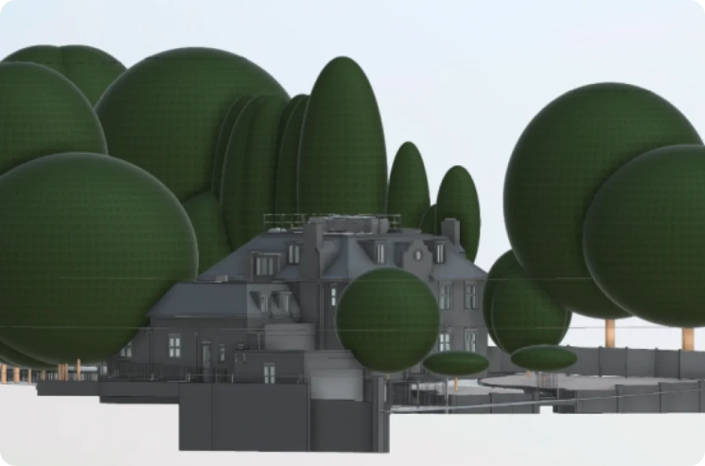
- 3D Point Cloud: The imagery captured by drones can be used to produce a variety of 2D and 3D deliverables, such as BIM models, 2D topographic plans, condition reports, and verified views.
Why choose Red Laser for your drone surveys?
Expertise, precision, and reliable results
Red Laser combines years of surveying expertise with a usage of advanced drone technology to deliver the best, reliable and precise data for your projects. Our personalised approach ensures that each survey is tailored to meet your specific needs, whether it's for a small-scale project or a large, complex site. Trust us to deliver accurate results on time and within budget. Contact us today to discuss your project and get a customised quote for your surveying drone cost.
Get a quote“It’s been a pleasure working with you and your team on this project!”
Our case studies
See how we’ve helped clients achieve their goals with reliable surveying and geospatial solutions
Start working with us
Partner with Red Laser for a confident project launch
What is a drone survey?
A drone survey provides a comprehensive aerial perspective, ideal for mapping or accessing difficult-to-reach areas of land or buildings. Our specialists use UAVs (unmanned aerial vehicles) equipped with downward-facing sensors to capture precise aerial photography and topographical data.
Our latest drones deliver detailed plans and topographical surveys, ensuring complete confidence in the results. With this technology, you can create 3D maps, 2D plans, and comprehensive surveys, allowing for safe and efficient planning and management across a variety of projects.
What are the benefits of drone surveys?
- Drone surveys / UAV surveys are accurate and comprehensive – there is no better way to achieve full survey results and inspections from overhead
- Drone survey services are cost-effective – they are affordable at the point of setup, and will deliver results which would otherwise demand extensive investment
- Drone and UAV surveys allow you to access tricky or inaccessible areas of land or site on which you need to plan
What can drones be used to survey?
Drones and UAVs may be used to survey land and buildings for the following purposes and needs:
- To enable accurate land development and planning – such as road construction and public services
- To monitor for slopes and precise data that advises on safety hazards – such as landslides – as well as potential blocks for land and building planning
- To create accurate maps and plans of densely populated areas – for town and urban planning professionals who need to develop areas which are already widely occupied
- For cartography – to help produce accurate maps and land surveys which are up to date and which are more reliable than outdated maps and guides
- For digital reality
How much does a drone survey cost?
The cost of drone surveying services can differ depending on a number of specifics:
- The location of your survey
- The size of the property and location you need drone surveying and mapping for
- The type of drone building survey you require – your type of premises can impact cost
- How easy it is to access your property and land
- How close your project is to built-up areas and points of public interest, such as transport terminals and stadiums
What formats can drone surveys deliver in?
Drone surveys can produce maps and plans in a variety of deliverables. Our drone surveying services can be flexible to your own software demands. The files we can deliver may include:
- DSM models in .xyz, .las, .laz and .tiff
- 3D point cloud files in .xyz, .las, .laz and .ply
- Orthomosaic mapping in .html, .tiff, .png, .jpg and .kml
- Contour lining in .pdf, .dxf and .shp
- 3D textured mesh in .obj, .pdf, .fbx, .ply and .dxf
