Surveying and geospatial solutions
Boosting project success with data driven decisions: surveying expertise and space digitisation
Get a quote24/7
availability
0+
years of experience
0+
projects completed
0+
clients served
Measured building survey
Detailed surveys to create precise building plans and architectural drawings.
Topographical survey
Accurate mappings of land features and contours for effective project planning.
Utility survey
Advanced utility detection services for safe and informed infrastructure development.
GPR
survey
Non-invasive ground imaging services to reveal and map subsurface structures.
BIM
services
Specialised in creating comprehensive digital building models to streamline project management.
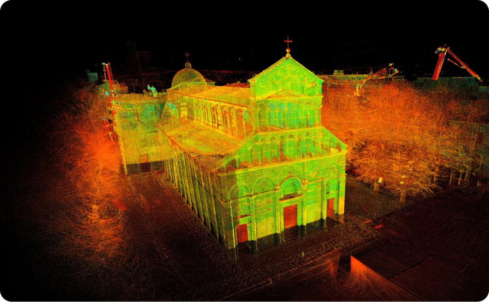
Laser scanning survey
Precise 3D models of physical spaces, supporting construction and renovation projects.
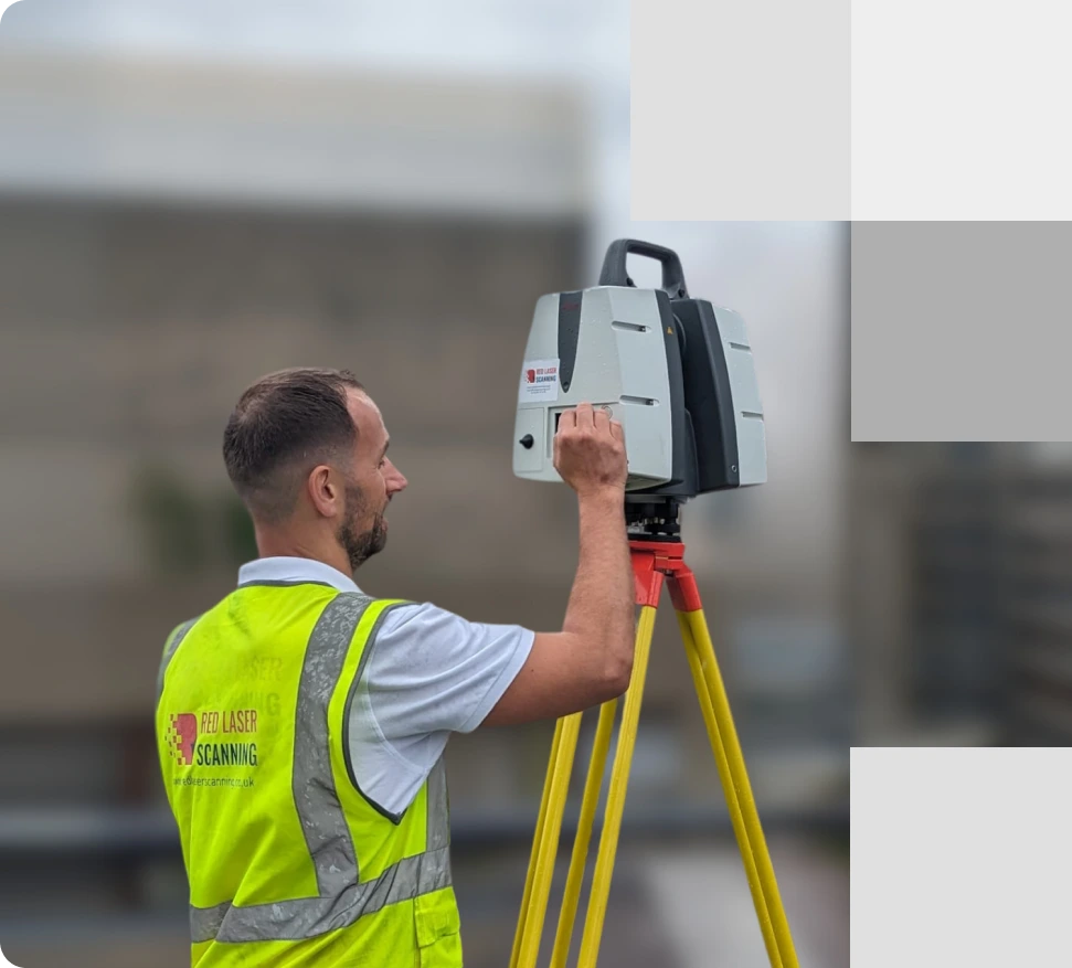
A skilled surveyor on-site with an advanced laser scanner conducting a measured building survey, ensuring accurate data collection
Delivering excellence
Expert solutions in geospatial, surveying and space digitalisation
Red Laser offers a range of advanced geospatial and surveying services that ensure accuracy and efficiency in every project. Our offerings include Measured Building and Topographical Surveys for precise architectural plans and land mapping, Utility and GPR Surveys for safe underground utility detection, and BIM and Laser Scanning Services for detailed 3D modelling and project management. Trust us to enhance your project outcomes with our expertise.
See moreWho we work with
Sectors
- Real estate and property
- Commercial & offices
- Heritage & listed buildings
- Industrial & logistics
- Education
- Healthcare
- Infrastructure
- Manufacturing
- Energy
- Environmental
- Public sector and government
Clients
- Architects
- Civil engineers
- Project managers
- Property owners
- Facilities managers
- Construction managers
- Fit out contractors
- Property consultants
Accuracy through process
The four pillars of our process explained
At Red Laser, our commitment to delivering accurate and reliable results is built on
four foundational pillars that streamline our processes and ensure
excellence in every project:
1
Enquire
Get in touch and tell us about your project.
We quickly assess your requirements and confirm the best approach.
Fast response
2
Scope, Quote & Book
We review the scope, issue a clear quote, and agree all details.
Once confirmed, we book your survey date.
Clear start
3
Survey on Site
Our team attends site and carries out the survey using the most suitable technology—safely, efficiently, and with minimal disruption.
Efficient & professional
4
Process, Check & Deliver
Your data is processed in-house, quality checked, and issued in the agreed formats—ready to use.
Quality assured. On time.
Innovative technology and equipment
Boosting project success
We pride ourselves on staying at the forefront of technology to provide our clients with the most accurate and comprehensive measured survey services available. Working with leading measured surveying tools from renowned brands such as Leica, FARO, and AutoDesk, we ensure delivery of precise and reliable measured survey results. We use different types of equipment depending on project, its size, complexity, access restrictions
See moreOur survey equipment
3D laser scanners
Our measured building surveyors utilise the latest 3D laser scanners, with a maximum accuracy error of +/-1mm. It captures the speed of 1,000,000 points per second, being the ideal tool to capture data efficiently.
Topographical equipment
We use high standard topographical equipment to carry out topographical and land surveys, no matter the complexity and area conditions. Our advanced topographical equipment includes total stations, GPS equipment and the use of 3D laser scanners to capture highly accurate data to deliver your topo drawings and 3D models.
Drones
Our drone surveyors used the latest UAV technology and aerial equipment to capture accurate measurements from above. We create highly accurate 3D point clouds through drone technology and orthophotos, along with the use of photogrammetry software.
Underground survey equipment
Our underground utility surveyors use GPR equipment, electromagnetic equipment and CCTV cameras to provide underground surveying. We also use a range of tracking equipment according to the underground services such as Sondes and drainage tracing.
High-resolution imagery cameras
We use high-resolution DSLR cameras to capture photos of buildings, especially heritage and listed buildings. Our lens will range up to 200mm to capture large scale projects and still be able to capture all detail.
Software
We use a range of software to produce your deliverables in the required level of detail and specified format. For our scan to CAD service, we used AutoCAD software to produce detailed floor plans, elevations and cross-sections. In addition, we can create 3D models using BIM software such as Revit and provide 3D models using SketchUp software.
See our models
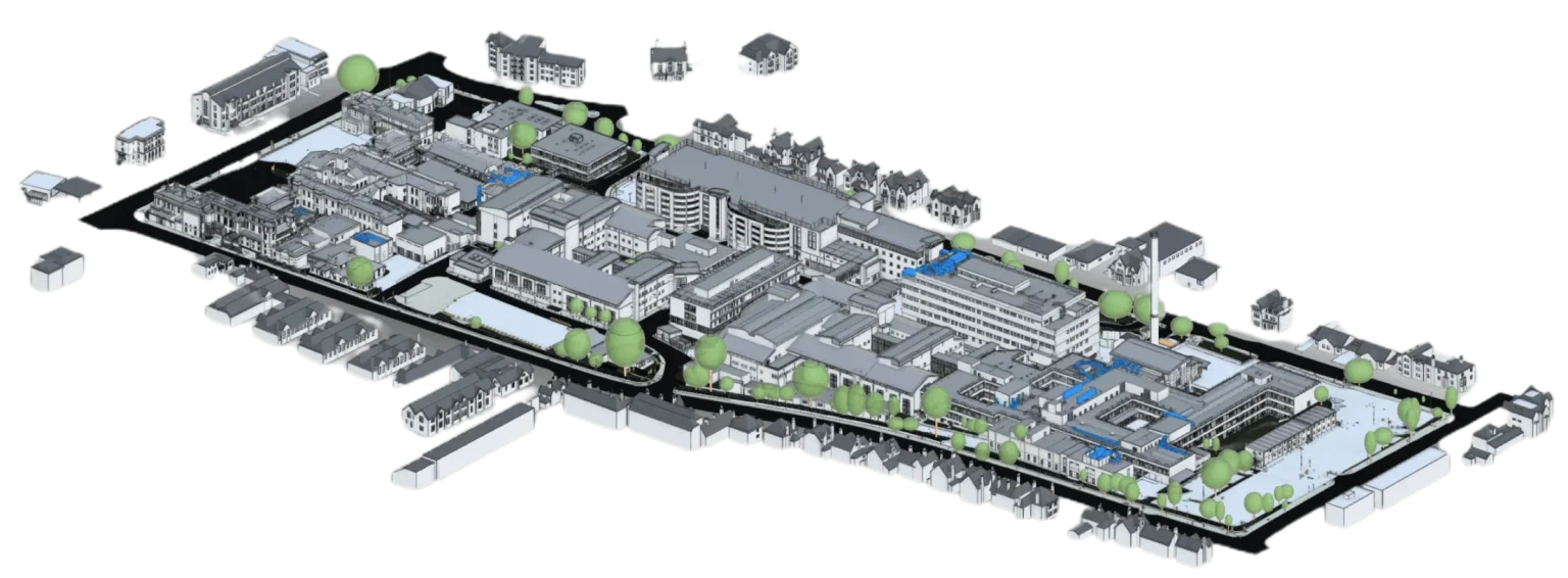
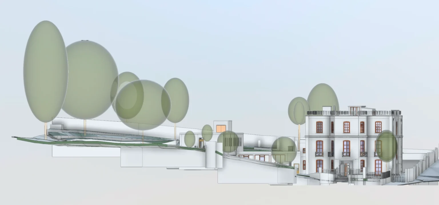
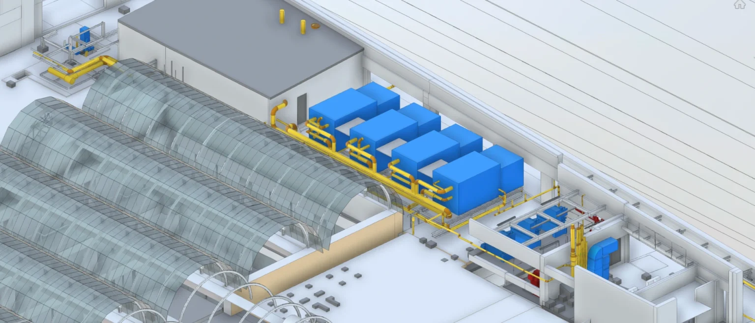
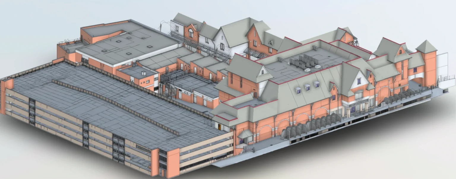
Advanced BIM solutions for comprehensive project management
Our Building Information Modelling (BIM) services cater to complex and large-scale projects, producing detailed models compliant with COBie standards for effective lifecycle management. These models are essential for construction projects and facility management, helping to optimise maintenance, space planning, and energy analysis. By integrating critical data, our BIM services enable informed decision-making, enhancing efficiency and reducing operational costs across the building’s lifecycle.


Our projects
Delivering surveying for projects across industries
Our projects span a variety of industries, offering tailored surveying services that guarantee precision and reliability for every specific need.
See more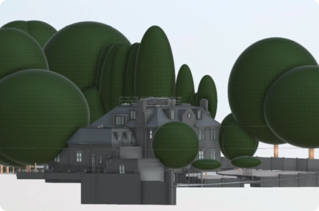
Meet our team
Boosting project success with our innovative approach and technology
Our team is the driving force behind our reliable and advanced measured building survey services. Our team, spanning architecture, construction, engineering, and surveying, holds advanced degrees, including PhDs and Masters, ensuring high-quality solutions with precision.
See morePawel
Managing Director
Marcin S
Manager & Lead Surveyor
Nick
Business Development Manager
Carlo
Head of Heritage Department
Start working with us
Partner with Red Laser for a confident project launch