Topographical & Measured Survey – Frognal Street, London
Get a quote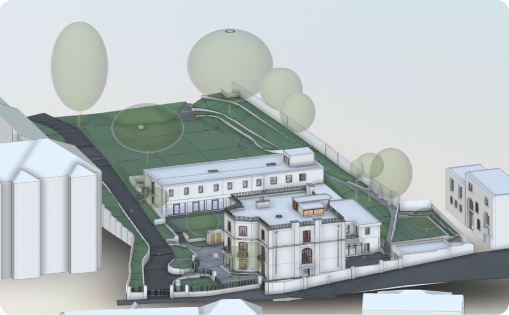
Comprehensive 3D model combining topographical survey and measured building survey data
Topographical and Measured Building Survey
Frognal Street, London
A combined topographical and measured building survey was commissioned for a residential property on Frognal Street, London, to support a planned refurbishment and replacement of rear extensions. The project required accurate site-wide data to inform design development, planning, and coordination with surrounding properties.
Given the complexity of the site and its relationship with neighbouring buildings, reliable survey information was essential to reduce risk and establish a clear baseline for design decisions.
Client Requirements
The client required a comprehensive survey package that captured both the building and its surrounding environment. This included:
The survey needed to record not only the property footprint but also garden areas, adjacent buildings, and public realm features that could influence planning and construction.

Accurate digital site model capturing the main property, external ground levels, full garden area and adjacent streetscape
Our Approach
Red Laser carried out an integrated topographical and measured building survey to capture the complete geometry of the site. Using high-accuracy survey methods, our team recorded the shapes and levels of the property, external ground levels, and relationships to neighbouring structures.
The survey extended beyond the main building to include the full garden area, boundary conditions, and adjacent streetscape. This ensured that level changes, access routes, and surrounding constraints were clearly understood from the outset.
All captured data was processed into coordinated datasets, forming the basis for accurate 2D drawings and detailed 3D models.
Deliverables
The final deliverables were structured to support both technical design and planning submissions:
- Topographical survey covering the full site footprint
- Measured building survey with as-built drawings
- 3D site and building models
- 2D plans, elevations, and cross-sections
The topographical data documented external ground levels, trees and planting, adjacent buildings, street furniture, pavements, utility boxes, gates, road markings, surface types, and drainage features.
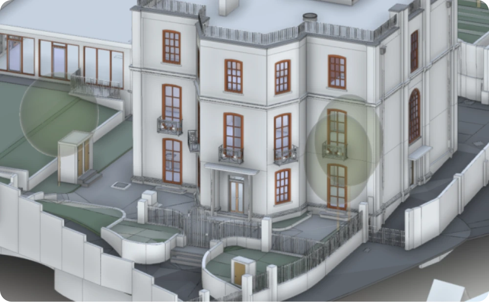
Accurate 3D model illustrating the existing residential building, rear extensions and external site features captured during a coordinated topographical and measured survey

Accurate CAD elevation drawings produced from a coordinated topographical and measured building survey, documenting front, side and rear façades

Accurate 2D cross sections illustrating internal floor levels and structural layout

Supporting Design and Planning
By combining topographical and measured building data into a single coordinated survey, the client team was able to assess constraints and opportunities across the entire site. The 3D models provided clear visual context, helping designers understand how proposed changes would interact with existing levels, boundaries, and neighbouring properties.
This integrated approach reduced the risk of design conflicts and supported a smoother progression through planning and detailed design stages.
Outcome
The completed survey delivered a clear, accurate representation of the site and existing building condition. With verified data covering both the built form and surrounding landscape, the client gained confidence in their refurbishment and extension proposals.
The survey formed a reliable foundation for informed decision-making, helping the project move forward with clarity and reduced uncertainty.
Detailed 3D model generated from topographical and measured survey data, showing buildings, trees, planting, pavements, utility boxes, gates and surrounding streetscape features
Start Your Project with Confidence
If your project requires a coordinated topographical and measured building survey to support planning or refurbishment, we can help.
Start working with us
Partner with Red Laser for a confident project launch