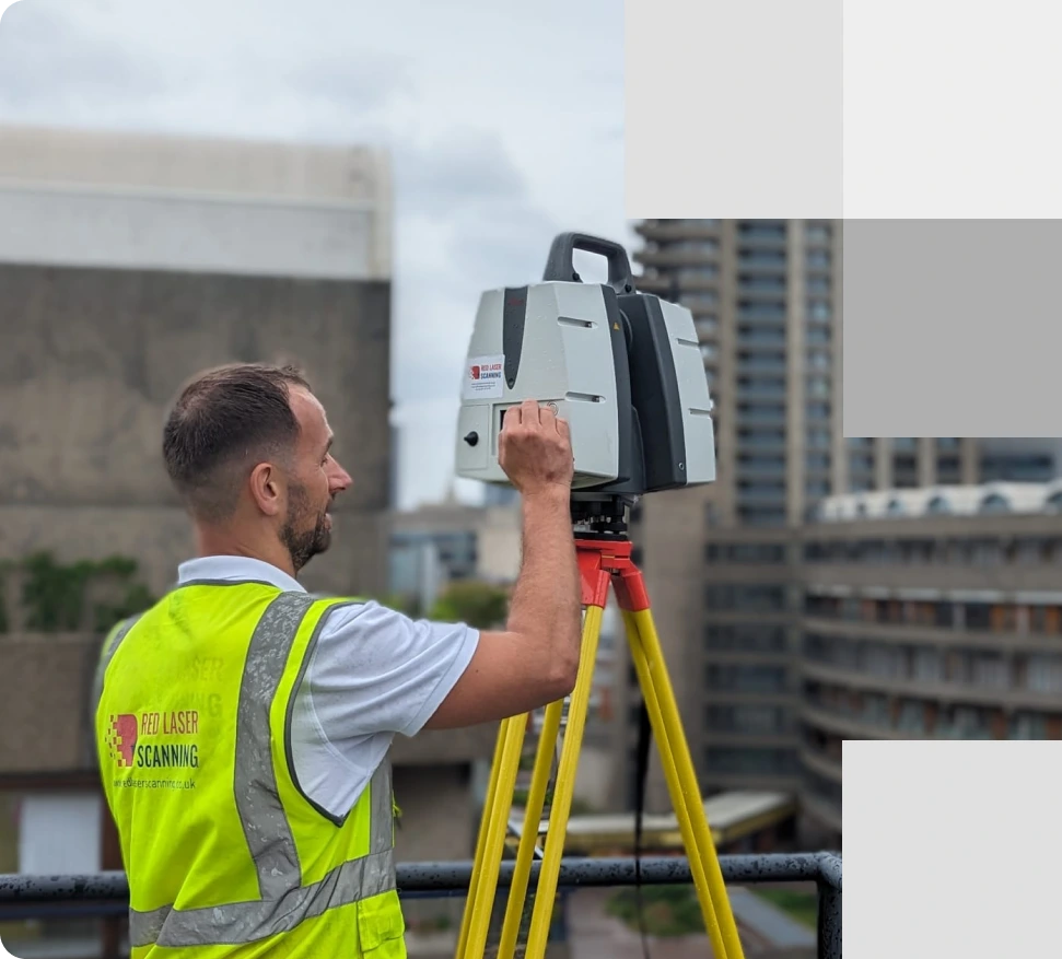
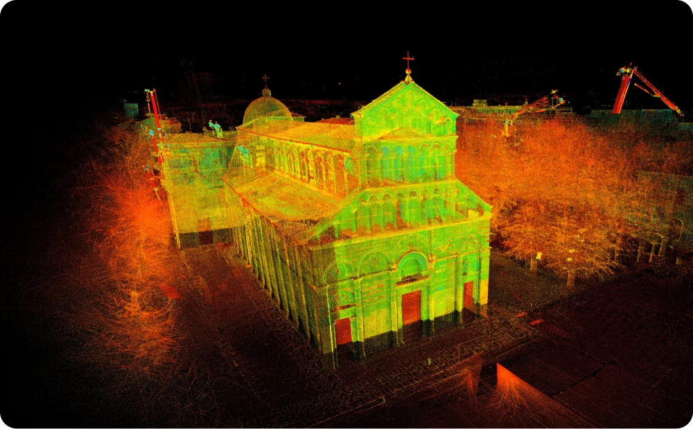
A surveyor with a scanner captures 3D point cloud data for precise measurements and documentation of the site
About laser scan to point cloud survey
Precise point cloud surveys for architecture and construction
Our 3D point cloud survey services offer precise, adaptable solutions for architectural, construction, and infrastructure projects across the UK. With high-accuracy 3D laser scanners capturing over 1 million surveying points per second, our team produces detailed point cloud surveys, creating an exact spatial representation of your site. This data is compatible with CAD and Revit software, enabling seamless integration into project workflows for accurate planning, modelling, and analysis.
Understanding the value of point cloud data
A point cloud survey is a set of surveying points in a 3D x, y, and z coordinate system, representing the surfaces of a scanned object or site. With extensive data captured by laser scanning technology, point cloud survey files are invaluable for creating precise 2D drawings, 3D models, and comprehensive digital twin environments. Our point surveying data, available in both greyscale and colour, supports detailed architectural and structural insights, enhancing accuracy and reducing project timelines.
Point cloud file formats we offer
- FLS: Optimised for use with Faro Scene.
- E57: Compact, vendor-neutral format for easy integration.
- RCP: Ideal for AutoCAD and Revit, supporting 2D and 3D modelling.
- PTS, PTX: Exported from Leica Cyclone, compatible across platforms.
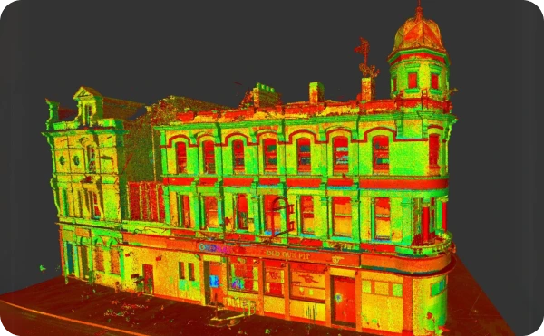
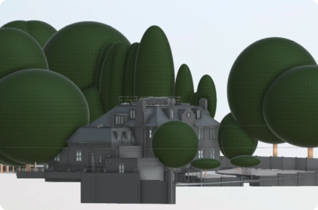
Captured through advanced scanning technology, this 3D point cloud of a building provides essential data for structural analysis and informed project planning
Ready to get started?
Speak to our team about how our point cloud surveys can support your project goals
Advantages of our 3D point cloud services
Our point cloud surveys data provides benefits across applications:
Using 3D Laser scanners to capture point cloud
Capturing detailed point clouds, accurate and efficient
At Red Laser, our 3D laser scanners work by emitting laser beams that bounce back after hitting a surface, recording millions of surveying points per second. Each point represents a precise location in 3D space with X, Y, and Z coordinates, creating what is known as a point cloud. This method of point surveying is highly accurate, capturing details within millimetre precision, making it ideal for intricate measurements and complex environments. The reliability of 3D laser scanning is rooted in its non-intrusive, fast, and efficient process, reducing on-site time while minimising errors and point cloud survey cost. The resulting point clouds provide an accurate and comprehensive digital representation of an object, building, or landscape, allowing teams to make informed decisions and streamline project workflows across architecture, construction, and engineering.
Explore our point cloud survey deliverables
Explore our point cloud survey portfolio
See examples of how our precise point cloud data supports projects in various industries.


Get accurate, reliable Point cloud data with Red laser
Your partner for precision Point cloud surveying
At Red Laser, we combine advanced technology with expert surveying techniques, delivering detailed cloud point data to support different types of projects. Contact us to discuss your requirements and discover how our point cloud surveys can elevate your project’s accuracy and efficiency. With competitive point cloud survey cost, we ensure high-quality results for all point surveying needs.
Get a quote“We have asked Red Laser Scanning to do our floor plans and point cloud for our planning application. Very professional service. Also competitive pricing.
Would recommend!”
Our case studies
See how we’ve helped clients achieve their goals with reliable surveying and geospatial solutions
Start working with us
Partner with Red Laser for a confident project launch
What is a point cloud?
A point cloud is a product of a measured survey with the use of laser scanning equipment. It contains points in the three-dimensional coordinate system with information about the scanning position in the existing space or object.
How do you create a point cloud?
A 3D point cloud file is created of millions of measured points. The collection starts by aiming the scanner within view of the area or object you want to measure. The point cloud collected is then processed and registered using specialised software.
How do we capture the 3D point cloud?
Our survey London company uses the latest laser scanning equipment such as laser scanners, and drone surveying to capture point cloud data.
What can you do with a point cloud?
A point cloud can be used in various applications due to its accuracy, non-contact method, and increased efficiency. Point clouds can also be used to create BIMs to optimise the efficiency of development, management of design and construction projects.
Why use a 3D point cloud service?
A scan to point cloud service eliminates human error in captured measurements due to the use of high-quality and advanced surveying equipment. You are guaranteed accurate and precise results through measured building surveying.
What are the different formats of a 3d point cloud?
- FLS
- E57
- RCP
- PTS
- PTX
