Topographical survey services
Our topographical survey provides thorough, precise, and detailed information tailored to your project’s requirements
Get a quote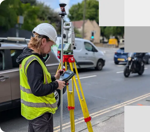
A surveyor operates a total station to perform a topographical survey. The equipment captures precise measurements and data to map the street accurately
Introduction to topographical survey services
Delivering detailed plans, 3D topographical models, CAD drawings, and contour maps
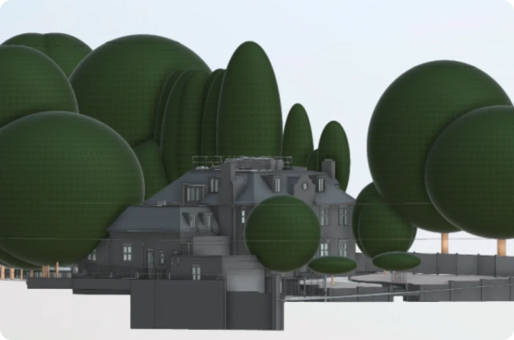
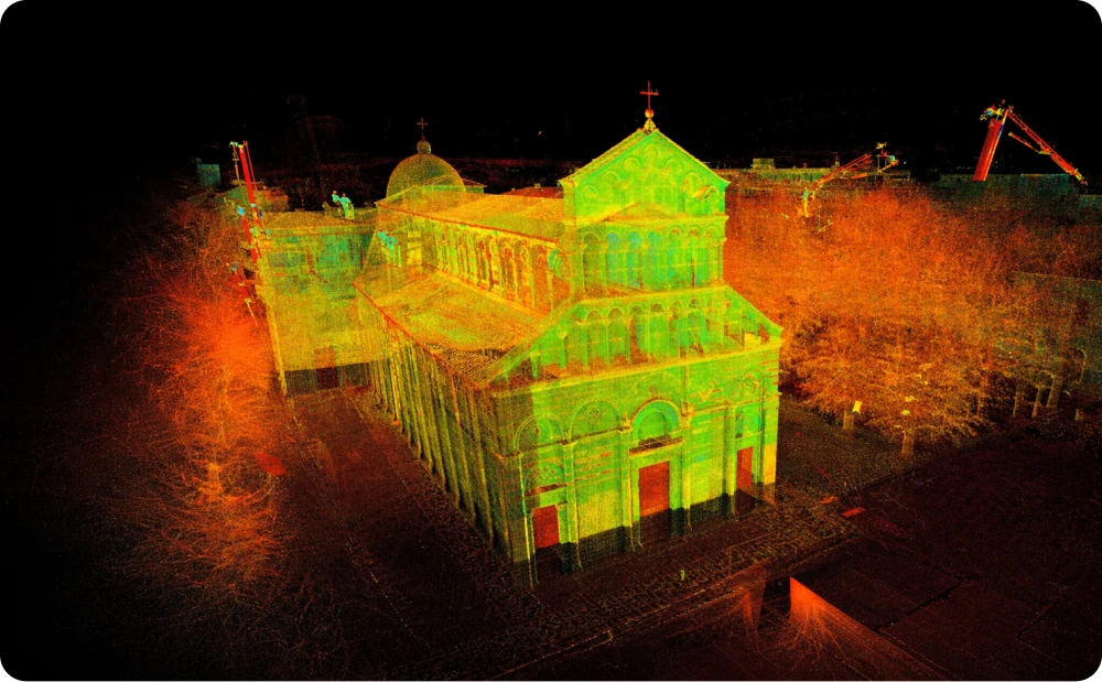
At Red Laser, we provide topographical survey services across London and the UK, including detailed topographical plans, 3D topographical models, CAD drawings, and contour maps. Our topographical surveys in London, also known as land surveys, or topo surveys, involve scanning a site or land to identify and analyse the features such as natural and man-made with precision. These surveys capture all elements, including property boundaries, land features, and physical details within the area of interest.
What can a topographical survey identify:
- Area boundary lines
- Buildings and structures
- Trees, bushes, and vegetation positions
- Water channels
- Water levels
- Ground heights, contours, and surfaces
Benefits of a comprehensive topographical survey
We offer a comprehensive topographical survey service to deliver everything you need for design, planning, and construction. Our detailed 3D topographical survey models and plans provide numerous advantages:
- High-resolution imagery and data capture, often utilising drone technology.
- Facilitating planning and designing stages of land development projects.
- Ensuring compliance with local regulations and planning permissions, helping to avoid costly legal issues and project delays.
- Identifying drainage system issues.
- Accurate terrain mapping for property boundaries.
- Risk assessment for natural disasters.
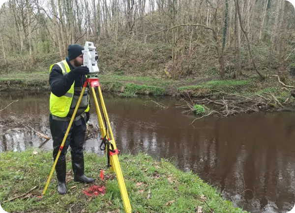
Expert surveyor utilising advanced GPS technology for a topographical survey to assess environmental conditions and ensure precise data for impact evaluation
Applications of topographical surveys
Topographical surveys provide architects, engineers, or developers with vital data that offer various insights needed during the design, planning, and construction phase
These topographical surveys are very important for a wide range of applications across different industries. Here’s how topographical surveys near you can benefit your project:
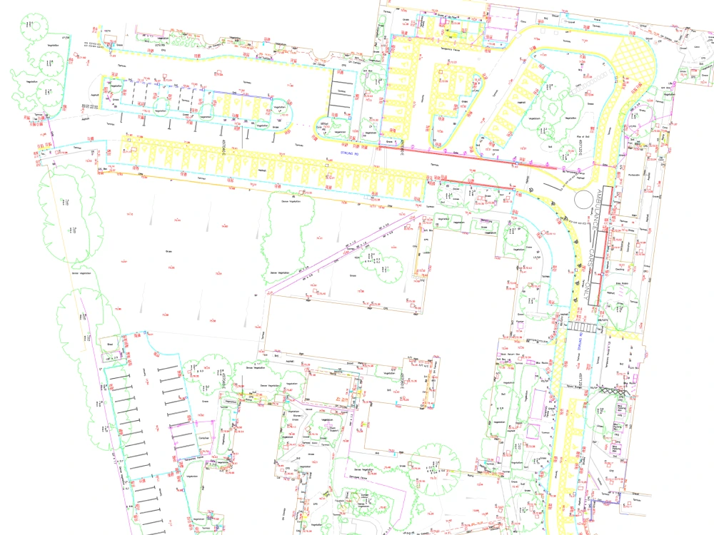
High-precision drawings tailored to your needs
Our topographical drawings are delivered to meet the highest standards of clarity and precision:
- Format Options: Available in CAD format, with scaled PDF copies also provided for convenience.
- Customisable Level of Detail: It involves choosing from various levels of detail, such as 1:100, 1:200, or 1:500, to suit your project needs.
- Enhanced Readability: Our drawings utilise layers, colour coding, line types, and weights to ensure they are user-friendly and easy to interpret.
- Ordnance Survey Grid Alignment: All drawings accurately align with ordnance survey grids for consistency and precision.
- Additional Mapping Details: We can include extra mapping elements beyond the initial survey area for a more comprehensive overview.
- Rigorous Quality Checks: Every drawing undergoes stringent quality control checks to ensure accuracy and reliability.
Choosing the right topographical surveyor
Key factors to consider when choosing a topographical surveyor
When selecting a topographical surveyor, it's essential to consider expertise, credentials, and reputation. At Red Laser, our team has extensive experience in 3D topographical survey, backed by strong educational backgrounds in surveying and architecture. We hold industry accreditations that ensure compliance with the highest standards. Our commitment to quality is reflected in our repeat clients and successful partnerships with leading industry professionals. We also offer competitive topographical survey cost, making us a reliable choice for your surveying needs.
Get a quote“We really appreciate the effort Antonio and Danas went to Monday to get survey completed. We will 100% keep Red Laser in mind for future work.”
Our case studies
See how we’ve helped clients achieve their goals with reliable surveying and geospatial solutions
Start working with us
Partner with Red Laser for a confident project launch

What is a topographical survey?
Land surveyors undertake a topographical survey to provide information on land elevations and capture natural and manmade features with levels. It presents complete data of plot of land, including property, land features and physical boundary details. Identify ground and site levels with features or areas likely to arise above or even beneath the main surface.
What information will be included?
You will receive high quality and detailed topo drawings or 3D models if specified. These will include existing buildings and structures, boundaries, ground surfaces, maintenance holes, utility poles, tree positions, walkways, service covers, and established site levels. If you require additional details, you are free to discuss such matters before your topographical survey.
How are topographical surveys used?
Topographical surveys can be used for many sectors and factors. You may fulfil regulatory requirements for construction codes, obtain volumetric calculations, proceed with environmental restoration and property improvements, construction and architectural projects, plan new road layout formation and many more.
How long does a topographical survey take?
We issue quotes as soon as the same day. From there, a topographical survey for your site project may be available as quickly as the day after you call. Once a topographical survey completes on-site, we will swiftly work on your deliverables and confirm the delivery date. We break down everything on your quote after receiving all information and analysis of your project, considering all factors such as level of detail, scale, complexity, and urgency.
How much does a topographical survey cost?
The price of a topographical survey in London and the UK will depend on many factors. Factors include the size and complexity of a site, the deliverables requested, if models are specified in colour or greyscale, and the required level of detail. Red Laser ensures you get a correct and competitive quote, with no additional costs according to the information provided when forming your quote.
What equipment is used for a topographical survey?
Our surveyors use the latest 3D laser scanning technology from well-known brands such as FARO, Leica and more. Our equipment includes 3D laser scanners, GPS, drone technology or total stations.
We use these elements together with our experience and industry knowledge, so we can always guarantee that you will receive the best quality result and an efficient service every time.What formats do you deliver?
Red Laser produces scaled topo drawings in DWG and PDF format with the specified level of detail if requested. In addition, we deliver 3D Revit models and digital terrain models to share amongst your team and optimise collaboration and management.
Who will benefit from a topographical survey in london?
Professionals needing further understanding and analysis of their land, plot and all features considered when planning a project will request land and topographical survey. Our clients range from architects, designers, engineers, contractors, construction managers, facility managers and housebuilders.
