Efficient and reliable boundary surveying services
Precisely defining property lines and land boundaries with expert accuracy and care
Get a quote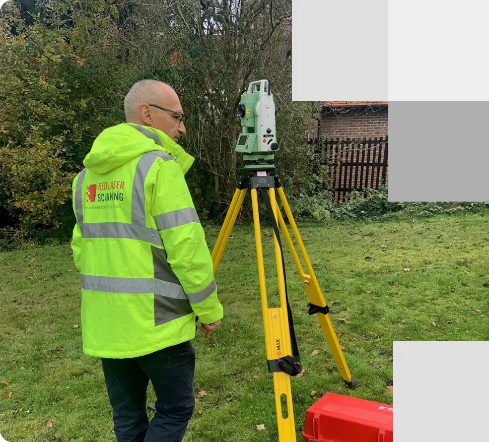
Our expert conducting a detailed boundary surveying in a park, ensuring accurate identification of property lines for clear demarcation and legal clarity
About our boundary surveying
Accurate property boundary identification and documentation
Boundary surveying is essential for defining the exact boundaries of a property and establishing the precise locations of physical features on-site. At Red Laser, we provide comprehensive boundary surveying services that ensure accurate documentation and clear identification of your property lines. Our services include:
- Overlay of Ordnance Survey (OS) Digital Data
- Site Boundary Survey – to document physical survey boundaries and other features
- Consultation with your Legal Advisory Team
- Overlay of Land Registry Title Plan
Our expert boundary surveyors deliver highly accurate data reflecting the components of your site, highlighting the precise position and location of the boundary line. We provide CAD drawings with precise measurements, tailored to the specific scale of your site.
Benefits of boundary surveying
Our boundary surveyors provide efficient boundary surveys tailored to meet your specific needs. By delivering precise and reliable data, we ensure that you have a clear understanding of your property’s boundaries. Here are a few benefits:
- Accurate property data: Obtain precise measurements and data for your property.
- Development planning: Support land development projects with clear surveying boundary lines.
- Legal compliance: Ensure your property boundaries comply with legal requirements.
- Boundary dispute resolution: Clearly define property lines to help resolve disputes.
- Property valuation: Accurate boundary land surveys are essential for property valuation and sales.
- Security and ownership: Confirm the extent of your property to secure ownership rights.
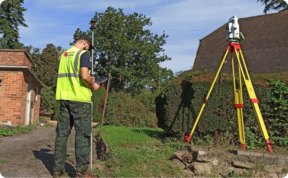
Surveyor utilising GPS and a total station to carry out boundary surveying, providing accurate measurements of property boundaries and ensuring precise land delineation
Looking for efficient and reliable boundary survey services?
Ensure accurate property boundaries—book your boundary land survey today
Applications of boundary surveying
Ensuring accurate property boundaries for various uses
Our comprehensive boundary surveying services are designed to provide accurate and reliable data for various purposes. Our team of experienced surveyors utilises the latest technology and techniques to ensure precise boundary identification and documentation. Our boundary survey services are crucial for:

The importance of site boundary surveying
Defining and understanding property boundaries
Understanding and accurately positioning your property boundaries is crucial, whether dealing with undefined boundaries or resolving disputes in the UK. At Red Laser, we compare existing HM Land Registry documentation with on-site features to identify potential boundary issues and assist in resolving boundary and party wall disputes. By surveying boundary lines with advanced equipment, we obtain precise results, providing a comprehensive understanding of boundary liabilities.
Choose red laser for accurate boundary surveying
Expert solutions for defining and protecting your property
At Red Laser, we are committed to providing precise and reliable boundary surveying services that safeguard your property rights and support your development plans. Contact us today to schedule a boundary survey and get detailed information on the cost of boundary survey to ensure your property lines are accurately defined.
Get a quote“I just wanted to thank you and your colleagues for all your help on the project.
You did a great job and we have now received planning permission, so I just wanted to thank you. Would you please pass on my thanks to your colleagues and site team?”
Our case studies
See how we’ve helped clients achieve their goals with reliable surveying and geospatial solutions


Start working with us
Partner with Red Laser for a confident project launch

What is a boundary survey?
A boundary survey is a site survey that defines the boundaries of the property and identifies any physical features the area may have such as fences, walls, roads and trees etc.
What does a boundary surveyor do?
A boundary surveyor uses laser scanning and topographical equipment to identify the boundary lines and document exact location of features from your area and property. We provide land registry boundary determination by producing drawings with the required level of detail.
What can boundary surveys identify?
A survey boundary ensures that all these elements are accurately mapped and documented:
- Fences
- Walls
- Banks and ditches
- Buildings
- Trees
- Roads
How much will a boundary survey cost in the UK?
The exact cost of a boundary survey will depend on factors such as the size of the land, the complexity of the surveying boundary lines, and the required level of detail for your 2D CAD drawings. Additionally, site accessibility and property specifics will influence the overall cost. We ensure you receive a competitive quote based on all the information provided regarding why you require the survey.
How do you establish a boundary line?
There are several ways to establish boundary lines in a property, the most common of which is to check the demarcation lines indicated in the deeds of the property. In most cases, it will contain the survey boundary line to help owners know precisely where their properties and land begin and end.
How long is a boundary land survey valid? Will it expire?
Boundary surveys do not expire, however, it is required to gain a full understanding of property data and to proceed with planning works such as land development and property refurbishment.
