Exploring rights of light survey
Discover the importance of rights of light survey, ensuring legal compliance, enhancing property value, and fostering sustainable design
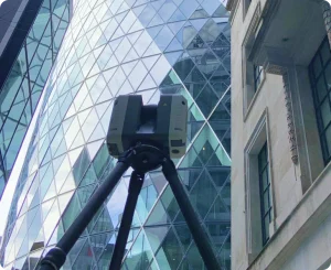
A measured survey is a precise dimensional record of an existing building or site, captured using 3D laser scanning or traditional survey instruments. Measured surveys — also called measurement surveys — produce CAD drawings, 3D models and point cloud data used by architects, developers and engineers for design, planning and construction. Red Laser delivers measured surveys across London and the UK — used for planning, design and construction decisions.
A measured survey is a precise dimensional record of an existing building or site — captured using 3D laser scanning or traditional survey instruments and delivered as CAD drawings, 3D models or point cloud data. The term covers a family of survey types rather than a single service. A measured building survey records the interior and exterior of a building. A topographic survey records a site’s physical features. A heritage survey documents a listed building using non-contact methods. What they share is the same underlying purpose: replacing assumptions about existing conditions with accurate, verified data. The RICS governs the standards for measured surveys of land, buildings and utilities in the UK. A measured survey carried out to RICS specification gives architects, developers and engineers a dataset they can build design decisions from with confidence.
The most commonly commissioned measured survey. Captures the interior and exterior dimensions of an existing building — floor plans, elevations, sections, ceiling plans and structural elements. Used by architects for refurbishment and planning applications, by developers for due diligence, and by engineers for coordination. Delivered as CAD drawings, a Revit model or point cloud data, depending on the project requirement.
Records the physical features of a site — ground levels, contours, boundaries, drainage, vegetation and existing structures. Used for development feasibility, planning applications and infrastructure design. Often commissioned alongside a measured building survey when a project involves both a building and external land.
Aerial data capture using photogrammetric drones for areas where ground-based access is restricted — roofs, large external façades and complex multi-building sites. Often combined with a measured building survey for the interior, giving architects and developers a complete building record from a single site visit.
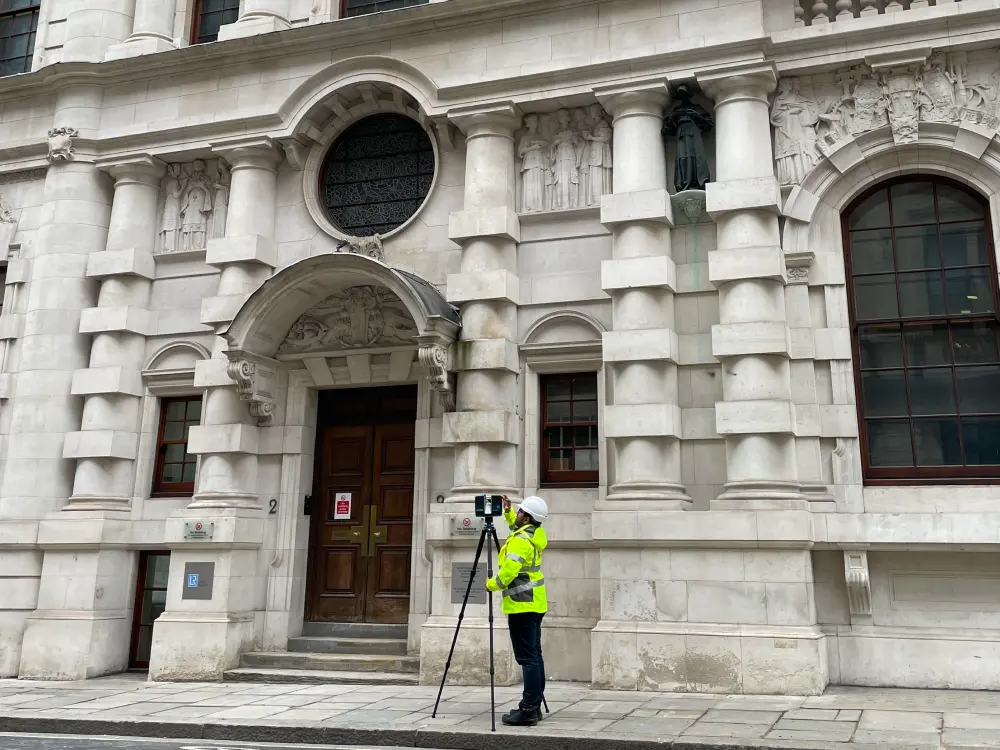
A non-contact measured record of listed buildings, churches and conservation area structures using laser scanning and photogrammetry. Produces the same dimensional accuracy as a measured building survey without physical intrusion to the building fabric. Required for conservation-led design, restoration planning and listed building consent applications.
Produces GIA, NIA, GEA and NLA floor area calculations to the RICS Code of Measuring Practice — the standard required for property valuation, lease agreements and planning submissions. Can be delivered as a standalone service or as part of a full measured building survey.
A measured record of a building as constructed, rather than as designed. Used when drawings do not reflect what was actually built — during refurbishment, at handover, or when original design documentation is unavailable. The process is the same as a measured building survey; the purpose is specifically to record the completed construction.
You need a measured survey whenever a project requires accurate existing conditions data — typically before design, refurbishment, planning application or building acquisition begins.
A measured survey produces accurate dimensional data — typically delivered as 2D CAD drawings, a 3D Revit model, or a point cloud, depending on what the project requires.
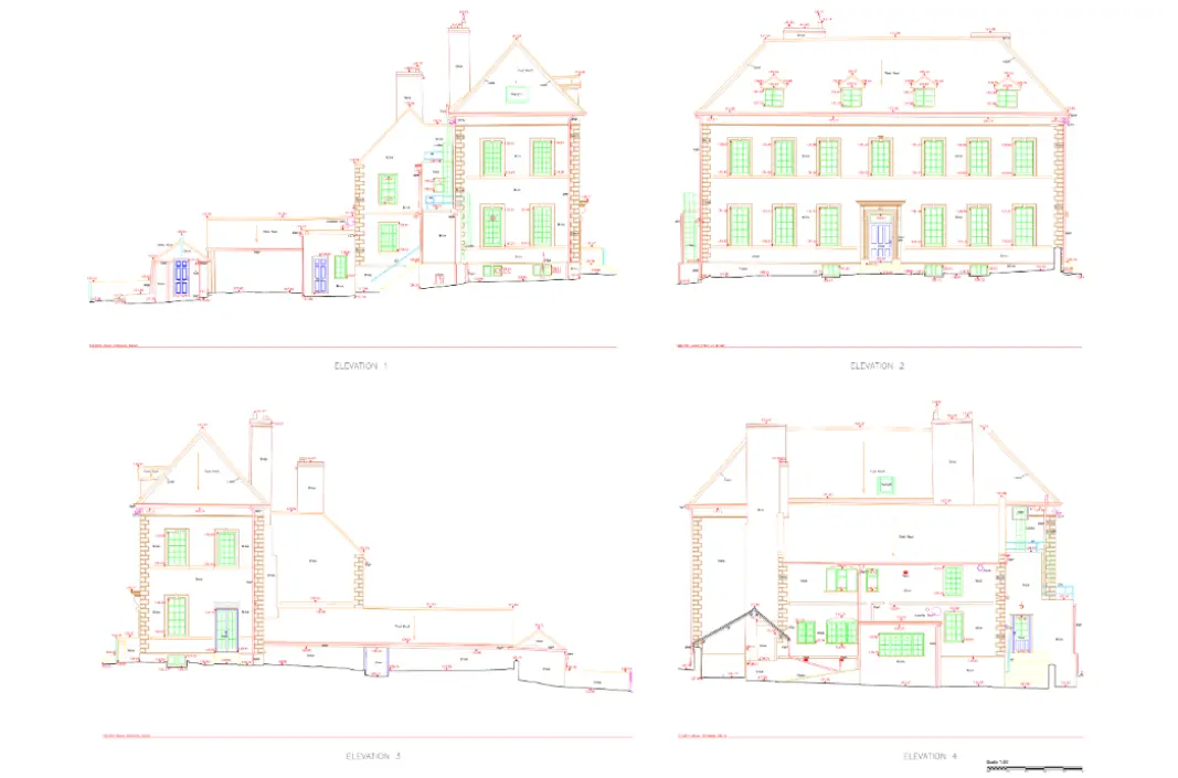
A measured survey example: an architect commissioning a measured building survey of a Victorian office building for a planning application receives AutoCAD floor plans at 1:50, external elevations at 1:50, and the registered point cloud in E57 format — all produced from a single site visit.
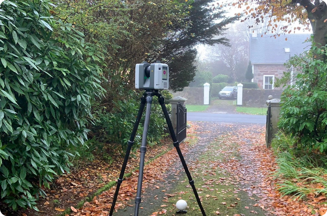
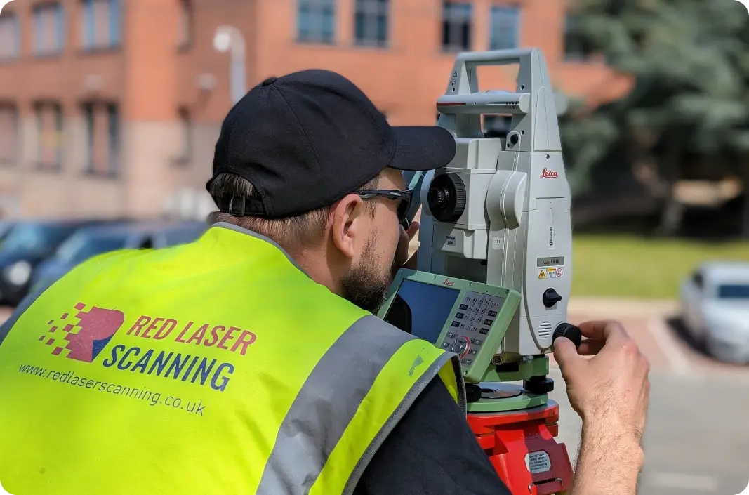
A measured survey carried out using Leica RTC360 3D laser scanners is accurate to ±1mm — the standard Red Laser works to on every project. That level of accuracy means the floor plan you receive reflects the building as it actually exists, not as it was assumed or approximated. For architects designing to tight tolerances, developers calculating lettable area for valuation, or engineers coordinating with structural elements, ±1mm accuracy is not a technical detail — it is what prevents costly errors downstream.
Traditional tape measure surveys introduce human error at every measurement point. Laser scanning eliminates that variable by capturing millions of data points simultaneously from a fixed position, creating a complete digital record of the space in a single site visit.
Measured surveys are carried out by specialist surveying companies using 3D laser scanners, total stations and photogrammetric equipment. Not all providers work to the same standards — the RICS Measured Survey specification sets the benchmark for accuracy, Level of Detail and deliverable quality in the UK.
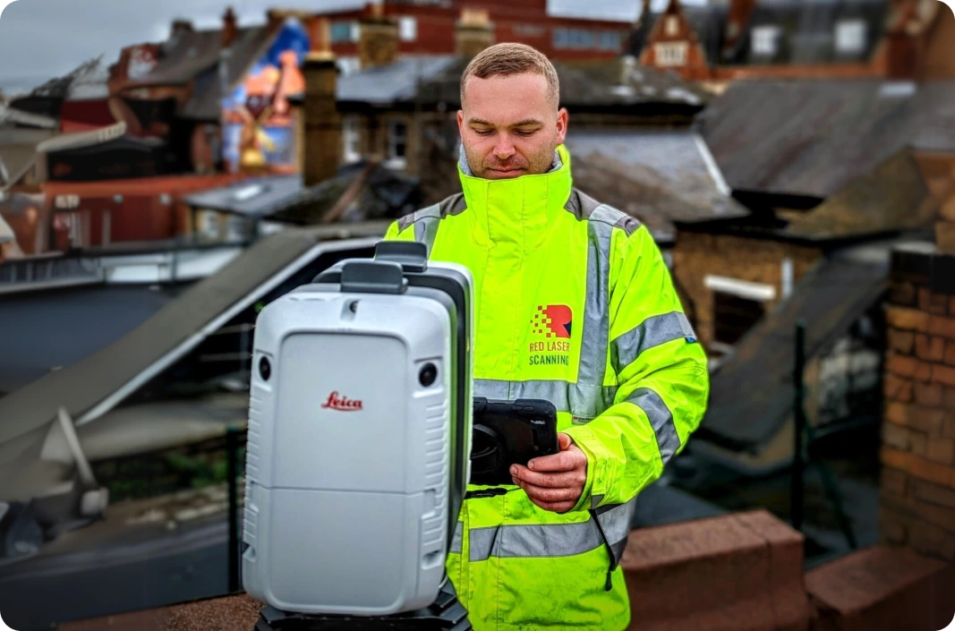
Red Laser is a London-based measured survey company delivering measured building surveys, topographic surveys and heritage surveys across the UK. Every survey is processed in-house — no outsourcing — and deliverables are checked against the project brief as part of our in-house QC before issue. When you contact Red Laser, everyone you speak to has a professional background in surveying, construction or engineering.
Measured survey cost depends on building size, number of floors, Level of Detail required, deliverables needed and access conditions. Red Laser provides a detailed, itemised quote as soon as scope is confirmed — covering every element of scope so there are no surprises after the survey is complete.
The main factors that affect cost:
Straightforward pricing. No hidden fees. For a detailed breakdown, see our measured building survey cost guide.
A measured survey is a precise dimensional record of an existing building or site — captured using 3D laser scanning or traditional survey instruments and delivered as CAD drawings, 3D models or point cloud data. The term covers several survey types including measured building surveys, topographic surveys and heritage surveys, each suited to a different project requirement.
You need a measured survey whenever a project requires accurate existing conditions data — typically before design, refurbishment, planning application or building acquisition begins. Common situations include planning applications for extensions or change of use, refurbishment or fit-out design, pre-acquisition due diligence, BIM model creation and heritage documentation.
A measured survey carried out using Leica RTC360 3D laser scanners is accurate to ±1mm. Laser scanning eliminates the human error introduced by traditional tape measure methods by capturing millions of data points simultaneously from a fixed position, creating a complete digital record of the building or site in a single visit.
Measured survey cost depends on building size, number of floors, Level of Detail required, deliverables needed and access conditions. Red Laser provides a detailed, itemised quote issued as soon as scope is confirmed — covering every element of scope with no cost surprises after the survey is complete.
For a full overview of Red Laser’s measured survey services — and help identifying which survey your project needs — see our measured survey services page.
If you already know you need a measured building survey, our measured building survey page covers the full scope, deliverables, process and how to get a quote.
Reliable data, delivered on time.