Photogrammetry and orthophotos
Delivering accurate orthophotos with advanced photogrammetric surveys
Get a quote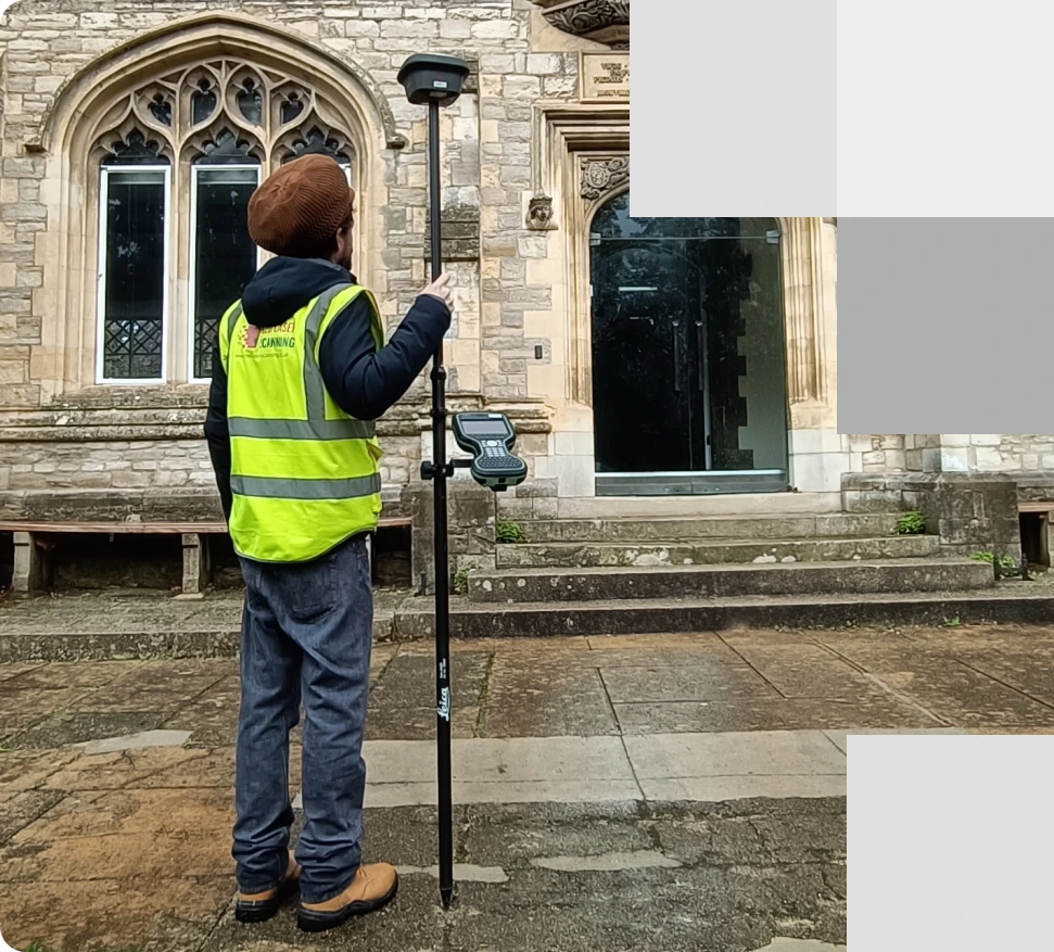
Surveyor using GPS technology for georeferencing in front of a historic building
Comprehensive photogrammetry solutions
At Red Laser, we specialise in delivering professional photogrammetry solutions tailored to a variety of industries, including topographic mapping, architecture, engineering, manufacturing, heritage preservation, and geology. This advanced process, often referred to as photogrammetric scanning, photogrammetry 3D scanning, or laser scanning photogrammetry, converts images into accurate data models using point clouds, providing precise 3D representations for diverse applications. By utilising aircraft or photogrammetry drone surveys, we capture high-resolution aerial photographs that are transformed into detailed orthophotos or orthophoto maps, ensuring efficient and reliable results for your project needs.
Key Deliverables:
- Point clouds from photography: Turn aerial images into measurable datasets.
- Accurate Visual Representations (AVRs): Ideal for planning and development.
- Orthophotos & orthomosaics: Accurate measurements of topography, infrastructure, and buildings.
- SLAM mapping: Real-time mapping with simultaneous positioning.
- 360-degree photo tours: Immersive visuals for remote inspection.
- Condition surveys: Non-invasive assessments of buildings and infrastructure.
What is an orthophoto?
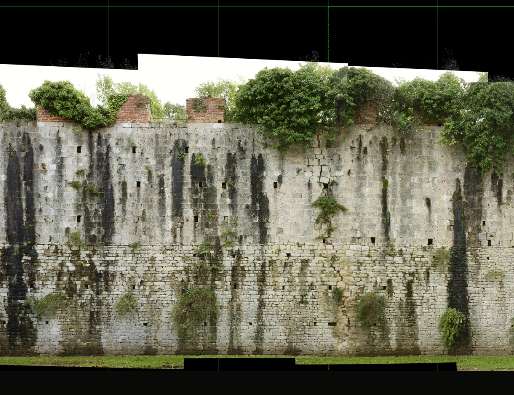
An orthophoto is a high-accuracy aerial image that has been geometrically corrected to eliminate distortion caused by camera tilt and terrain. Unlike standard photographs, orthophotos provide true-to-scale representation, making them ideal for precise measurements and mapping. These images are widely used in topographic surveys, urban planning, construction, and environmental studies, offering a reliable foundation for design, analysis, and decision-making.
Why choose photogrammetry for your project?
- Accuracy and efficiency: Obtain precise measurements quickly, saving time and costs.
- Reusable data: Store and reprocess data for future use without repeat surveys.
- Comprehensive visuals: Create detailed 3D models and orthophotos for planning and design.
- Minimal disruption: Capture data without interrupting operations or requiring on-site analysis.
- Enhanced accessibility: Safely gather data from remote or hazardous locations.
- Versatile applications: Use data across industries like construction, heritage, and environmental monitoring.
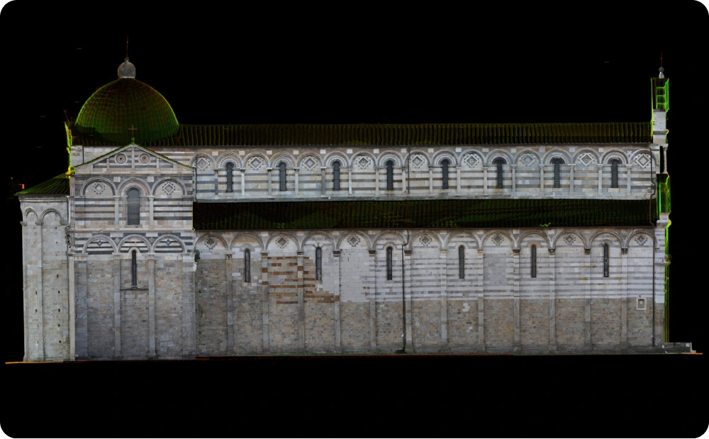
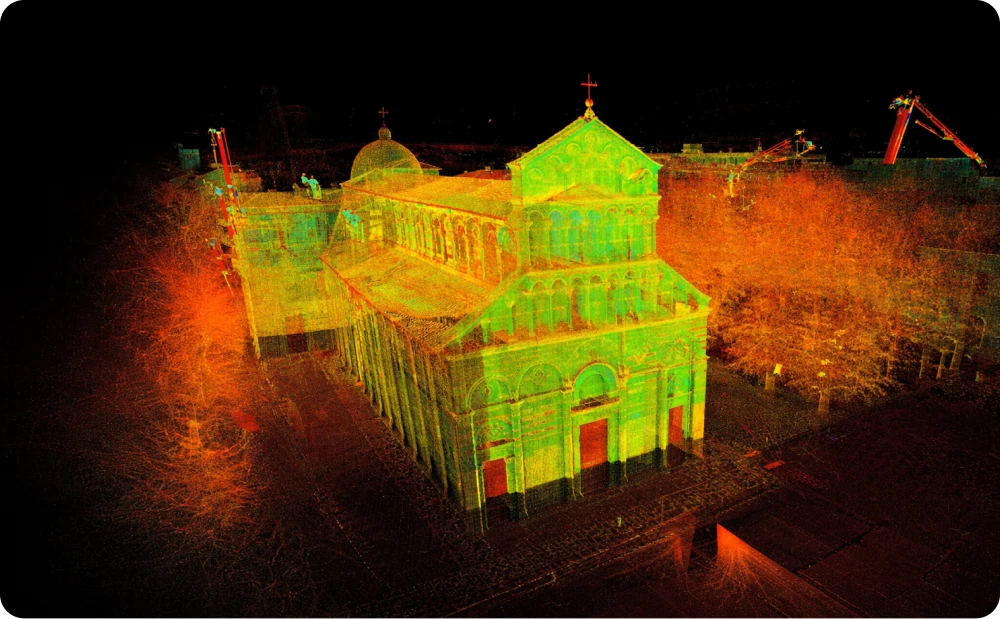
This orthophoto at scale 1:20 captures the external elevation of the church, providing detailed documentation of its architectural features
Applications of photogrammetry
Photogrammetry offers a wide range of applications, offering accurate, detailed visual and spatial data. From topographic mapping to infrastructure inspections, photogrammetry solutions are vital for decision-making in diverse sectors. Discover how this technology enhances projects in construction, heritage preservation, urban planning, and more.
Ready to get started?
Contact us today to learn more about how our photogrammetry can benefit your project!
Examples of our work
Explore our photogrammetry projects
See how our advanced 3D scanning photogrammetry solutions have supported clients in construction, real estate, and infrastructure projects.


Partner with Red Laser for photogrammetry excellence
Reliable, Experienced, and Innovative
With advanced technology and a team of skilled technicians, Red Laser delivers accurate and dependable laser scanning photogrammetry services. Trust us to provide solutions tailored to your project, ensuring safety, efficiency, and precision every step of the way.
Get a quote“Many thanks for the files and the great service you guys provide.”
Our case studies
See how we’ve helped clients achieve their goals with reliable surveying and geospatial solutions
Start working with us
Partner with Red Laser for a confident project launch

What is photogrammetry scanning?
Photogrammetry or photogrammetric scanning is the method in which measurements are taken of an object or site based on digital photo imagery. Different techniques can be used in data gathering including the use of handheld cameras, aircraft or even drones.
What are the advantages of photogrammetry surveying?
Photogrammetry surveying ensures highly accurate data, preserves the condition of the site during a time period for reference and can be used to access difficult-to-reach locations.
How are topographical surveys used?
Topographical surveys can be used for many sectors and factors. You may fulfil regulatory requirements for construction codes, obtain volumetric calculations, proceed with environmental restoration and property improvements, construction and architectural projects, plan new road layout formation and many more.
How much does photogrammetry cost?
Like other types of surveys, photogrammetry costs will depend on the extent of the project and the accessibility of the site.
What are the uses of photogrammetry?
- Land surveying
- Real estate
- Engineering
- Construction
- Mining
- Film industry
- Gaming
- Agriculture
- Heritage
- Geology
What are the benefits of hiring professionals in photogrammetry?
Successful photogrammetry surveying requires the use of high-quality tools and equipment that can be expensive to buy on your own. So, if you want accurate results without the heft expenses, work with our team for your photogrammetry requirements.
