Measured Building and Topographical Survey with 3D Revit Model
Get a quote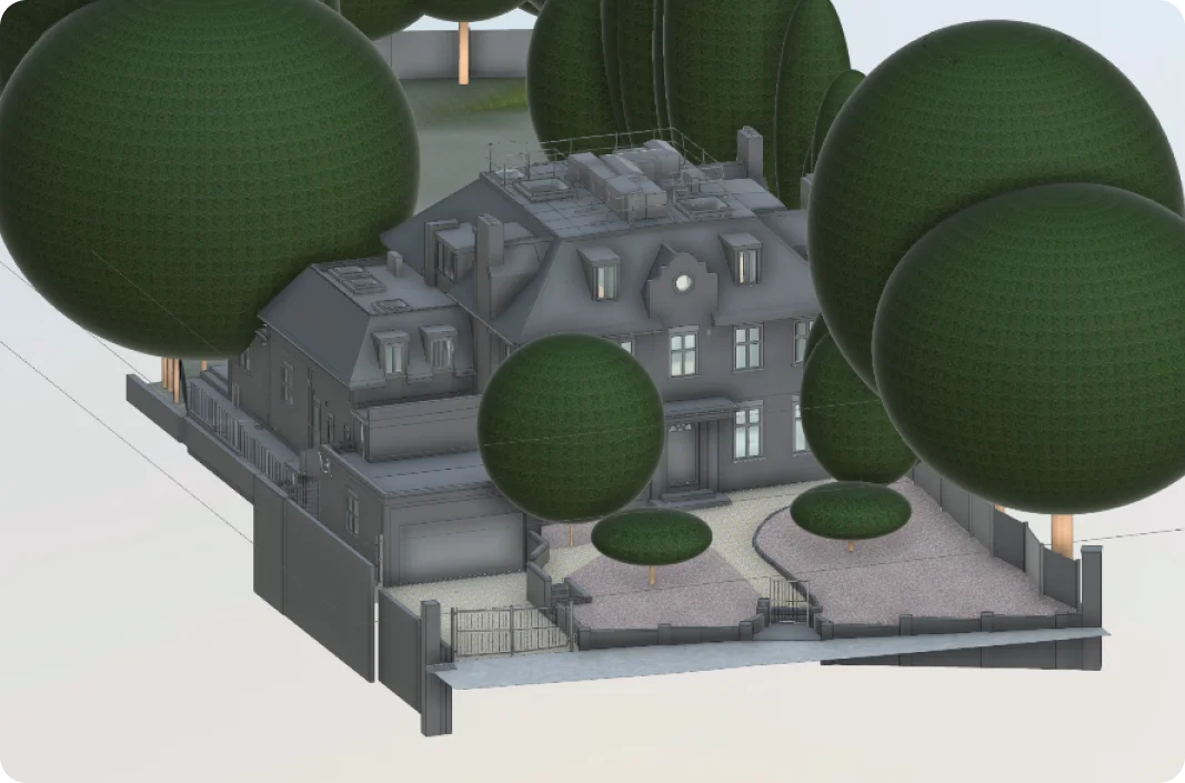
3D Revit model developed from laser scanning measured building and topographical survey data, capturing the main house, boundaries, garden areas and surrounding site context
Location: Hampstead Lane, London
Project Overview
A comprehensive measured building and topographical survey was commissioned for a residential property on Hampstead Lane, London, to support a full refurbishment and extension scheme. The project required accurate documentation of both the existing building and its surrounding site to provide architects with a reliable foundation for design and construction drawings.
Given the scale of the property and the complexity of its external areas, precise, coordinated survey data was essential to reduce risk and support confident decision-making.
Client Requirements
The architect required a complete and coordinated survey package to inform detailed design development. The brief included:
The survey needed to document the building footprint, landscaped gardens, boundary conditions, and neighbouring context, alongside detailed internal geometry.
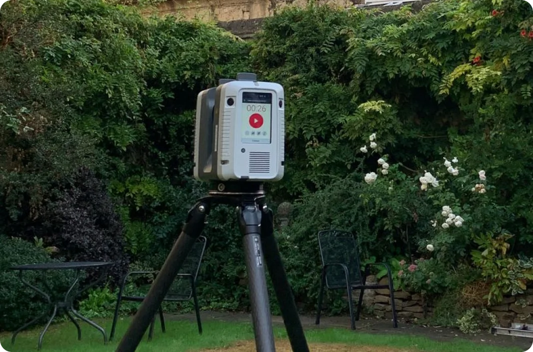
Advanced 3D laser scanning technology in use to record internal layouts, floor levels and external site features
Our Approach
Red Laser carried out a combined measured building and topographical survey using high-accuracy 3D laser scanning technology. The survey captured internal layouts, floor levels, window cill and door head heights, ceiling structures, and external features across the site.
Topographical data was integrated with the building survey to record external open areas, boundary walls, steps, external staircases, trees, pavements, and surrounding structures. All data was processed into a verified point cloud and validated for consistency before model production.
Based on the client’s requirements, a 3D Revit model was developed using an appropriate level of detail—LOD 300 for building elements and higher-detail modelling for site and underground constraints where required.
Deliverables
The final deliverables included:
- Complete laser scanning measured building survey
- Topographical model of the site and external areas
- 3D Revit model combining building and site data
- Supporting 2D drawings derived from the coordinated dataset
Together, these outputs provided a clear and accurate digital representation of both the building and its context.
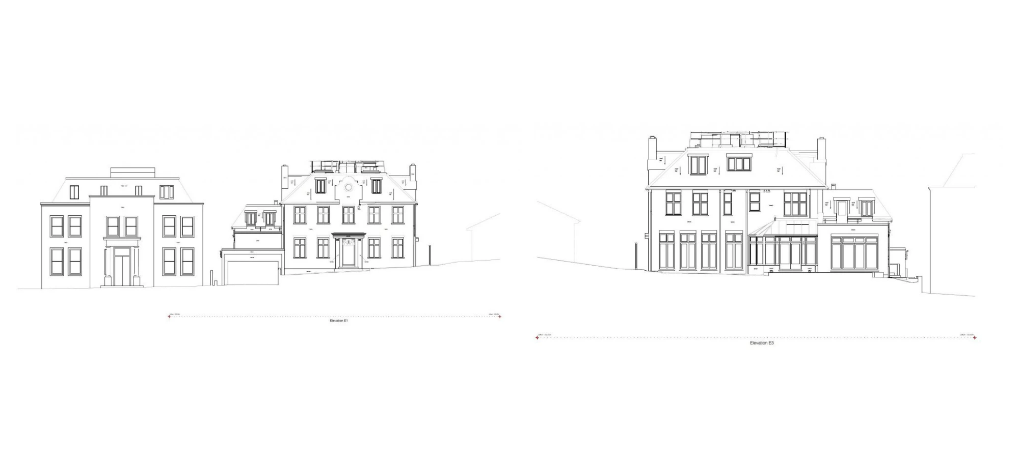
Accurate 2D elevation drawings generated from coordinated measured building and topographical survey data, providing a reliable foundation for refurbishment and extension design development
Aerial view of the coordinated 3D Revit model combining measured building and topographical survey data, illustrating roof geometry, landscaped gardens, trees and full site context

Supporting Design and Construction
The coordinated Revit model enabled the design team to align refurbishment and extension proposals with verified existing conditions. By combining building and topographical information in a single dataset, the survey reduced the risk of design clashes and supported smoother progression into construction detailing.
Access to accurate 3D data also improved collaboration across disciplines, ensuring that all consultants were working from the same dependable source of information.
Outcome
The survey delivered a robust, accurate baseline for the Hampstead Lane refurbishment project. With reliable measured data and a coordinated Revit model in place, the client was able to progress design and construction planning with confidence and reduced uncertainty.
This project highlights the value of integrating measured building and topographical surveys to support complex residential refurbishment schemes.
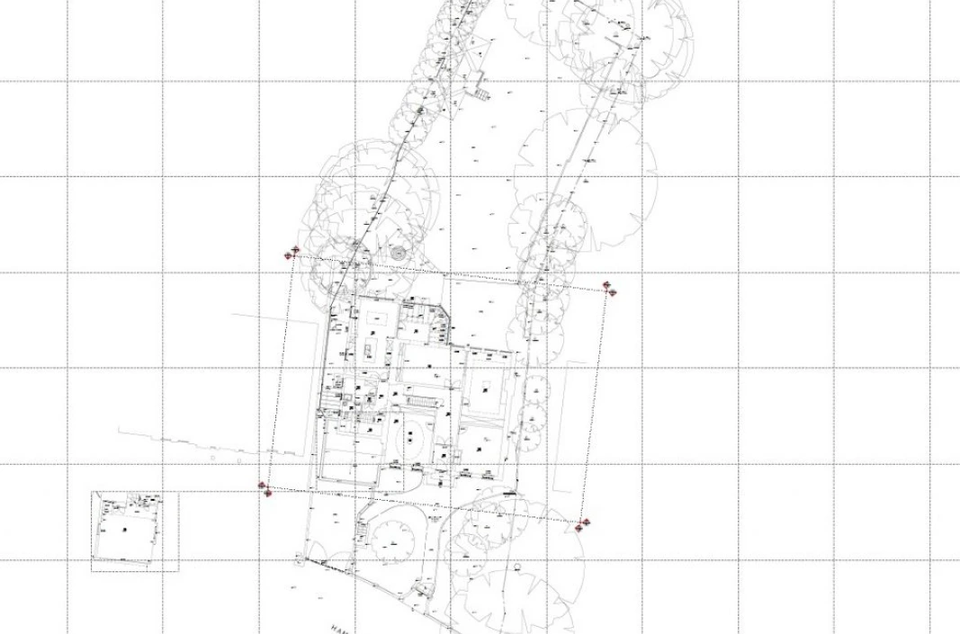
Combined topographical survey plan showing trees, site levels and existing building floor layout
Start Your Project with Confidence
If your project requires accurate measured surveys, topographical data, or coordinated 3D Revit models, we can help.
Start working with us
Partner with Red Laser for a confident project launch