3D Laser Scanning Services
Our 3D laser scanning specialists provide accurate point clouds, CAD drawings, 3D models, and BIM models for seamless project execution.
Get a quote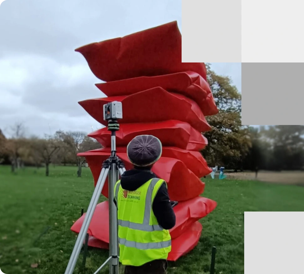
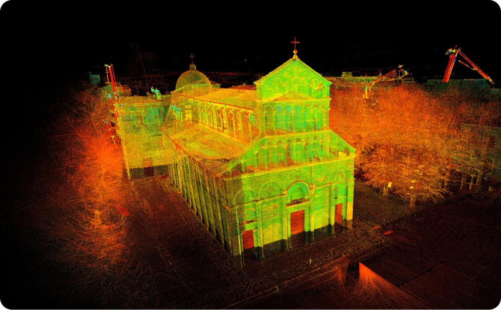
Our expert performs 3D laser scanning of the Frieze Sculpture, Red Stack, located in Regent’s Park, London, ensuring accurate data collection for effective analysis and preservation
About our 3D laser scanning services
Delivering precise 3D laser surveys and diverse range of deliverables
We are a leading 3D laser scanning company based in London, specialising in surveying solutions with the latest technology. The methods applied for our laser survey use a non-contact and able to capture three-dimensional details of physical structures. Our highly skilled engineers utilise different types of 3D laser scanners to conduct point cloud surveys, ensuring accurate and detailed data collection, regardless of project size or complexity. With an accuracy of +/- 2 mm with our laser scanners results that will be specifically tailored for your specific project requirements
As part of our 3D laser scanning survey, we can deliver the following:
- Quantitative data
- 360 virtual tours and photography
Benefits of 3D laser scanning surveys
Our 3D laser scanning survey is an exceptional surveying tool for many reasons, offering valuable benefits throughout every phase of your project. 3D laser scanning is an essential tool in modern construction and design, delivering unmatched efficiency, accuracy, and flexibility compared to traditional surveying methods.
- High-speed scanning
- Versatile data export
- Comprehensive coverage
- Accuracy and reliability
- Quick turnaround
- Cost efficiency
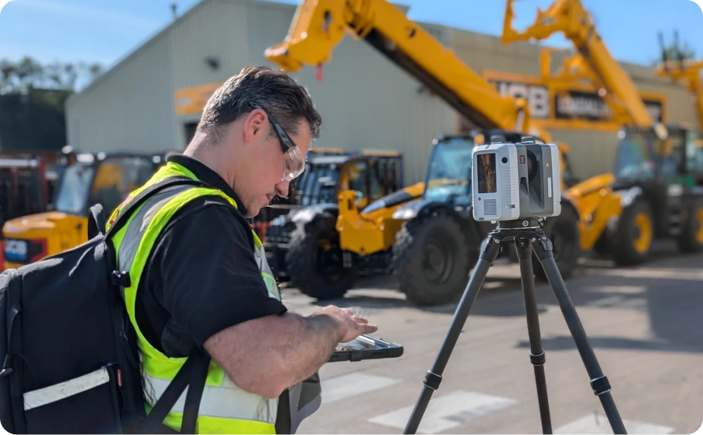
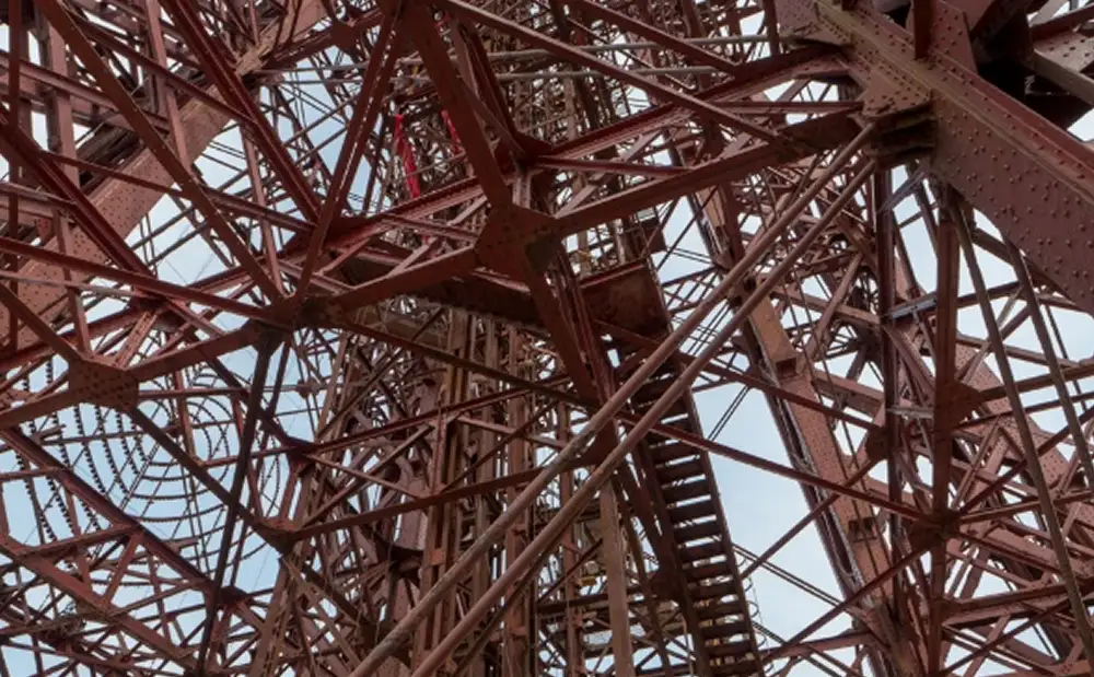
Our expert conducts a high-quality 3D laser scanning, capturing precise data points for accurate building analysis, ensuring reliable measurements for your project
Contact our specialists for professional 3D laser scanning services
We are here to cater to your project’s unique needs with tailored laser scanning solutions. Contact us today for a quick quote and start your project with confidence.
Applications of 3D laser scanning
Precision, accuracy, and reliability tailored to your project needs
Our 3D laser surveys deliver precise data and detailed models, offering versatility across diverse project applications. With our expertise, we can tailor these insights to meet the specific needs of your project, ensuring accuracy and enhancing decision-making.
Expert team of 3D laser surveyors
Skilled professionals delivering precision and excellence
Our 3D laser scanning team at Red Laser is comprised of highly skilled experts with a wealth of experience in 3d laser surveying. With professional education in fields such as geospatial mapping, geodesy, cartography, and architectural surveying from leading universities, our surveyors bring a depth of knowledge to every project. We are continuously expanding our expertise through specialised training in the latest laser scanning technologies and software. Our team is proficient in operating advanced 3D laser scanners, such as Leica, topographical tools, and other technology, ensuring precise and efficient data collection.
Book your 3D laser scanning survey with confidence
Trust our specialists for precise, high-quality surveying with detailed insights and results. Our expert team at Red Laser brings advanced 3D laser survey technology to your next project. Whether it's construction, architectural design, or facility management, our precision scanning services guarantee detailed, accurate, and reliable data. We also offer competitive 3D scanning prices to fit your budget. Our commitment to precision and professionalism ensures the success of your project
Get a quote“Great cooperation, full professionalism, recommendations to all those who need 3D scanning. Fast and at competitive price. Thank you and I will definitely use your services in my next projects.”
Our case studies
See how we’ve helped clients achieve their goals with reliable surveying and geospatial solutions
Start working with us
Partner with Red Laser for a confident project launch
What is 3D laser scanning?
3D laser scanning involves capturing precise three-dimensional data of an existing building or object using non-intrusive methods. Through 3D building scanning technology, we measure XYZ points to accurately capture essential data for any building or site project.
What do we use?
Our 3D laser scanning company uses advanced laser scanning technology such as laser scanners and advanced software to process the data into a single point cloud. We proceed with the production of scan to CAD using CAD software and 3D models through Revit software.
How much does it cost?
The cost of a laser scanning service depends on the scale of your building project. We assess the complexity, scale, and accessibility of your project to provide accurate 3D scanning prices. Additionally, the cost will reflect the specified deliverables, including the required level of detail.
What can you expect from our laser surveys?
Red Laser will capture high accuracy data and efficient results using the latest 3D laser scanning technology. By capturing over 1 million points per second, we can provide different formats and the required level of detail to all commercial and residential projects.
How long does a laser scanning service take?
A laser scanning survey service can take up to 2 hours using advanced laser surveying equipment. Our surveyors will provide you with a realistic timeframe and a swift turnaround when delivering your scan to CAD and 3D models.
What deliverables can you receive from a 3D laser scanning service?
- 3D point cloud data in greyscale or colour.
- Scan to CAD such as floor plans, roof plans, internal elevations, external elevations and cross-sections.
- 3D Models: BIM/Revit/CAD/Plant design in the required level of detail.
