Laser Scanning Survey for Structural Restoration – Church of San Paolo, Italy
Get a quote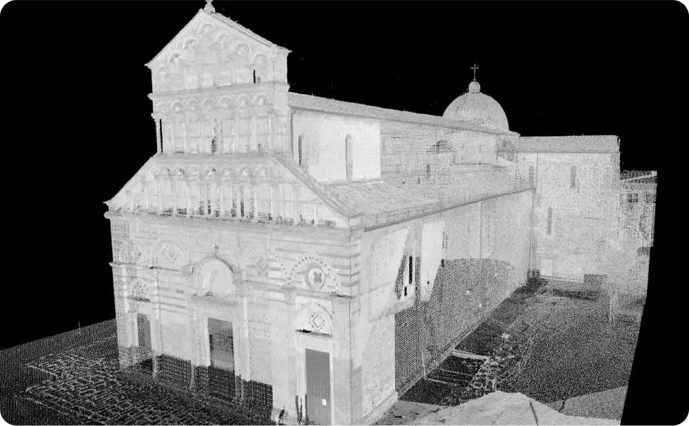
Greyscale 3D laser scan point cloud of the Church of San Paolo in Pisa captured for structural restoration documentation
Location: Church of San Paolo, Pisa (Italy)
Project Overview
The Church of San Paolo in Pisa required accurate, reliable survey data to support a sensitive structural restoration programme. The project focused on documenting the existing fabric of the church, assessing the condition of its masonry walls, and identifying structural movement that could affect long-term stability.
A detailed measured survey was commissioned to provide a dependable base for restoration design, structural analysis, and ongoing monitoring.
Client Requirements
The restoration team required:
Accuracy was critical. The survey needed to record individual stone geometry and millimetric gaps between masonry units to inform stone-by-stone restoration decisions.

Red Laser surveyor operating high resolutions 3D laser scanner during a measured building survey
Our Approach
We carried out a comprehensive 3D laser scanning survey of the Church of San Paolo using high-resolution scanners capable of capturing up to one million points per second, with an accuracy of ±1 mm.
The non-invasive scanning process allowed us to survey both internal and external elevations without physical contact with the historic fabric. The high density of measured points enabled precise definition of each stone, including subtle deformation and displacement across the masonry walls.
Scan data was processed into a complete 3D point cloud of the church, forming the foundation for all subsequent analysis and drawing production.
Deliverables
The survey outputs were structured to support both architectural documentation and structural assessment:
- Full 3D point cloud (intensity map and greyscale)
- 2D CAD plans, sections, and elevations at 1:20 scale
- High-resolution orthophotos at 1:20 scale
- Detailed crack system mapping across key structural walls
These deliverables provided a clear, measurable record of the church’s existing condition.
High-resolution orthophotos and scaled CAD elevations derived from 3D laser scanning, including detailed crack system mapping
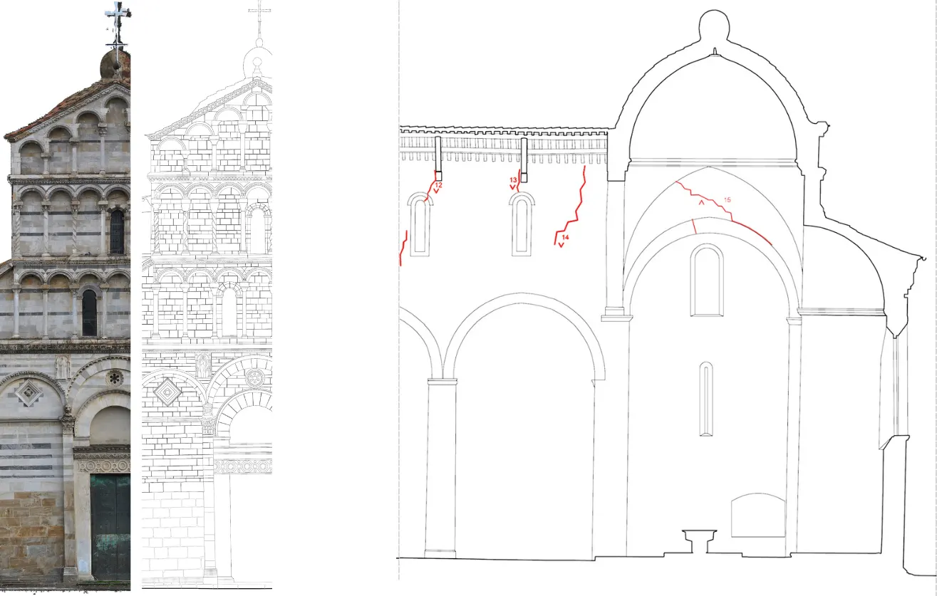
High-resolution orthophoto elevation of the Church of San Paolo in Pisa generated from 3D laser scan data for conservation documentation

Identifying Structural Issues
High-resolution orthophotos and detailed CAD elevations played a key role in identifying a complex system of crossing cracks running through the church’s masonry walls. The combination of photographic accuracy and measured geometry allowed the restoration team to assess crack patterns, extent, and alignment with structural elements.
This level of detail was essential for understanding the causes of movement and planning appropriate structural interventions.
Outcome
The laser scanning survey delivered a precise and comprehensive record of the Church of San Paolo’s structural condition. The data supported informed decision-making throughout the restoration process, reducing uncertainty and risk at an early stage.
By providing accurate drawings, orthophotos, and crack mapping, the survey formed the technical foundation for a carefully planned and targeted restoration strategy—protecting the historic fabric while enabling confident structural repair.
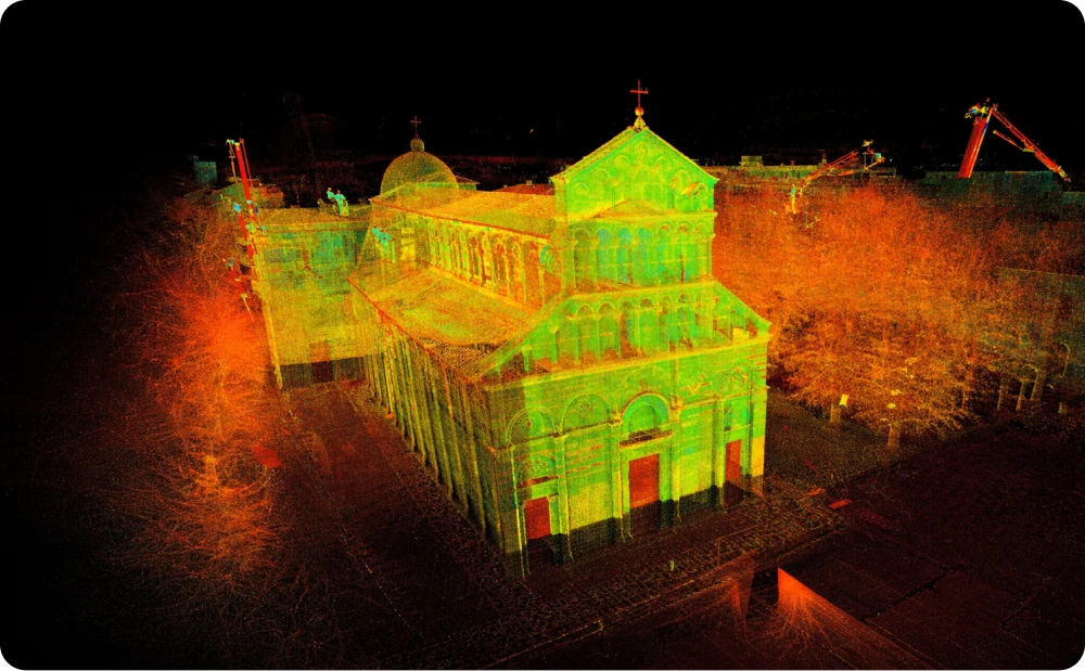
Intensity map view of the 3D laser scan point cloud of the Church of San Paolo in Pisa used for structural assessment and crack identification
Start Your Project with Confidence
If your project requires accurate documentation of complex or historic structures, we can help.
Start working with us
Partner with Red Laser for a confident project launch