
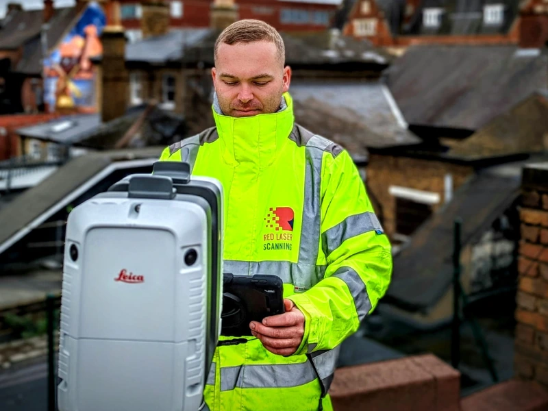
Surveyor conducting a measured building survey to capture precise data for delivering detailed and customised project deliverables
Professional CAD drawing services by Red Laser
Delivering accurate CAD Drawings: Floor Plans, Elevations, Sections and more
Red Laser offers precise CAD drawing services for projects of all sizes, producing detailed, high-accuracy CAD plans that support contractors, developers, engineers, architects, and project managers. Our scan to CAD services London encompass a range of deliverables, including floor plans, cross-sections, elevations, roof plans, and more. We employ advanced equipment, such as 3D laser scanners, topographical tools, and drones, to collect comprehensive data that transforms into high-quality CAD surveys.
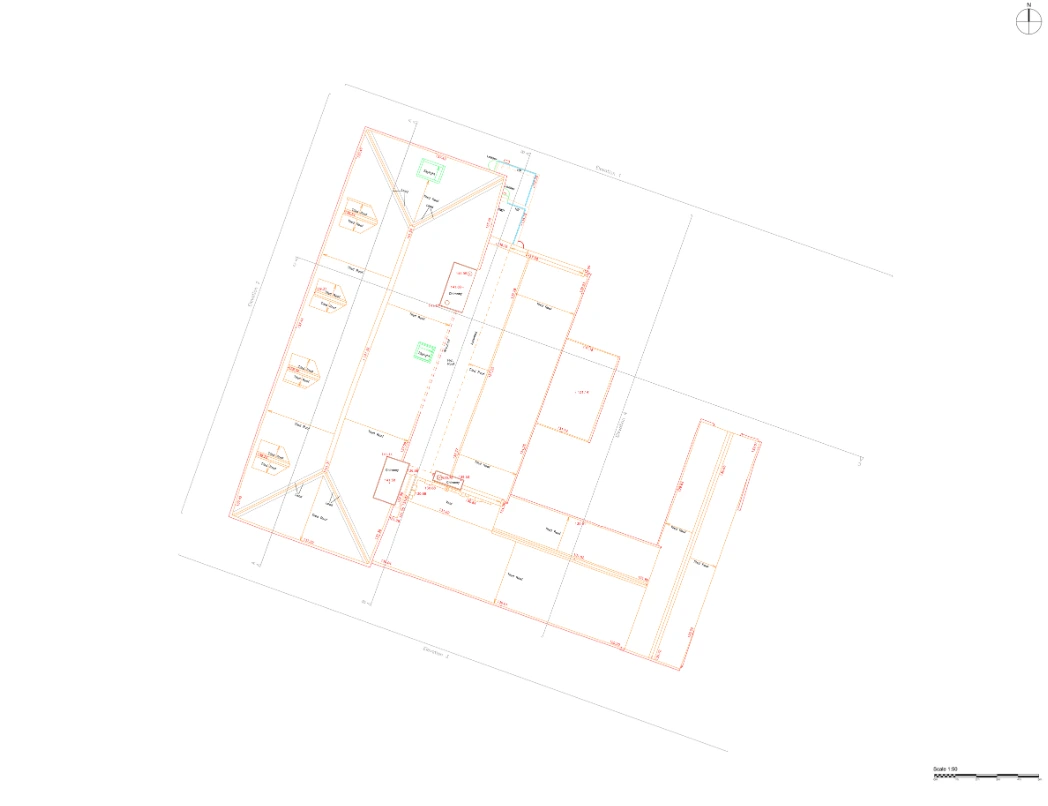
- Floor Plans
- Roof Plans
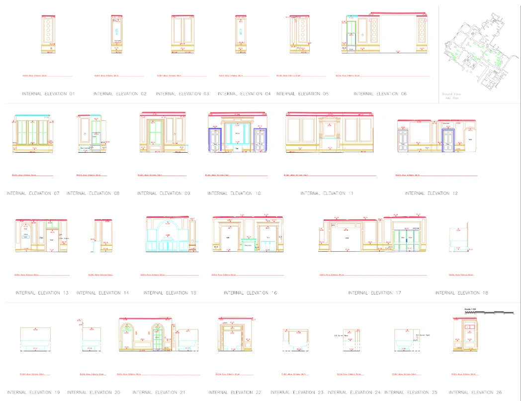
- Elevations
- Sectional Elevations
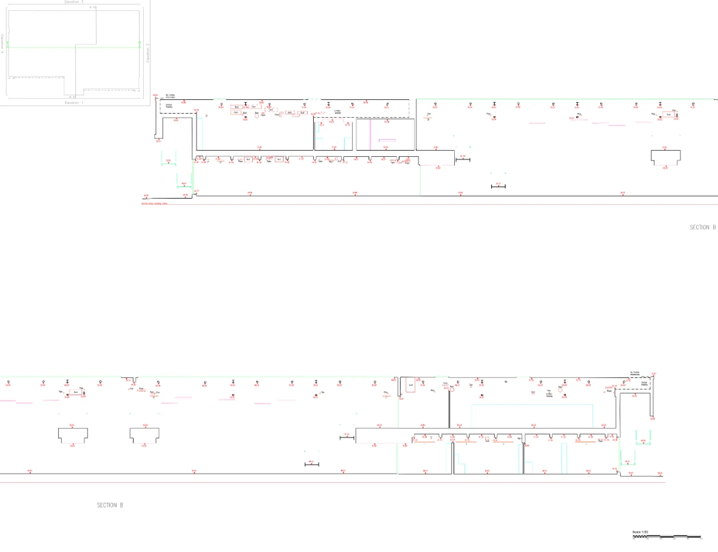
- Cross-Sections
- Ceiling Plans
- Topographical Drawings
- Site layouts
Accurate CAD drawings from 3D laser scanning data
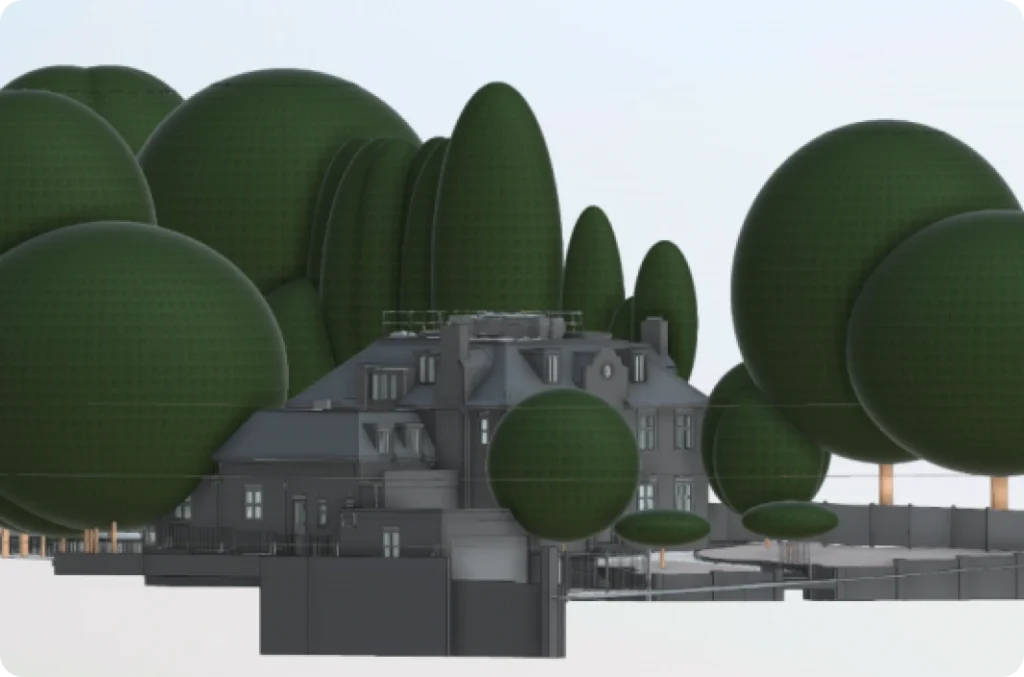
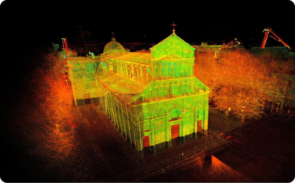
Scan to CAD is a streamlined process that transforms raw point cloud data from 3D laser scanning into highly accurate, functional CAD drawings. During scan to CAD, millions of precise data points are captured, processed, and developed into comprehensive 2D drawings and 3D digital models that capture every aspect of the building or object in detail. Our skilled technicians utilise industry-leading software, including AutoCAD for precise 2D drawings and Revit for advanced 3D modelling, ensuring that all data is compatible and ready for immediate application. This process improves accuracy, shortens project timelines, and optimises workflows for design, construction, and renovation projects.
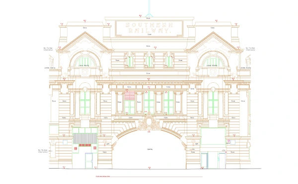
A precise CAD elevation scan of a railway building "Southern Railway," highlighting the structure's ornate arches, windows, and classical architectural features
Get your project moving with expert CAD drawings services
Connect with our team to get started
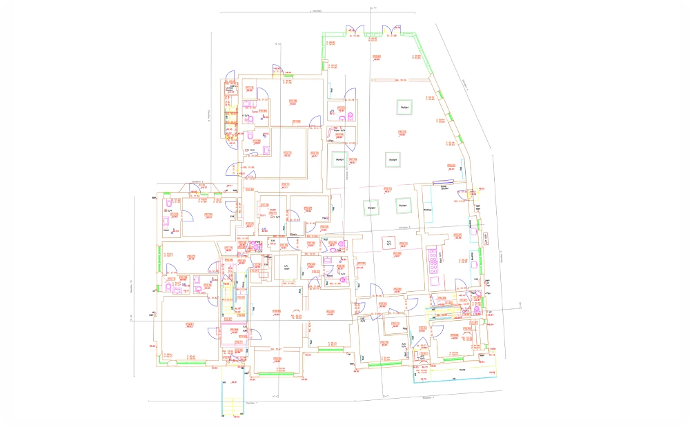
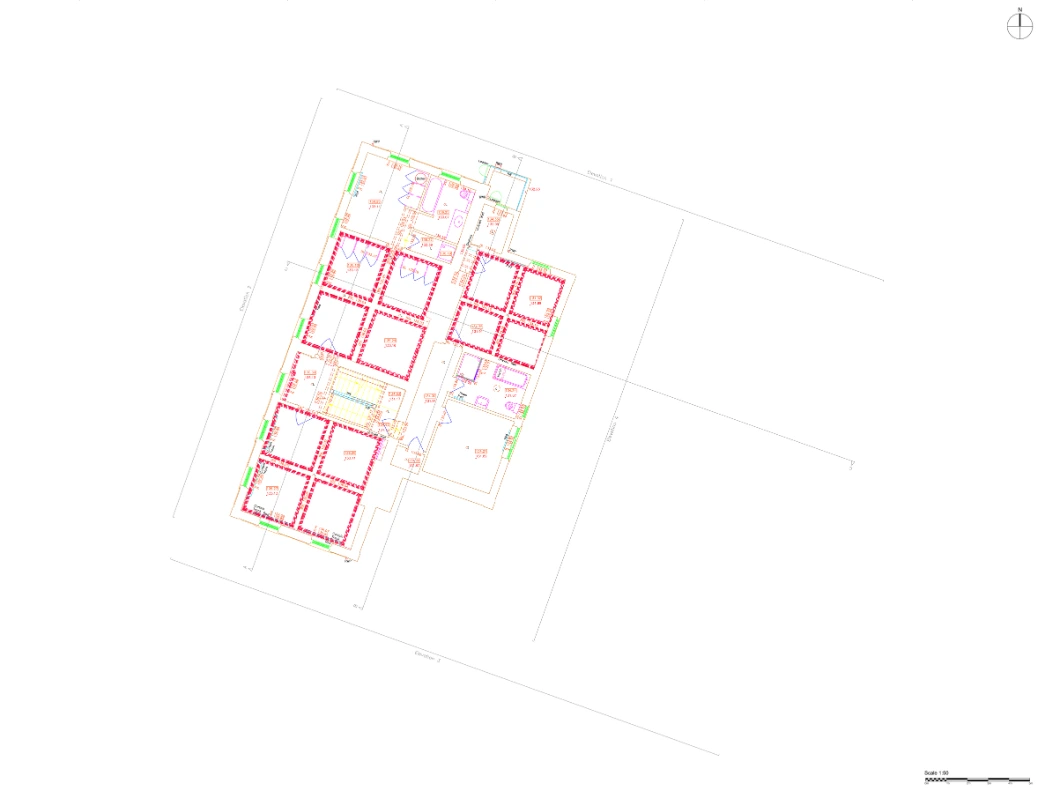
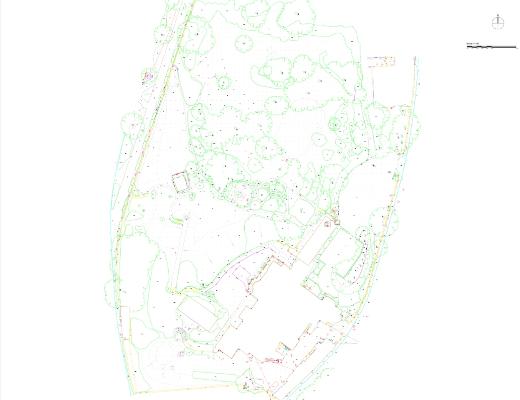
A detailed floor plan at scale 1:50, with RICS Survey Detail Accuracy Band D (+/- 10mm)
Levels of detail and file formats
To meet specific project requirements, we clarify your required level of detail in advance, determining the density needed in the point cloud. Common detail levels include scales of 1:20, 1:50, 1:100, and 1:200.
Available Formats:
- DWG: For use with AutoCAD and other CAD software
- DXF: Compatible with nearly all CAD programs
- PDF: Simple viewing and sharing
High-accuracy CAD drawings
From 3D laser scans to detailed CAD models
Using advanced point cloud data as a foundation, we ensure precision in each CAD drawing. Our 3D laser scanners collect up to 1 million points per second, with each point providing spatial data (X, Y, Z). This data is consolidated into a single point cloud file, enabling our CAD technicians to produce high-quality, detailed CAD planning in AutoCAD with unmatched accuracy.
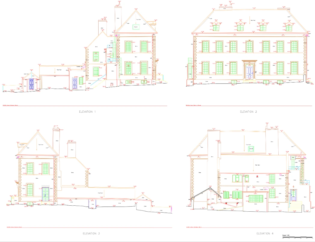
CAD drawings examples
Explore a variety of CAD drawing examples from past projects, showcasing our precision and adaptability across different sectors
Get your CAD drawings with confidence
Partner with Red Laser for expert CAD solutions
Whether you need to know more about CAD surveys and drawings or need it for construction, renovation, or a historical project, Red Laser team ensures every detail is captured, helping you streamline planning and execution with our Scan to CAD services London. Contact us today for reliable, expertly crafted CAD survey services and drawings tailored to your project’s needs.
Get a quote“Thanks so much- excellent service as usual. My architect definitely praises your style.”
Our case studies
See how we’ve helped clients achieve their goals with reliable surveying and geospatial solutions
Start working with us
Partner with Red Laser for a confident project launch
What are the built plans?
Scan to CAD are detailed plans that indicate all existing data in a tangible format, perfect for architects or construction professionals to use. An as-built CAD drawing can record the changes and track the phase of the building project at any existing point of the project.
Why use a scan to CAD?
It displays the geometry, dimensions, measurements, and location of physical features. An as-built drawing provides precise details and facilitates the project planning, allowing it to be distributed to clients such as estate agents, future buyers and architects.
What types of plans do we offer?
As part of scan to cad survey we provide floor plans, roof plans, reflected ceiling plans, site plans, internal elevations, external elevations and cross-sections.
How much does scanning to CAD cost?
The cost of CAD services depends on the size and complexity of the building structure or site area. Factors such as the required level of detail and access conditions at the time of the survey come into play when determining the cost of your measured drawing. We provide an accurate quote according to your specification.
How long does it take to produce drawings?
Our scan to cad survey service is provided as quickly as the next day. We process the data and complete as-built drawings a minimum a week depending on the size and complexity. You will receive all specified according to your project requirements.
What is LOD?
LOD stands for Level of Detail. The level of detail is dependent on the purpose of the survey, project and what results you are looking to achieve. This will target the scale of your drawing and how precise the information is documented.
