Measured Building Survey with Revit & SketchUp Models – Victoria Rise, London
Get a quote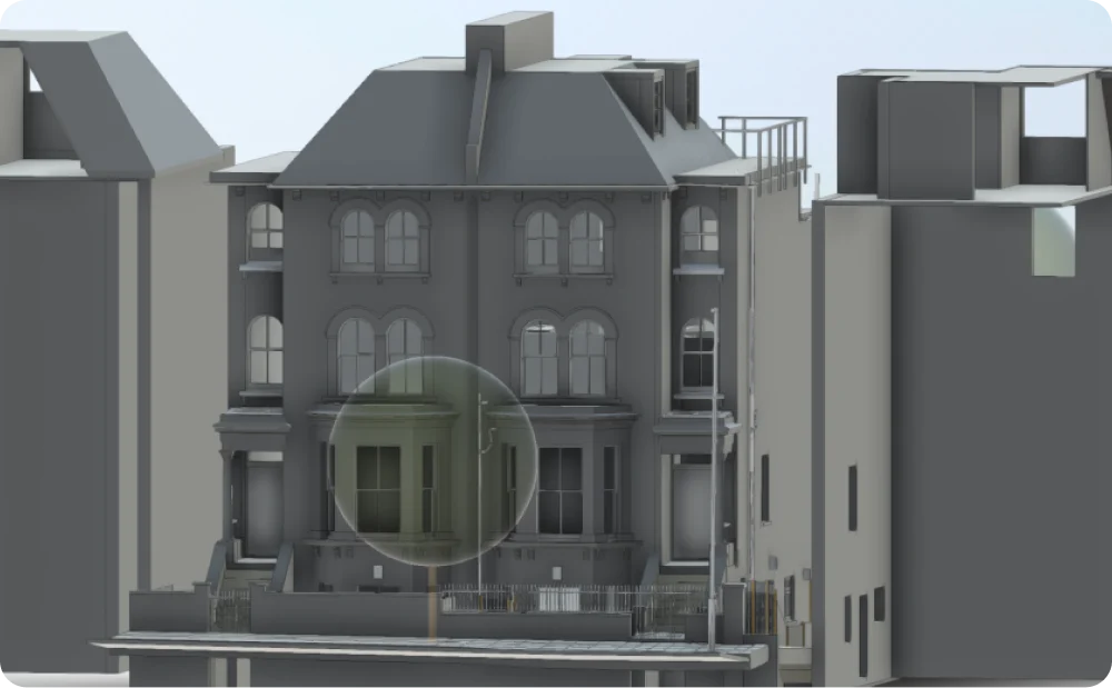
3D Revit model of residential property on Victoria Rise, London, developed from measured building survey data including neighbouring context
Location: Victoria Rise, London
Project Overview
A detailed measured building survey was commissioned for a residential property on Victoria Rise, London, to support design development and planning assessment. The project required accurate documentation of the existing building and its relationship with neighbouring properties, delivered in both BIM and SketchUp formats to suit different stages of design work.
The objective was to provide reliable, coordinated data that could be easily interrogated, modelled, and shared across the project team.
Client Requirements
The client required a flexible survey and modelling solution that would support both technical coordination and visual design testing. The brief included:
The SketchUp model needed to be carefully organised, with grouped and layered elements, to allow fast iteration during early design stages.
Single-colour SketchUp model of Victoria Rise property organised with grouped and layered architectural elements for efficient design development
Our Approach
Red Laser carried out a comprehensive internal and external laser scanning survey of the property. The captured data was processed into a verified point cloud, which formed the basis for both the Revit and SketchUp models.
External elevations and CAD drawings were first produced to validate geometry and alignment. From this controlled dataset, a coordinated 3D Revit model was developed, alongside a SketchUp model tailored to the client’s workflow.
In the SketchUp environment, architectural elements such as walls, windows, doors, stairs, trees, fences, and fixtures were grouped and layered logically. The model was delivered in a single colour to prioritise form, scale, and spatial relationships over visual styling.
Deliverables
The final deliverables included:
- Internal and external measured building survey
- Full external elevation drawings
- 3D Revit model
- Structured SketchUp model
Both models accurately represent the existing building and surrounding context, including neighbouring properties, enabling consistent use across planning and design stages.
Greyscale LOD3 Revit model of Victoria Rise property developed from measured building survey data

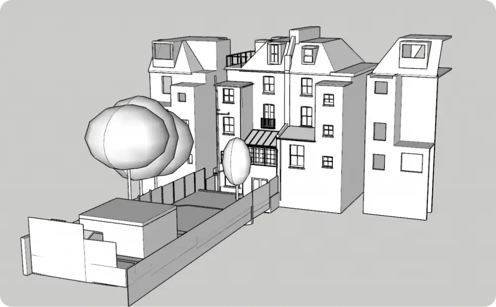
Top-down 3D roof view of Victoria Rise property and neighbouring buildings created from measured survey data.

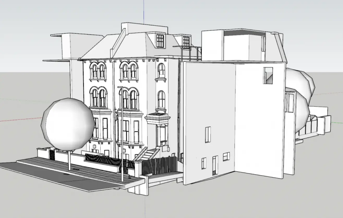
Comprehensive SketchUp model structured with grouped and layered elements, accurately representing the existing building and neighbouring properties
Supporting Design and Planning
The Revit model provided a dependable BIM reference for coordination and technical analysis, while the SketchUp model offered a lightweight, flexible tool for massing studies and design exploration.
By delivering the same verified geometry in multiple formats, the survey supported collaboration between architects, designers, and planners without duplication of effort or loss of accuracy.
Outcome
The project delivered a clear, coordinated digital representation of the Victoria Rise property. With accurate survey data underpinning both Revit and SketchUp models, the client was able to assess design options confidently and progress planning discussions with clarity.
This case study demonstrates how measured surveys combined with tailored digital models can streamline design workflows and reduce uncertainty at early project stages.
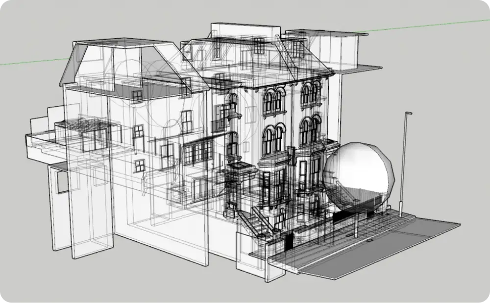
Transparent wireframe view of Victoria Rise SketchUp model showing coordinated internal and external geometry from measured survey data
Start Your Project with Confidence
If your project requires accurate measured surveys and flexible 3D models for planning or design development, we can help.
Start working with us
Partner with Red Laser for a confident project launch