Topographic surveys for design and construction projects
Accurate and reliable measured surveys backed by industry expertise
Get a quoteMaximising project success with topographic surveys: A must-have for design, construction, and property development
In the realms of design, construction, and property development, success hinges on detailed planning and foresight. Topographic surveys, also known as land or topo surveys, are indispensable tools in this process. Red Laser specialises in providing comprehensive topographic surveying services across London and the UK, utilising advanced technology to produce precise and detailed site data. This guide delves into why these surveys are essential for professionals in these fields, illustrating through examples and outlining the multifaceted benefits they offer.
Topographic surveys: The backbone of accurate planning
Topographic surveying is an in-depth study of a land’s features, both natural and man-made. It’s a foundational step in any significant construction or development project. It provides critical data such as the layout of buildings, natural landforms, boundary lines, and the precise topography of the site.
Why do design, construction, and development professionals need topographic surveying?
- Design accuracy and innovation: Architects and designers rely on on-site inspection for accurate representations of the existing landscape. This data is crucial for designing structures that seamlessly integrate with their environment, considering factors like natural light, terrain, and existing vegetation.
- Efficient construction planning: Construction managers use topographic surveying to plan projects effectively. By understanding the site’s topography, they can anticipate challenges like uneven ground, potential drainage issues, or the need for additional land preparation.
- Strategic property development: Property developers need site plans to evaluate the potential of a site. They can determine the feasibility of their projects, assess environmental impact, and plan for sustainable development.
Real-world applications
- Before purchasing land: To assess its suitability for the intended purpose.
- In urban development: To integrate new structures into existing cityscapes responsibly.
- In landscape design: To create harmonious and functional outdoor spaces.
- For infrastructure projects: Such as roads, bridges, or utilities, where understanding the terrain is crucial.
The benefits of topographic surveys
- Risk mitigation: Identify potential issues like soil instability or flood risks, avoiding costly future problems.
- Legal compliance: Ensure adherence to zoning laws and building regulations.
- Resource optimisation: Enable efficient allocation of materials and labour.
- Feasibility analysis: Developers often face uncertainties about a property’s potential. A topographical survey provides concrete data that informs decisions about property utilisation and maximizing investment value.
- Land use optimisation: Understanding the contours and features of a land parcel helps in optimising its use – whether for residential, commercial, or mixed-use developments.

Why Red Laser team?
At Red Laser, we combine expertise with the latest technology to provide accurate, detailed topographic surveys. Our services are tailored to meet the unique demands of design, construction, and property development projects, ensuring that every detail is captured and analysed for optimal planning and execution.
Avoiding mistakes and problems
Topographic surveying is instrumental in preventing a myriad of challenges and pitfalls that often plague development projects. By employing advanced techniques and technologies, topographic surveying not only addresses known issues but also anticipates and mitigates potential risks, ensuring smooth project execution and successful outcomes. Here’s how topographic surveying helps in avoiding various mistakes and problems:
- Boundary disputes: Accurately determining property lines through topographic surveying prevents legal disputes and costly litigation, safeguarding the interests of all parties involved. For instance, in a suburban construction project, precise topographic surveying can help a developer avert a potential lawsuit by accurately delineating property lines, thus avoiding a boundary dispute with a neighbouring landowner.
- Unforeseen construction challenges: Understanding the terrain and identifying potential obstacles beforehand allows developers to anticipate and plan for construction challenges, minimising delays and cost overruns. In a construction project, thorough topographic surveying can reveal hidden geological features, enabling engineers to adjust plans and avoid costly delays caused by unforeseen terrain complexities.
- Environmental impact: A topographic survey plays a crucial role in identifying and protecting natural features, ensuring compliance with environmental regulations and minimising the project’s ecological footprint. For instance, in a coastal development project, a topographic survey can identify protected wetlands, prompting adjustments to minimise environmental disruption and ensure regulatory compliance.
- Utility interference: Mapping underground utility lines and infrastructure through topographic surveying helps prevent accidental damage during excavation and construction, avoiding disruptions to services and costly repairs.
- Flooding risks: By identifying natural drainage patterns and flood-prone areas, topographic surveying enables developers to implement proper drainage systems and flood mitigation measures, reducing the risk of property damage and ensuring resilience against extreme weather events.
- Geological hazards: Topographic surveying reveals potential geological hazards such as landslides, sinkholes, or unstable soil conditions, allowing developers to take appropriate precautions or adjust project plans to mitigate risks to infrastructure and public safety.
- Regulatory compliance: Providing accurate data on land features and environmental conditions, topographic surveying ensures compliance with zoning regulations, building codes, and environmental laws, preventing delays, fines, or project cancellations due to non-compliance issues.
- Site access and logistics: Understanding the terrain and topographical features facilitates better planning of site access roads, transportation routes, and logistics, optimising construction processes and minimising disruptions to surrounding areas.
Equipment used by topographical surveyors
Global Positioning System (GPS)
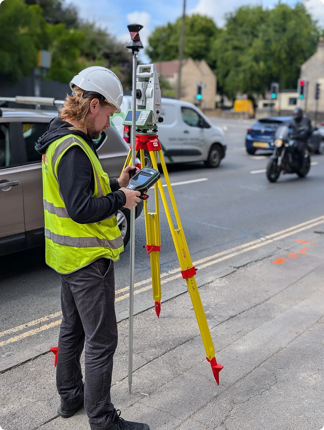
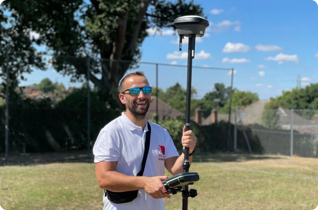
GPS technology plays a pivotal role in modern surveys, offering precision and efficiency in capturing geospatial data. Topographical surveyors use GPS to determine exact geographical coordinates and elevation of specific points on the land. Topo surveyors collect data with GPS receivers about the location of natural and man-made features, boundary lines, and topographic elements such as elevation and contours. This technology is especially beneficial in large-scale projects where extensive areas need to be covered, as it provides accurate and rapid data collection. GPS ensures that the spatial data is geographically referenced to a high degree of accuracy.


Total station
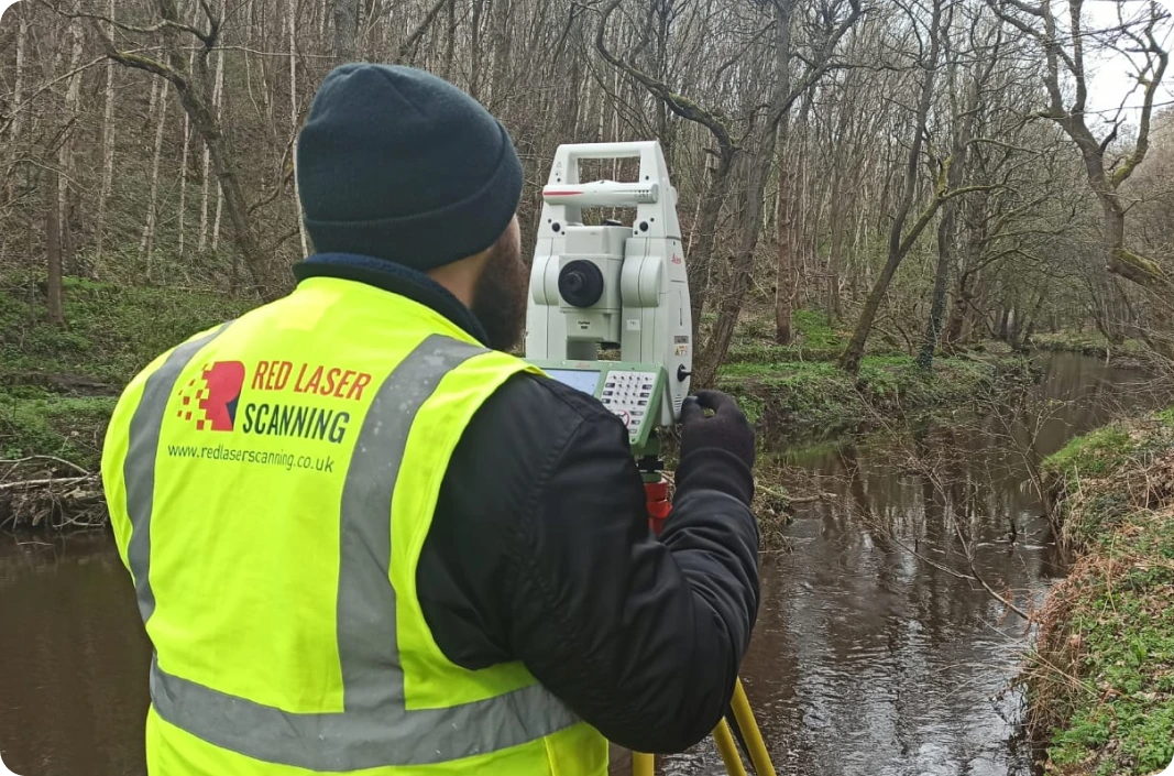
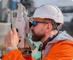
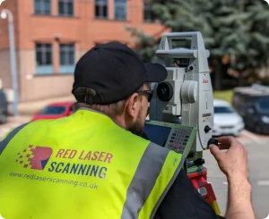
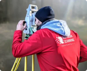
Total station is a tool used by topographical surveyors for measuring angles and distances with high precision. This sophisticated electronic/optical instrument integrates the functions of a theodolite for angle measurement and an electronic distance meter (EDM) to measure distances. When conducting a topo survey, surveyors set up the total station at a series of pre-determined points across the survey area. From each of these points, the instrument measures angles and distances to other points of interest on the site, such as property boundaries, corners of buildings, or specific landscape features. This data is then used to create detailed and accurate maps or 3D models of the surveyed area, showing its contours, elevations, and physical features.
The total station is particularly valued for its precision and versatility, making it ideal for a wide range of applications, from small-scale property surveys to large, complex land development projects. By providing comprehensive spatial data, Total Stations enables architects, engineers, and construction professionals to make informed decisions, ensuring accuracy in the planning and execution of their projects.
Comprehensive services tailored to your needs
- Customised solutions: Whether it’s a small plot or a large development area, our services are customised to meet your project’s specific needs.
- Advanced technologies: Utilising the latest in GPS, total stations, and UAV technology, we ensure high accuracy and detail in our topographic surveying.
- Expert team: Our experienced surveyors and technicians are skilled in handling complex surveying challenges, ensuring that your project is based on reliable data.
In the dynamic sectors of design, construction, and property development, topographic surveys are more than just a procedural step – they are a strategic asset. By providing critical insights into the physical characteristics of a site, these surveys enable professionals to plan and execute projects with confidence, efficiency, and innovation. Red Laser is dedicated to delivering services that meet the highest standards of precision and reliability, ensuring that your project is built on a foundation of accurate and comprehensive site data.


