Topographical surveys, commonly known for their integral role in design and construction, possess a vast array of applications that extend far beyond these traditional boundaries. This comprehensive tool, essential in mapping and analysing land features, offers invaluable insights for various projects across numerous sectors. From environmental management and archaeological explorations to urban planning and disaster mitigation, the scope of topographic surveys is remarkably broad and diverse. In this blog, we delve into the multitude of benefits and applications of topo surveys, highlighting their versatility and indispensability in a range of projects that shape our world. Whether it’s aiding sustainable development, uncovering historical insights, or enhancing agricultural efficiency, these surveys stand as a cornerstone tool in informed decision-making and innovative solutions across diverse disciplines.
Foundation for sustainable urban planning: In urban planning, topographical surveys lay the groundwork for sustainable city development. They enable planners to consider factors like flood risk areas, green spaces, and urban heat islands, thereby promoting eco-friendly and resilient urban designs.
Detailed site analysis: Provides an in-depth and clear view of the land or building site. This includes documenting features like terrain contours, existing structures, and boundary lines. For example, in urban development, understanding the exact terrain layout helps in planning infrastructures like roads and drainage systems.
Risk reduction during design and construction projects: Conducting a topographic survey significantly reduces the risk of costly errors. It reveals hidden aspects of the land, including historical changes and unseen complications. For instance, discovering an old, unmapped sewage line can save a project from future legal and structural issues.
Informed construction decisions Topographic surveys inform builders and developers about the land’s topography, impacting construction methods and materials. For example, identifying a slope might lead to choosing different foundation techniques to ensure stability.
Cost efficiency in construction: By identifying potential obstacles or delays beforehand, topographical surveys can help reduce unforeseen costs. Knowing the exact location of underground utilities, for instance, prevents expensive rework or damage during construction.
Planning application success: Having a detailed topographical drawing can streamline the planning application process. It provides authorities with a clear understanding of the proposed project and its impact on the surrounding environment, thereby reducing the likelihood of application refusals.
Accurate boundary determination: Topographical plans are critical in accurately defining property boundaries. This is especially important in areas where land ownership might be disputed or unclear, helping to avoid legal complications.
Enhanced design and architecture: For architects, a topo survey provides a detailed canvas to design structures that complement the natural landscape. In hilly terrains, for instance, building designs can be adapted to the contours of the land, creating aesthetically pleasing and functional structures.
Enhanced design and architecture: For architects, a topo survey provides a detailed canvas to design structures that complement the natural landscape. In hilly terrains, for instance, building designs can be adapted to the contours of the land, creating aesthetically pleasing and functional structures.
Enhanced design and architecture: For architects, a topo survey provides a detailed canvas to design structures that complement the natural landscape. In hilly terrains, for instance, building designs can be adapted to the contours of the land, creating aesthetically pleasing and functional structures.
Essential for infrastructure development: Infrastructure projects such as roadways, bridges, and utilities demand precise land data. They ensure that infrastructure is built considering the land’s natural contours, leading to safer and more sustainable constructions.
Environmental consideration and management: In environmental studies, understanding the landscape is key to conservation efforts. They help in identifying natural habitats, assessing the impact of proposed developments, and aiding in the creation of environmental protection plans. For instance, in wetland restoration projects, these surveys provide vital data for effective habitat rehabilitation. These surveys play a vital role in environmental conservation. By identifying natural features like wetlands or protected vegetation, developers can plan projects that minimise environmental impact.
Archaeological explorations: Archaeologists rely on topo surveys to locate potential excavation sites and understand the terrain’s history. The surveys offer insights into past human activities and natural changes over time, playing a pivotal role in uncovering historical and cultural treasures.
Disaster management and mitigation: Topographical surveys aid in disaster management by mapping flood zones, landslide-prone areas, and other hazard zones. This information is vital for emergency planning and developing strategies to mitigate the effects of natural disasters.
Beneficial for agricultural planning: In agriculture, these surveys help in designing efficient farm layouts, irrigation systems, and managing soil erosion. They enable farmers to optimise land use, ensuring sustainable and productive agricultural practices.
Geological studies: Geologists utilise topographical findings to study landforms and geological structures. This is crucial in understanding earth processes, mineral exploration, and assessing geological hazards.
Water resource management: These surveys are vital in managing water resources, including planning for dams, reservoirs, and water treatment facilities. They help in understanding watershed characteristics and planning for sustainable water management.
We provide high-precision topo surveys for bridges, offering detailed topo survey reports and using cutting-edge topo survey equipment for accuracy
Take the next step
Partner with Red Laser for comprehensive survey services that will provide the clarity and accuracy you need to make informed decisions and achieve optimal outcomes.
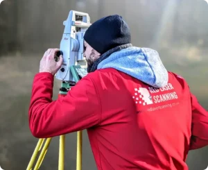
How can Red Laser team help you with your topo survey requirement?
When you partner with Red Laser for your topographical survey needs, you’re choosing a team dedicated to delivering clarity and precision. Our comprehensive survey services empower you to make well-informed decisions, leading to the best possible outcomes for your projects. Topographical surveys are essential in a variety of fields, not just design and construction. They play a significant role in environmental conservation, archaeological research, and urban planning, providing the detailed and accurate land data necessary for informed and sustainable development. In today’s world, where accurate decision-making is crucial, our topographical surveys are the key to unlocking progress and innovation in multiple sectors. Let Red Laser’s expertise guide you in harnessing the full potential of topographical surveys for your project’s success.
We provide expert topo surveys using the latest Leica topo survey equipment, delivering accurate topo land survey reports at competitive topo survey costs
Contact us today
Ready to explore how our survey services can benefit your project? Reach out to us today. We’re eager to discuss your specific needs and demonstrate how our expertise can be the catalyst for your project’s success. With Red Laser, you’re not just getting a service provider; you’re gaining a partner committed to bringing precision, quality, and value to your endeavours.
Learn everything you need to know about total stations and why Red Laser uses this high-quality instrument to complete your surveying…
Manage Consent
To provide the best experiences, we use technologies like cookies to store and/or access device information. Consenting to these technologies will allow us to process data such as browsing behaviour or unique IDs on this site. Not consenting or withdrawing consent, may adversely affect certain features and functions.
Functional Always active
The technical storage or access is strictly necessary for the legitimate purpose of enabling the use of a specific service explicitly requested by the subscriber or user, or for the sole purpose of carrying out the transmission of a communication over an electronic communications network.
Preferences
The technical storage or access is necessary for the legitimate purpose of storing preferences that are not requested by the subscriber or user.
Statistics
The technical storage or access that is used exclusively for statistical purposes.The technical storage or access that is used exclusively for anonymous statistical purposes. Without a subpoena, voluntary compliance on the part of your Internet Service Provider, or additional records from a third party, information stored or retrieved for this purpose alone cannot usually be used to identify you.
Marketing
The technical storage or access is required to create user profiles to send advertising, or to track the user on a website or across several websites for similar marketing purposes.