Underground surveys in our comprehensive 2025 guide
Discover the essentials of underground surveys in our 2025 guide. Methods, benefits, applications, and how it informs project planning and…
An underground utility survey is a crucial process that identifies and maps hidden infrastructure beneath the ground. It helps locate essential utilities such as gas pipelines, electrical cables, water mains, and telecommunication networks. Conducting such a survey before excavation or construction prevents damage to underground services surveys, reduces project delays, and ensures site safety.
Modern cities and infrastructure projects rely heavily on buried utilities. A detailed underground utility survey provides engineers and contractors with essential data to plan their work efficiently, avoiding potential disruptions. With the increasing complexity of underground networks, precise mapping is more critical than ever to prevent costly errors and ensure regulatory compliance. This can include the following:
Additionally, performing a thorough underground utility survey helps reduce project delays. Unforeseen utility clashes can halt progress, require costly repairs, or result in legal disputes. Knowing the exact position of underground infrastructure allows engineers and contractors to adjust their plans accordingly, saving time and money.
In large-scale construction projects, especially in densely populated urban areas, underground utilities are often extensive and complex. Cities and industrial zones depend on an intricate network of buried services that need careful mapping and management. A detailed underground utility survey provides valuable data to help engineers, architects, and contractors plan their work more efficiently.
An underground utility survey is typically conducted before construction, excavation, or redevelopment projects to avoid accidental damage to existing utilities such as water pipes, gas lines, sewage systems, and telecommunications cables.
The process begins with a comprehensive review of existing records and utility plans. This desk-based assessment helps identify known utilities and assess the likelihood of unknown or undocumented services. Following this, our experts examine the site in detail, systematically scanning for signs of underground systems. The aim is to establish the position, route, and depth of utilities to create an accurate subsurface map.
Communication with utility providers and local authorities is often part of the process, as it ensures that any available plans or updates are factored into the survey. Surveyors may also mark the ground to highlight utility paths and boundaries for onsite reference. Careful planning and sequencing of the survey ensure full coverage of the area, often working in grids or sectors to maintain thoroughness.
Once the data is gathered and verified, detailed maps and reports are produced. These typically include the type of utility, its estimated depth, and its route across the site. The results help project planners avoid costly delays, service interruptions, and safety hazards during construction.
By integrating these techniques, our professionals ensure accuracy and reduce the risk of damaging critical infrastructure.
Additionally, advanced data collection methods, such as Geographic Information Systems (GIS), allow for seamless integration with digital project planning tools, ensuring all stakeholders have access to accurate utility information.
Without a proper survey, construction projects face significant risks, including financial losses, utility service disruptions, and potential legal consequences. A single miscalculated excavation can lead to widespread power outages, water supply interruptions, or gas leaks, causing severe inconvenience and hazards.
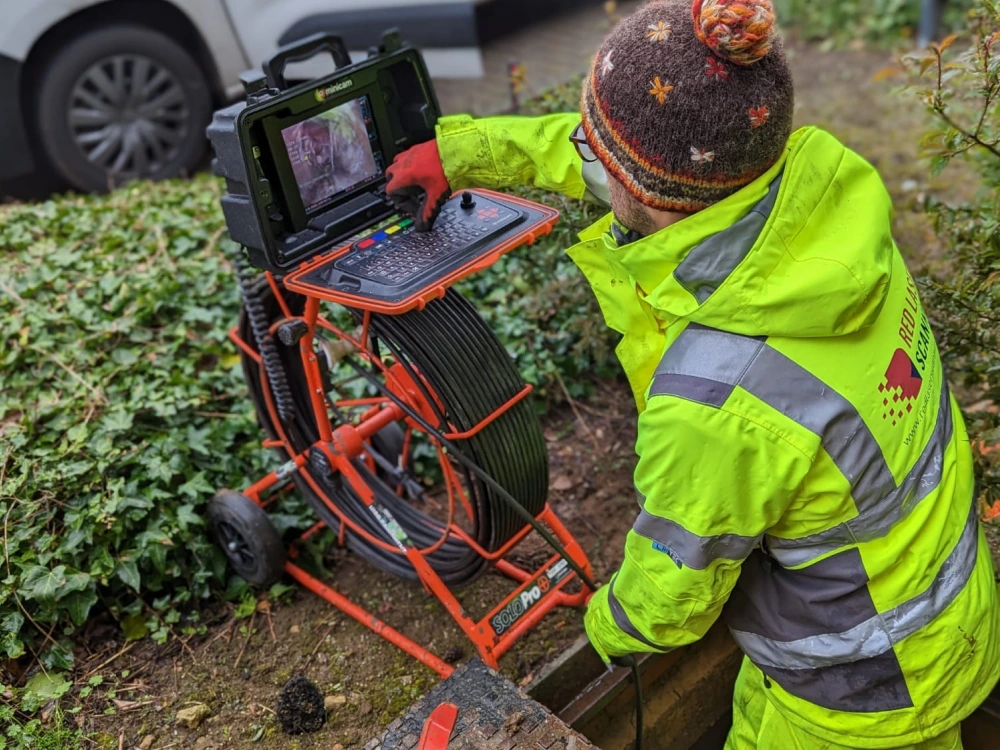
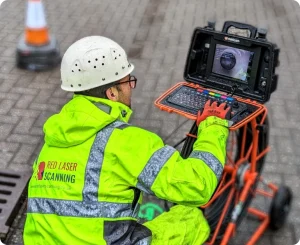
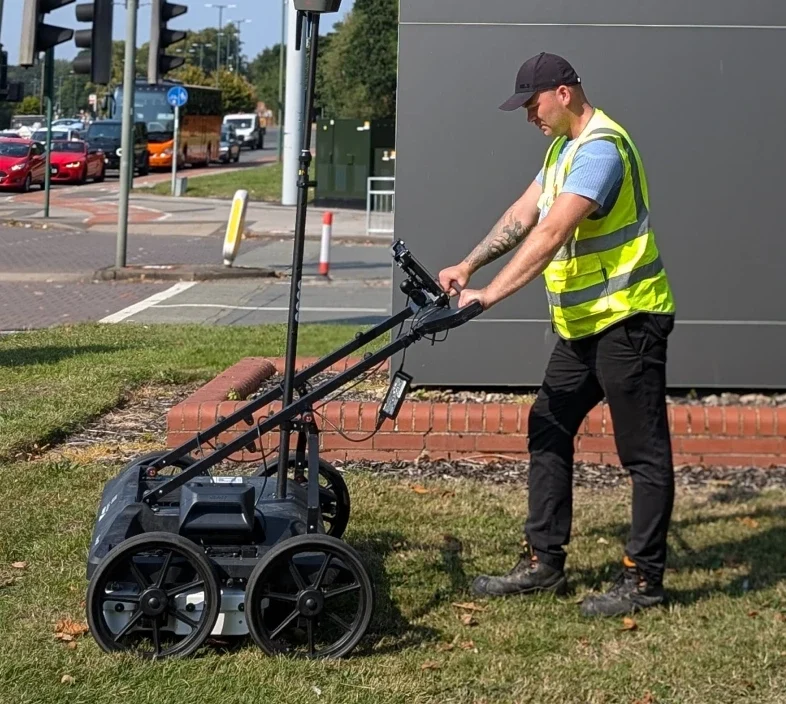
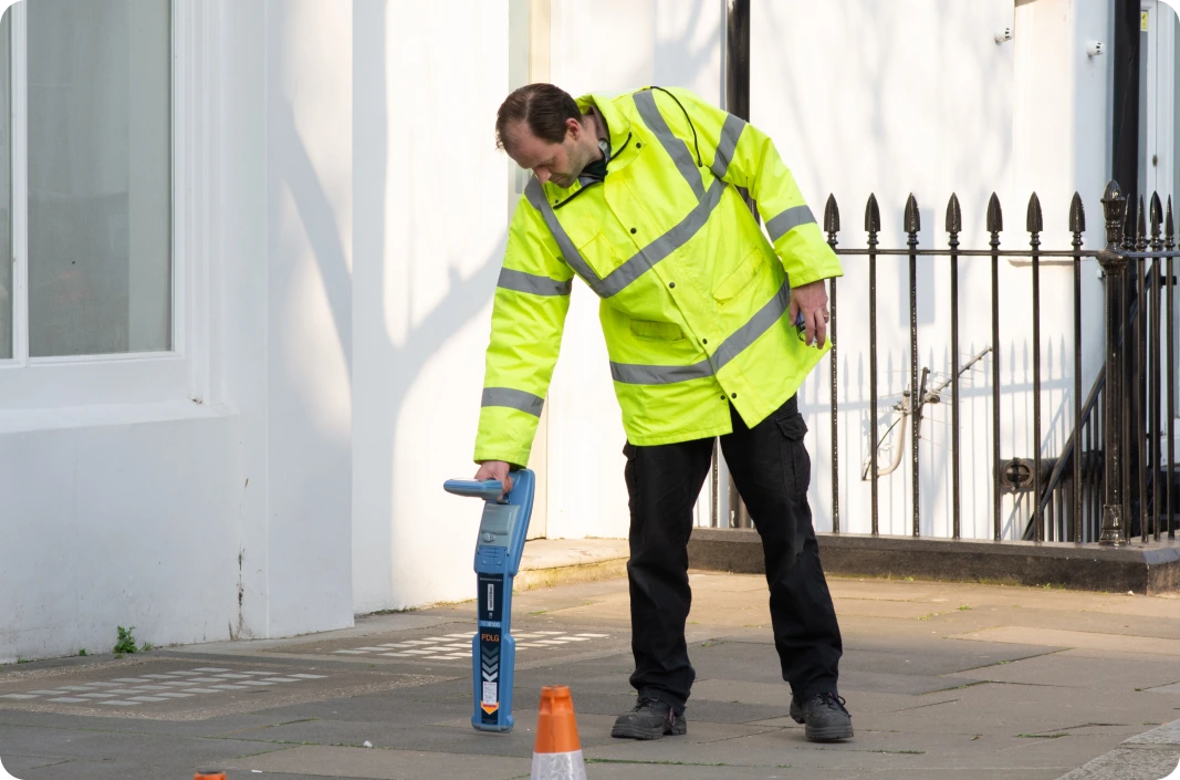
Underground utility surveys require specialised equipment and techniques to ensure precise mapping. Some of the most commonly used underground surveying equipment includes:
Each method has its advantages, and surveyors often use a combination of these techniques to ensure comprehensive results. The choice of technology depends on the project’s specific needs, soil conditions, and the type of utilities being mapped.
Are you planning a construction or excavation project? Protect your site, workers, and budget by investing in a professional underground utility survey. Our expert team provides detailed utility mapping to ensure your project runs smoothly without unexpected disruptions.
Contact us today to schedule a consultation and ensure a seamless, safe, and cost-effective project. Don’t risk costly delays—get a precise underground utility survey before you dig!
Red laser is a leading provider of underground services surveys, utilising the latest underground surveying equipment and underground surveying methods. With a commitment to accuracy and safety, we help businesses and contractors navigate complex underground infrastructures. Our team of specialists employs advanced technology to provide precise and reliable results.
We work with construction firms, government agencies, and private developers to ensure that every excavation is conducted with minimal risk. Whether you’re working on a large-scale infrastructure project or a small residential build, we have the expertise to assist you.