CCTV drain inspection: Your comprehensive guide
Explore the complete guide to CCTV drain inspection, including costs, camera options, and benefits. Maintain your drainage system with expert…
Ground Penetrating Radar (GPR) technology, a sophisticated and invaluable tool in subsurface exploration, has significantly advanced our understanding of what lies beneath the earth’s surface. This article delves deep into the world of ground penetrating radars, exploring the intricacies of GPR equipment and discussing the various applications and capabilities of this groundbreaking technology.
When considering what is a ground penetrating radar, it is essential to understand that it is a non-destructive geophysical method that uses radar pulses to create an image of the subsurface. This advanced technology stands out for its ability to detect and reflect signals from beneath the Earth’s surface, making it a crucial tool in many fields. The effectiveness of ground penetrating radar service in providing detailed subsurface images without any physical drilling or excavation sets it apart from traditional survey methods.
The principle behind this technology is based on emitting high-frequency radio waves into the ground. When these waves encounter subsurface structures or materials, they are reflected back to the surface and captured by the GPR equipment. The time taken for these radar waves to return, along with their strength, is critical in determining the properties of the subsurface object or feature.
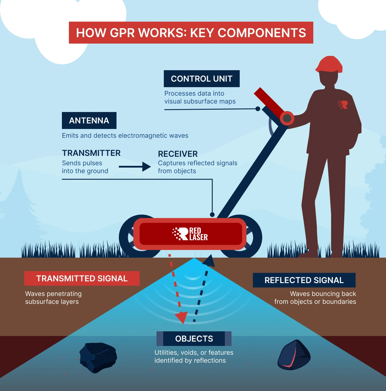
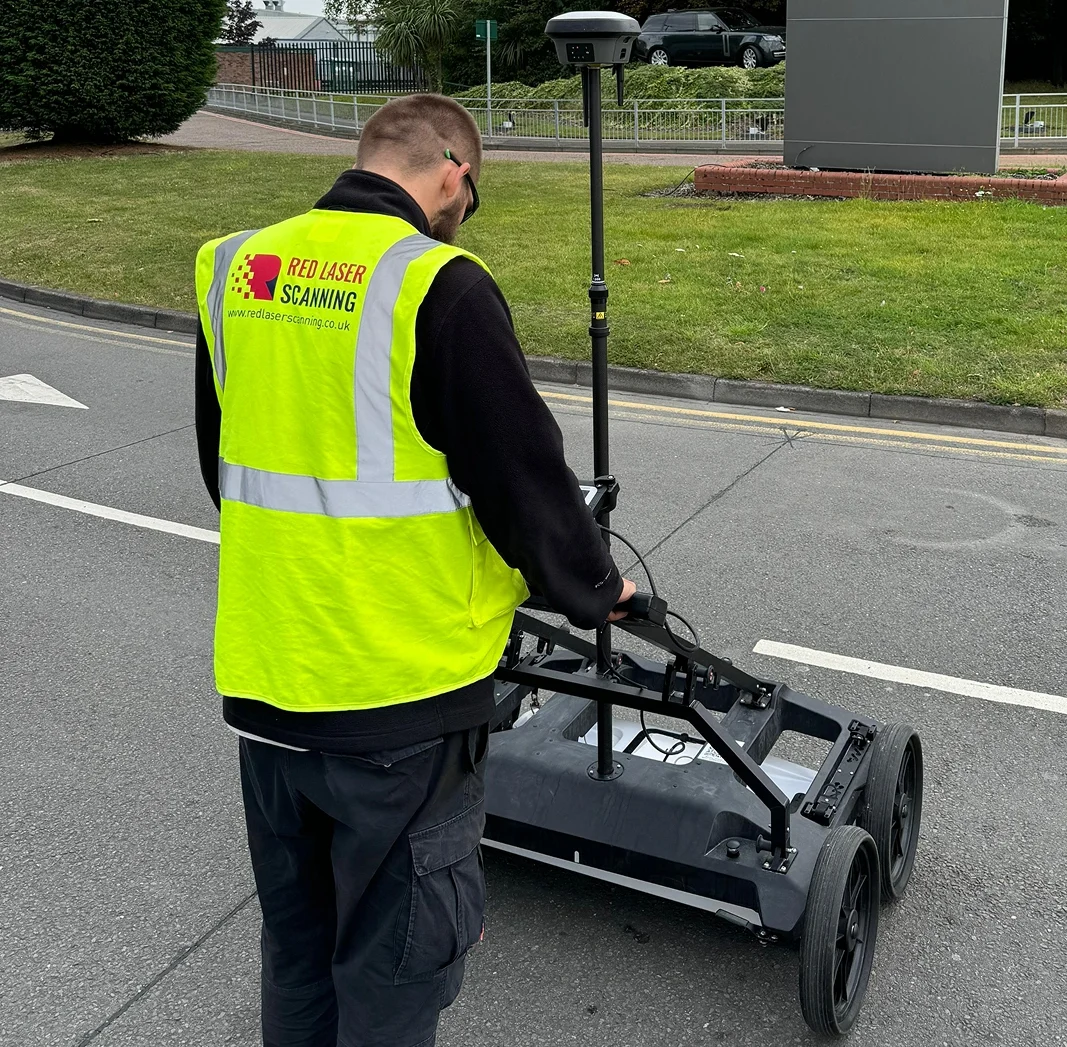
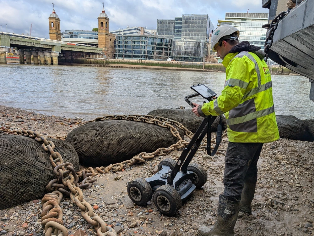
At the core of the equipment are the control unit and the antenna. The control unit, often a sophisticated computer system, is responsible for sending and receiving radar signals. The antenna, crucial in transmitting radar waves into the ground, is designed to capture the reflected signals. The combination of the control unit and antenna in GPR survey equipment determines the depth and resolution capabilities of the survey, making them vital components in the effectiveness of ground penetrating radars. Many users searching for ground penetrating radar near me can benefit from understanding how these components impact the accuracy of their results.
After the capture of reflected signals by ground penetrating radar equipment, the next crucial step is data processing. This involves transforming the raw data into a visual format that can be easily interpreted. Advanced software is employed to develop images or profiles that accurately represent the subsurface structures, playing a pivotal role in interpreting the findings from GPR surveys.
Ground Penetrating Radar images, commonly known as radargrams, are intricate visual representations of the subsurface structures and features. These images are produced by recording the reflected electromagnetic waves emitted by the GPR equipment as they bounce back from different types of materials underground. In a radargram, the surface is represented at the top, with deeper subsurface layers appearing as the image descends. Various colours or shades of grey indicate the intensity of the reflection, which can help identify changes in material composition, voids, or objects buried beneath the surface. The horizontal axis typically represents the distance or area surveyed, while the vertical axis shows the depth, calibrated based on the speed of the radar waves through the ground. Interpretation of these images requires expertise, as the patterns and anomalies depicted can provide critical information about the subsurface environment, such as the location of buried utilities, the presence of archaeological artefacts, or the identification of geological formations.
The choice of companies offering ground penetrating radar services is critical. Considerations should include their technological capabilities, experience, compliance record, and customer feedback. Understanding the ground penetrating radar survey cost UK is crucial for businesses planning such investigations, ensuring cost-effectiveness while maintaining high-quality results.A provider with a strong reputation will offer transparency, extensive expertise, and a portfolio of successful projects.
The applications of ground penetrating radar are diverse and impactful. GPR survey equipment is extensively used in geological investigations, utility detection, forensic inquiries, archaeological digs, and environmental studies. The ability of GPR to detect various objects such as pipes, cables, and voids, and to assess changes in material properties, makes it an indispensable tool in these fields. By employing ground penetrating radar services, businesses and researchers can achieve high-precision underground surveys, reducing risks and improving project outcomes. Factoring in the ground penetrating radar survey costs the UK, helps organisations budget effectively for these advanced survey techniques.
One of the most frequently asked questions about ground penetrating radar service is its depth penetration capability. This depth largely depends on the ground conditions and the frequency of the antenna used. Higher frequency antennas can capture finer details but have a shallower depth penetration, whereas lower frequency antennas can penetrate deeper with lesser detail. On average, ground penetrating radars can reach depths up to 100 feet (30 metres), although this can vary based on specific environmental conditions.
The versatility of ground penetrating radar means it is used by a wide range of professionals. Geologists, engineers, archaeologists, environmentalists, and utility locators are some of the primary users of this technology. Their reliance on GPR equipment highlights its importance in providing critical subsurface information that aids in decision-making and planning.
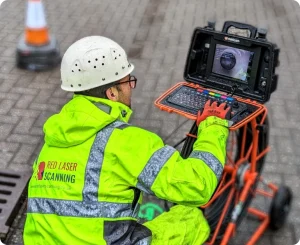
Red Laser, a prominent provider of ground penetration radar survey services, employs ground penetration equipment and boasts a team of experienced technicians. Their services are pivotal in various sectors, including infrastructure development, archaeology, and environmental assessment. Red Laser’s use of advanced ground penetrating radar equipment exemplifies the practical applications of GPR in contemporary scenarios.