Exploring rights of light survey
Discover the importance of rights of light survey, ensuring legal compliance, enhancing property value, and fostering sustainable design
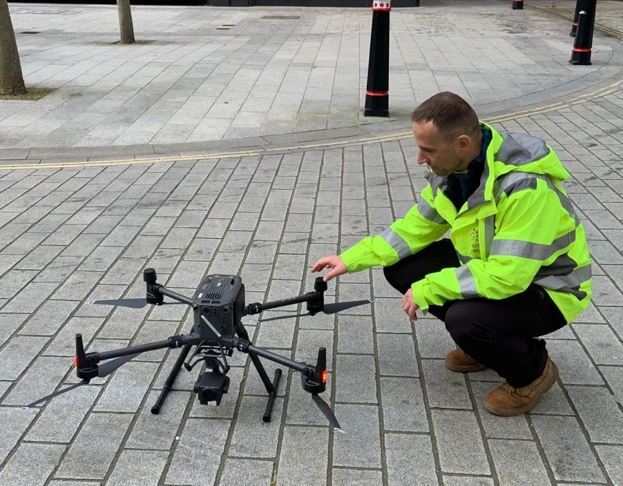
Most people are familiar with the term “drones” and their capabilities in today’s world. However, if you’re not, a drone is essentially an unmanned aerial vehicle (UAV) equipped to capture images while in flight. It can be operated remotely and is now widely used across various industries for a range of purposes.
Drone surveys play an important role in 3D laser scanning and building site projects, providing a comprehensive aerial perspective. By capturing high-resolution images from above, drone surveys enhance project planning and execution, ensuring accuracy and efficiency.
At Red Laser, our advanced drones produce detailed plans and topographical roof surveys with precision. No matter the size or complexity of the site, our drone survey mapping delivers reliable results, helping clients make informed decisions.
In addition to aerial imagery, drones can capture multiple angles, enabling professionals to generate 3D models, conduct volume calculations, and track site changes over time. Their ability to efficiently map large and complex areas makes them indispensable in construction, real estate, mining, and environmental monitoring.
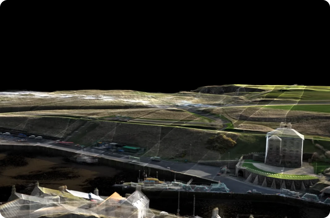
Drone surveys use unmanned aerial vehicles (UAVs) equipped with cameras, LiDAR sensors, or photogrammetry technology to capture high-resolution images and data of a specific area. The process typically involves planning the flight path, conducting the survey, and processing the collected data.
Drone surveys are transforming how projects are planned, executed, and monitored — offering major advantages across industries. Whether you’re working in construction, property management, infrastructure, or land development, here’s how drone surveys can enhance your project:
Drone surveys don’t just make data collection easier—they give you a clearer view of your entire site, from every angle. Whether you need a one-off survey or regular progress monitoring, this technology helps you stay informed, make faster decisions, and catch problems before they turn into delays. It’s a smarter, safer, and more scalable way to manage projects—whatever the size or scope.
At Red Laser, we don’t just fly drones — we deliver precision data that drives confident decisions. Based in London and operating across the UK, our drone surveying services are designed to meet the highest standards of accuracy, efficiency, and safety.
When you choose Red Laser, you’re choosing a partner that blends advanced drone tech with deep surveying expertise — delivering results you can rely on.
Contact us today for trusted drone survey services across the UK
To deliver precise and reliable results, Red Laser uses a combination of advanced drone equipment and data processing tools, including:
Drone surveys provide a wide range of high-value outputs that support every stage of your project — from planning and design to execution. At Red Laser, we specialise in delivering tailored drone survey data across London and the UK, with results formatted to fit seamlessly into your existing software and workflows.
Here’s what you can expect from drone surveys:
No matter the project — construction, land assessment, or roof inspection — our drone data is designed to integrate smoothly into your workflow, saving you time, reducing on-site risk, and improving decision-making.
If you are interested in learning more about drone surveys in London and across the UK, Red Laser offers expert solutions tailored to your project needs.
Our accurate and efficient drone survey services provide high-quality data for construction, mapping, and land assessment while minimising disruption.
With advanced UAV technology, we ensure cost-effective and precise surveying for even the most challenging locations. Whether you need a drone roof survey, topographic survey, or site mapping, our team is ready to assist.
Contact us today to discuss your project and discover how our drone surveys can enhance your planning and decision-making with advanced accuracy, speed, and reliability.
We are committed to delivering comprehensive and high-quality surveying services to support your construction and infrastructure projects across the UK.